Click to visit the main New York Public Library Homepage
The New York Public Library
Digital Collections
About Digital Collections
Browse
Search only public domain materials
Items
Collections
Divisions
Home
Search
Browse
About
Search only public domain materials
Items
Collections
Divisions
Digital Collections
Using Images
Using Data
Search
Filtered search
Show filters
Hide filters
Show Only Public Domain
topic
Exhibitions
13694
Real property
8059
Fire insurance
4993
Cities & towns
4909
Parks
2805
More
Less
name
New York World's Fair (1939-1940 : New York, N.Y.)
13733
Sperr, Percy Loomis, 1890-1964
5836
Sanborn Map Company
4993
Davies, Diana, 1938-
2438
Abbott, Berenice, 1898-1991
2141
More
Less
collection
New York World's Fair 1939 and 1940 Incorporated records
13630
Photographic views of New York City, 1870's-1970's, from the collections of the New York Public Library
10585
Robert N. Dennis collection of stereoscopic views
9098
Atlases of New York City
8898
Diana Davies photographs
2438
More
Less
place
x
New York (State)
New York
42826
New York (N.Y.)
23244
Manhattan (New York, N.Y.)
11618
Brooklyn (New York, N.Y.)
2537
More
Less
genre
Photographs
44996
Maps
9706
Stereographs
9098
Prints
1046
Postcards
754
More
Less
publisher
Sanborn Map Company
4907
G.W. Bromley & Co
2002
MIT Press
942
E. Belcher Hyde
557
Detroit Publishing Company
442
More
Less
division
Manuscripts and Archives Division
16340
Milstein Division
14326
Wallach Division: Photography Collection
12037
Map Division
9797
NYPL Archives
1688
More
Less
type
still image
48722
cartographic
8778
text
957
notated music
22
sound recording
17
More
Less
Date Range
to
57,795 results found
Filtering on:
x
Date
: 1892 - 1974
x
Place
: New York (State)
Sort by:
Title
Date created
Date digitized
Sequence
Results 251 - 300
m
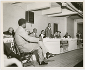
Dr. Martin Luther King, Jr., …
m
Women on assembly line at Art…
m
Civil rights activist Ella Ba…
Map of property New York Dock…
Carl Schurz Park
Brooklyn, from Rand McNally m…
m
New York City and vicinity
Park between 35th and 36th St…
Birdseye view of greater New …
m
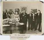
Sculptor Augusta Savage with …
m
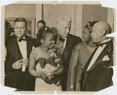
Sculptor Augusta Savage, with…
Hagstrom's map of lower New Y…
Rand McNally official 1921 au…
Hammond's handy reference map…
m
Riverside Park
Map of Kissena Park, third wa…
m
Map of Manhattan showing the …
Map showing suggested connect…
Railroad suburbs between Holl…
King's bird's-eye view of Bro…
Block sketch 1679, New York C…
Guide map to the Brooklyn and…
East River Heights, first war…
Map of the borough of Brookly…
Map of the borough of Brookly…
Map of Bellaire Estates : own…
m
Hammond's complete map of New…
Hollis Terrace addition no. 1…
Map of New York City and the …
m
Map of the borough of Brookly…
Map of 272 lots in the 30th w…
m
The Rand McNally map of the b…
Brooklyn Liberty Loan Committ…
Bush Terminal, map showing bu…
Panoramic view of New York Ci…
Map of the borough of Brookly…
The Brooklyn of the future : …
Map showing proposed extensio…
m
The five boroughs of the city…
Map of Jamaica Fells : fourth…
m
Map of the borough of Brookly…
Map of Hudson & Manhattan Rai…
Map of the country thirty mil…
Rapid transit map of Kings, Q…
Map of the New York City metr…
Colonial Park
Brooklyn and vicinity
m
Map of the borough of Queens,…
Port of New York Authority : …
Rand McNally Map of Brooklyn
1
2
3
4
5
6
7
8
9
10
…
231
232
Previous
Next
1
2
3
4
5
6
7
8
9
10
…
231
232
Previous
Next