Click to visit the main New York Public Library Homepage
The New York Public Library
Digital Collections
About Digital Collections
Browse
Search only public domain materials
Items
Collections
Divisions
Home
Search
Browse
About
Search only public domain materials
Items
Collections
Divisions
Digital Collections
Using Images
Using Data
Search
Filtered search
Show filters
Hide filters
Show Only Public Domain
topic
Real property
824
Fire insurance
294
Cities & towns
292
History
116
Description and travel
112
More
Less
name
Sanborn Map Company
294
Ullitz, Hugo
201
E. Belcher Hyde Map Company
165
E.B. Hyde & Co
137
Century Map Company
111
More
Less
collection
Atlases of New York City
663
Atlases of the United States
324
Maps of New York City and State
141
Materīaly po istorīi russkoĭ kartografīi
103
Maps of North America
69
More
Less
place
New York (State)
855
New York
362
Brooklyn (New York, N.Y.)
155
Maps
142
Manhattan (New York, N.Y.)
118
More
Less
genre
Maps
1465
Atlases
324
Topographic maps
71
Cadastral maps
39
Surveys
20
More
Less
publisher
Sanborn Map Company
294
E. Belcher Hyde
165
Century Map Company
111
G.W. Bromley & Co
107
Tip. S.V. Kulʹzhenko
103
More
Less
division
Map Division
1269
General Research Division
106
Manuscripts and Archives Division
40
Milstein Division
29
Schomburg Jean Blackwell Hutson Research and Reference Division
17
More
Less
type
x
cartographic
text
18
still image
8
Date Range
to
1,471 results found
Filtering on:
x
Date
: 1899 - 1904
x
Type
: cartographic
Sort by:
Title
Date created
Date digitized
Sequence
m
Mapah derekh emet : Mapa Dere…
Zoological chart of the world…
m
Chart of the world exhibiting…
Records of searches in relati…
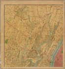
Map of the borough of Brookly…
Map of lots belonging to the …
m
The Blanchard Press correctly…
Rand, McNally & Co.'s new aut…
m
Rand, McNally & Co.'s complet…
m
New York City and vicinity
Erie Railroad suburban lines
King's bird's-eye view of Bro…
Rand McNally standard map of …
Guide map to the Brooklyn and…
Map of the borough of Brookly…
The Brooklyn of the future : …
Map showing proposed extensio…
Map of the borough of Brookly…
Rand, McNally & Co.'s new han…
Map of New York City region a…
Rand McNally standard map of …
m
Map of New York City : showin…
Map of the City of New York :…
m
Sea Gate, New York Harbor
Center of New York, first cit…
m
Rand-McNally standard map of …
m
Map of New York : showing Leh…
m
Map of the borough of Brookly…
m
Map of the metropolitan distr…
Map of portion of greater New…
m
Town site of La Gloria: looki…
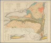
Economic and geologic map of …
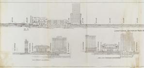
Express level - 1st half
Sections and Elevations - 1st…
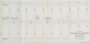
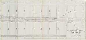
Street Level - 1st half
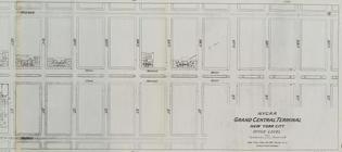
Street Level - 2nd half
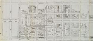
Office level left side
Office level right side
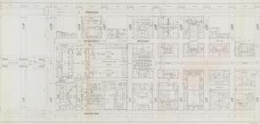
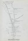
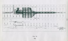
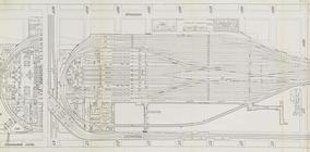
Map. Manhattan's Railroad ent…
Map 10 overhead foot bridges …
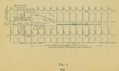
Map depot and yard (figure 5)
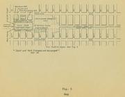
Map station and yard (figure …
Map. Manhattan's Railroad ent…
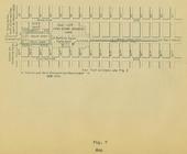
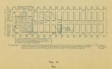
Map (figure 14)
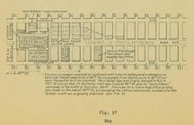
Map (figure 17)
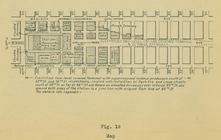
Map (figure 19)
Suburban Level - 1st half.
Suburban Level - 2nd half.
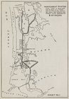
The subway problem: map of in…
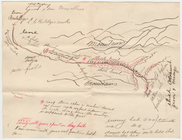
Hand-drawn map
1
2
3
4
5
6
Previous
Next
1
2
3
4
5
6
Previous
Next