Click to visit the main New York Public Library Homepage
The New York Public Library
Digital Collections
About Digital Collections
Browse
Search only public domain materials
Items
Collections
Divisions
Home
Search
Browse
About
Search only public domain materials
Items
Collections
Divisions
Digital Collections
Using Images
Using Data
Search
Filtered search
Show filters
Hide filters
Show Only Public Domain
topic
Real property
1957
Parks
1652
Libraries
1535
Educational facilities
791
Elevated railroads
750
More
Less
name
Sperr, Percy Loomis, 1890-1964
1686
New York Public Library
1521
G.W. Bromley & Co
1389
New York Public Library. Humanities and Social Sciences Library
709
Stephen A. Schwarzman Building (New York, N.Y.)
697
More
Less
collection
Photographic views of New York City, 1870's-1970's, from the collections of the New York Public Library
4420
Atlases of New York City
2323
Robert N. Dennis collection of stereoscopic views
2145
New York Public Library Visual Materials
1514
Wallach Division Picture Collection
644
More
Less
place
x
New York
New York (State)
13624
New York (N.Y.)
8808
Manhattan (New York, N.Y.)
5519
Brooklyn (New York, N.Y.)
1244
More
Less
genre
Photographs
9741
Maps
2488
Stereographs
2145
Postcards
343
Prints
302
More
Less
publisher
G.W. Bromley & Co
1341
E. Belcher Hyde
557
G.C. Hesselgren Pub. Co
301
New York (N.Y.). Board of Estimate and Apportionment
112
New York Interborough Rapid Transit Company
95
More
Less
division
Milstein Division
5216
Map Division
2565
Wallach Division: Photography Collection
2473
NYPL Archives
1389
Wallach Division: Picture Collection
591
More
Less
type
still image
11041
cartographic
2488
text
634
moving image
1
Date Range
to
13,644 results found
Filtering on:
x
Date
: 1900 - 1930
x
Place
: New York
Sort by:
Title
Date created
Date digitized
Sequence
Results 251 - 300
m
Brooklyn: Dumont Avenue - Ver…
m
The Wanamaker diary map of Ne…
m
Tentative height districts, M…
m
Tentative use districts, Manh…
Freight terminal map of New Y…
Commission on building distri…
Center of New York, first cit…
Block line map of the heavy v…
m
Rand-McNally standard map of …
m
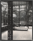
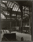
Penn. Station, Interior
m
Penn. Station, Interior
m
Hagstrom's map of upper New Y…
Williams' map of boroughs of …
Map of boroughs of Manhattan …
m
Authentic street plan of grea…
m
Hammond's new guide map of Ma…
m
Map of the borough of Brookly…
Mapa de la ciudad de Nueva Yo…
Maps accompanying report of M…
The Narrows tunnel : chart of…
m
Map of the underground railwa…
Grouping of troops and other …
Proposed location of the Narr…
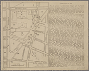
A landmark map of City Hall P…
Hagstrom's New York house-num…
m
Financial district map of New…
m
Borough of Manhattan, 300 foo…
Map of the borough of Manhatt…
Freight terminal map of the P…
Block no. 86 : confidential r…
m
Street guide of Manhattan and…
Map of portion of greater New…
m
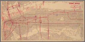
Columbia University in the Ci…
Greater New York's Census dis…
m
Rand McNally commercial map o…
m
Hudson River vehicular tunnel…
Hagstrom's map of ... New Yor…
Map of Morningside Park
Library School of The New Yor…
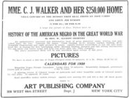
History of the American Negro…
m
Map of original grants and fa…
m
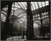
Penn. Station, Interior
m
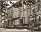
Washington Square North, #121…
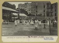
Lawn-tennis and volley-ball g…
m
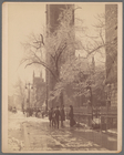
Fifth Ave., March 16th, 1900
m
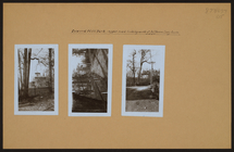
Manhattan: Inwood Hill Park.
m
Manhattan: Inwood Hill Park.
m
Manhattan: Inwood Hill Park.
New Yorkers prefer Grand Auto…
m
Brooklyn: Degraw Street - Smi…
1
2
3
4
5
6
7
8
9
10
…
54
55
Previous
Next
1
2
3
4
5
6
7
8
9
10
…
54
55
Previous
Next