Click to visit the main New York Public Library Homepage
The New York Public Library
Digital Collections
About Digital Collections
Browse
Search only public domain materials
Items
Collections
Divisions
Home
Search
Browse
About
Search only public domain materials
Items
Collections
Divisions
Digital Collections
Using Images
Using Data
Search
Filtered search
Show filters
Hide filters
Show Only Public Domain
topic
Real property
6724
Fire insurance
4483
Cities & towns
4398
Maps
275
Zoning
114
More
Less
name
Sanborn Map Company
4486
G.W. Bromley & Co
2148
Bromley, George Washington
555
Bromley, Walter Scott
555
Ullitz, Hugo
550
More
Less
collection
x
Atlases of New York City
place
New York (State)
6970
New York
2146
Manhattan (New York, N.Y.)
1441
New York (N.Y.)
1097
Bronx (New York, N.Y.)
521
More
Less
genre
Maps
7897
Indexes
119
Topographic maps
119
Cadastral maps
52
Index maps
47
More
Less
publisher
Sanborn Map Company
4534
G.W. Bromley & Co
2050
E. Belcher Hyde
654
Sanborn Map Co
84
The Board
76
More
Less
division
Map Division
8016
type
cartographic
7896
text
216
still image
4
Date Range
to
8,016 results found
Filtering on:
x
Date
: 1902 - 1978
x
Rights
: Public Domain
x
Collection
: Atlases of New York City
For more collection details, visit the
Atlases of New York City collection page
.
Sort by:
Title
Date created
Date digitized
Sequence
m
Map 35 - Richmond
m
Map 34 - Richmond
m
Map 33 - Richmond
m
Map 32 - Richmond
m
Map 31 - Queens
m
Map 30 - Brooklyn and Queens
m
Map 29 - Brooklyn and Queens
m
Map 28 - Brooklyn
m
Map 27 - Richmond
m
Map 26 - Richmond
m
Map 25 - Queens
m
Map 24 - Brooklyn and Queens
m
Map 23 - Brooklyn
m
Map 22 - Brooklyn
m
Map 21 - Richmond
m
Map 20 - Richmond
m
Map 19 - Queens
m
Map 18 - Brooklyn and Queens
m
Map 17 - Queens and Brooklyn
m
Map 16 - Manhattan and Brookl…
m
Map 15 - Queens
m
Map 14 - Queens
m
Map 13 - Brooklyn and Queens
m
Map 12 - Manhattan and Brookl…
m
Map 11 - Queens
m
Map 10 - Queens
m
Map 9 - Manhattan, Brooklyn, …
m
Map 8 - Manhattan, Brooklyn, …
m
Map 7 - Bronx and Queens
m
Map 6 - Manhattan, Bronx, and…
m
Map 5 - Manhattan
m
Map 4 - Bronx
m
Map 2 - Bronx
m
Map 1 - Manhattan and Bronx
Index map and legend
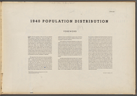
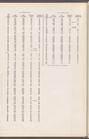
1940 population distribution:…
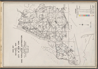
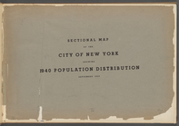
Sectional map of the City of …
m
Map 3 - Manhattan and Bronx
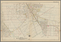
Bounded by Avenue K., Ralph A…
Bounded by E. 103rd Street, A…
Bounded by Avenue D., Ralph A…
Bounded by Rockaway Avenue, R…
Bounded by Ralph Avenue, E. 9…
Bounded by Avenue J., E. 56th…
Bounded by Avenue P., E. 31st…
Bounded by Avenue V., Knapp S…
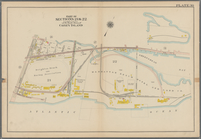
Coney Island: Part of Section…
Coney Island. Bounded by Cana…
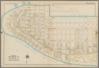
Bounded by Bay View Avenue, W…
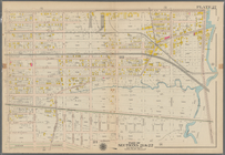
Bounded by Ocean Avenue, Emmo…
1
2
3
4
5
6
7
8
9
10
…
32
33
Previous
Next
1
2
3
4
5
6
7
8
9
10
…
32
33
Previous
Next