Click to visit the main New York Public Library Homepage
The New York Public Library
Digital Collections
About Digital Collections
Browse
Search only public domain materials
Items
Collections
Divisions
Home
Search
Browse
About
Search only public domain materials
Items
Collections
Divisions
Digital Collections
Using Images
Using Data
Search
Filtered search
Show filters
Hide filters
Show Only Public Domain
topic
Real property
2254
Fire insurance
1137
Cities & towns
1058
Zoning
116
Maps
85
More
Less
name
Sanborn Map Company
1138
G.W. Bromley & Co
830
Austro-Hungarian Monarchy. Militärgeographisches Institut
623
Ullitz, Hugo
523
E.B. Hyde & Co
512
More
Less
collection
Atlases of New York City
2949
Atlases of the United States
856
Spezialkarte der Osterreichisch-Ungarischen Monarchie
623
Maps of New York City and State
353
Maps of Asia
41
More
Less
place
New York (State)
2633
New York
1289
Maps
547
New York (N.Y.)
530
Brooklyn (New York, N.Y.)
528
More
Less
genre
Maps
4902
Atlases
842
Topographic maps
720
Cadastral maps
53
Pamphlets
36
More
Less
publisher
Sanborn Map Company
1185
G.W. Bromley & Co
733
E. Belcher Hyde
714
K.u.K. Militargeographisches Institut
623
E. Belcher-Hyde
112
More
Less
division
Map Division
4833
General Research Division
54
Schomburg Jean Blackwell Hutson Research and Reference Division
28
Manuscripts and Archives Division
14
Dorot Jewish Division
3
More
Less
type
x
cartographic
text
82
still image
16
Date Range
to
4,940 results found
Filtering on:
x
Date
: 1905 - 1920
x
Type
: cartographic
Sort by:
Title
Date created
Date digitized
Sequence
Results 1751 - 1800
m
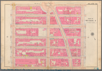
Plate 42, Part of Section 4: …
m
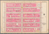
Plate 43, Part of Sections 4&…
m
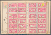
Plate 44, Part of Section 5: …
m
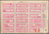
Plate 45, Part of Section 5: …
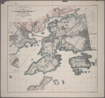
Index to the Topographical su…
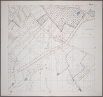
Sheet 1: Grid #6000E - 12000…
Sheet 2: Grid #8000E - 12000E…
Sheet 3: Grid #8000E - 12000E…
Sheet 4: Grid #9000E - 12000E…
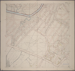
Sheet 6: Grid #14000E - 16000…
Sheet 7: Grid #13000E - 16000…
Sheet 8: Grid #12000E - #1600…
Sheet 9: Grid #12000E - 16000…
Sheet 10: Grid #12000E - 1600…
Sheet 11: Grid #12000E - 1600…
Sheet 12: Grid #12000E - 1600…
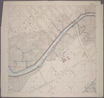
Sheet 13: Grid #16000E - 2000…
Sheet 14: Grid #16000E - 2000…
Sheet 15: Grid #16000E - 2000…
Sheet 16: Grid #16000E - 2000…
Sheet 17: Grid #16000E - 2000…
Sheet 18: Grid #16000E - 2000…
Sheet 19: Grid #16000E - 2000…
Sheet 20: Grid #16000E - 2000…
Sheet 21: Grid #18000E - 2400…
Sheet 22: Grid #20000E - 2400…
Sheet 23: Grid #20000E - 2400…
Sheet 24: Grid #20000E - 2400…
Sheet 25: Grid #20000E - 2400…
Sheet 26: Grid #20000E - 2400…
Sheet 27: Grid #20000E - 2400…
Sheet 28: Grid #20000E - 2200…
Sheet 29: Map of Pelham Bay P…
Sheet 30: Grid #24000E - 2800…
Sheet 31: Grid #24000E - 2800…
Sheet 32: Grid #24000E - 2800…
Sheet 33: Grid #24000E - 2800…
Sheet 34: Grid #24000E - 2800…
Sheet 35: Grid #28000E - 3200…
Sheet 36: Grid #28000E - 3200…
Sheet 37: Grid #28000E - 3200…
Sheet 38: Grid #26000E - 3000…
Sheet 39: Grid #32000E - 3600…
Sheet 40: Grid #32000E - 3600…
Sheet 41: Grid #36000E - 3800…
Sheet 42: Grid #34000E - 3500…
Sheet 43: Grid #32000E - 3900…
m
Plate 4, Part of Section 3: […
Richmond Borough: Index to Li…
Sheet Nos. 1 & 4. [Sheet No. …
1
2
…
5
6
7
8
9
10
11
12
…
19
20
Previous
Next
1
2
…
5
6
7
8
9
10
11
12
…
19
20
Previous
Next