Click to visit the main New York Public Library Homepage
The New York Public Library
Digital Collections
About Digital Collections
Browse
Search only public domain materials
Items
Collections
Divisions
Home
Search
Browse
About
Search only public domain materials
Items
Collections
Divisions
Digital Collections
Using Images
Using Data
Search
Filtered search
Show filters
Hide filters
Show Only Public Domain
topic
Real property
202
Cities & towns
80
Fire insurance
80
Maps
39
Real property auctions
5
More
Less
name
E. Belcher Hyde Map Company
83
E.B. Hyde & Co
83
Ullitz, Hugo
83
Sanborn Map Company
80
Bromley, George Washington
39
More
Less
collection
Atlases of New York City
281
Maps of New York City and State
28
Spezialkarte der Osterreichisch-Ungarischen Monarchie
27
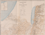
Ḳuṣejr ʻAmra ... Mit einer Karte von Arabia Petraea
3
An itinerary containing his ten yeeres travell: through the twelve dominions of Germany, Bohmerland, Sweitzerland, Netherland, Denmarke, Poland, Italy, Turky, France, England, Scotland & Ireland
2
More
Less
place
New York (State)
218
Brooklyn (New York, N.Y.)
124
New York
100
Maps
84
New York (N.Y.)
47
More
Less
genre
Maps
347
Topographic maps
27
Pamphlets
5
Manuscript maps
3
Prints
3
More
Less
publisher
E. Belcher Hyde
83
Sanborn Map Company
80
E. Belcher Hyde
42
G.W. Bromley & Co
39
E. Robinson Co
37
More
Less
division
Map Division
339
General Research Division
5
Milstein Division
2
Dorot Jewish Division
1
Schomburg Jean Blackwell Hutson Research and Reference Division
1
type
x
cartographic
text
8
still image
1
Date Range
to
348 results found
Filtering on:
x
Date
: 1907 - 1907
x
Type
: cartographic
Sort by:
Title
Date created
Date digitized
Sequence
m
There will be Sold at Public …
m
Absolute Sale without reserve…
m
Absolute Sale without reserve…
m
Public Auction Sale. 25 Bronx…
m
Private Sale of Private Dwell…
m
Map of 1250 Lots & Gores, sit…
m
Ogden Estate, Partition Sale.…
m
Executor's Sale by order of C…
m
Map of the Bronx [including Y…
Map of the northern part of t…
m
White route book, Number 3
m
White route book, Number 5
Die Karte von Arabia Petraea
Die Karte von Arabia Petraea
Situationsplan
Sillein und Wagg-Bistritz.
Lipto Szt. Miklos (Ungarn).
Trautenau und Politz.
Rossbach in Bohmen und Oelsni…
Plazow.
Chrzanow und Krzeszowice.
Saybusch.
Szolyva.
Okormezo (Galizien).
Wien. (Nieder-Osterreich)
Kabola Polyana …
Bogdan.
Maramaros-Sziget.
Szinyer-Varalja und Kraszna-B…
Felso-Visso.
Kirlibaba.
Gleichenberg.
Czakany und Zala-Lovo …
Dunafoldvar und Szabadszallas.
Gyergyobekas.
Also-Lendva und Lenti.
Gyeres.
Nada und Soborsin.
Ojtoz Pasz.
Putna-Patak.
Nerejul.
Mehadia.
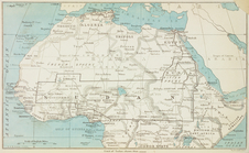
Map of the Sudan.
Linguistic families of Americ…
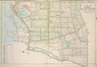
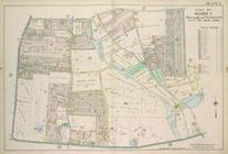
Plate 4, Part of Ward 1. [Map…
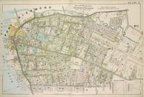
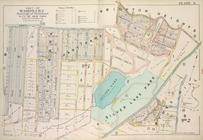
Plate 5, Part of Wards 1 & 3.…
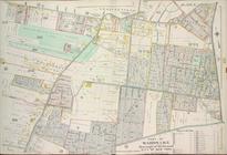
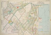
Plate 6, Part of Wards 1 & 3:…
Plate 7, Part of Ward 1: [Map…
Plate 8, Part of Wards 1 & 2:…
Plate 9, Part of Wards 1 & 2:…
1
2
Previous
Next
1
2
Previous
Next