Click to visit the main New York Public Library Homepage
The New York Public Library
Digital Collections
About Digital Collections
Browse
Search only public domain materials
Items
Collections
Divisions
Home
Search
Browse
About
Search only public domain materials
Items
Collections
Divisions
Digital Collections
Using Images
Using Data
Search
Filtered search
Show filters
Hide filters
Show Only Public Domain
topic
Railroads
22
Local transit
17
Real property auctions
16
Indian trails
12
Indians of North America
12
More
Less
name
Ohman, August R
16
Bolton, Reginald Pelham, 1856-1942
13
A.R. Ohman Map Co
12
Museum of the American Indian, Heye Foundation
12
C.S. Hammond & Company
8
More
Less
collection
x
Maps of New York City and State
place
New York (State)
84
New York
81
New York (N.Y.)
43
Manhattan (New York, N.Y.)
29
Brooklyn (New York, N.Y.)
21
More
Less
genre
x
Maps
Pamphlets
16
Aerial views
6
Manuscript maps
5
Mass transit
3
More
Less
publisher
Museum of the American Indian, Heye Foundation
12
producer not identified
4
August R. Ohman & Co
3
Brooklyn Daily Eagle
3
C.S. Hammond
3
More
Less
division
Map Division
147
type
cartographic
147
text
16
still image
3
Date Range
to
147 results found
Filtering on:
x
Date
: 1907 - 1912
x
Genre
: Maps
x
Collection
: Maps of New York City and State
For more collection details, visit the
Maps of New York City and State collection page
.
Sort by:
Title
Date created
Date digitized
Sequence
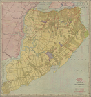
Map of the borough of Brookly…
m
Map of the borough of Brookly…
m
Map of Brooklyn
The Cord Meyer Development Co…
m
Petersen's map of Brooklyn
Williams' map of Borough of B…
Map of Jamaica in the 4th war…
m
Flushing Bay, Long Island, N.…
Railroads in Manhattan, Jerse…
Map of property New York Dock…
Map of Kissena Park, third wa…
Railroad suburbs between Holl…
East River Heights, first war…
Greater New York and Long Isl…
Map of the borough of Brookly…
Map of Bellaire Estates : own…
Panoramic view of New York Ci…
Map of Hudson & Manhattan Rai…
m
View of the city of New York …
m
Borough of Brooklyn, 5th cong…
Map of Hudson & Manhattan Rai…
Map of Bayside, third ward, b…
Greater New York City
m
Eagle Almanac map of the boro…
m
New York und Umgegend
Borough Park Company
Map showing location of propo…
Map of borough of Richmond
Rand McNally & Co.'s new hand…
Freight terminal map of New Y…
Hammond's new guide map of Ma…
Williams' map of boroughs of …
Map of boroughs of Manhattan …
m
Authentic street plan of grea…
m
Hammond's new guide map of Ma…
m
Data for population from cens…
Mapa de la ciudad de Nueva Yo…
Grouping of troops and other …
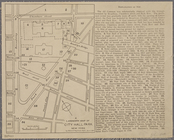
A landmark map of City Hall P…
Freight terminal map of the P…
Upper Manhattan, comprising t…
The lower end of Manhattan Is…
The southeastern part of the …
The southwestern part of the …
The northwesterly part of the…
The district of Pelham Neck, …
Southeastern part of the boro…
Werpoes, a village of the Man…
Yorkville and East Harlem in …
Southern part of the borough …