Click to visit the main New York Public Library Homepage
The New York Public Library
Digital Collections
About Digital Collections
Browse
Search only public domain materials
Items
Collections
Divisions
Home
Search
Browse
About
Search only public domain materials
Items
Collections
Divisions
Digital Collections
Using Images
Using Data
Search
Filtered search
Show filters
Hide filters
Show Only Public Domain
topic
Real property
993
Fire insurance
634
Cities & towns
633
Railroads
19
Indian trails
12
More
Less
name
Sanborn Map Company
635
Austro-Hungarian Monarchy. Militärgeographisches Institut
458
G.W. Bromley & Co
362
Bromley, George Washington
290
Bromley, Walter Scott
290
More
Less
collection
Atlases of New York City
1240
Atlases of the United States
548
Spezialkarte der Osterreichisch-Ungarischen Monarchie
458
Maps of New York City and State
136
Maps of North America
5
More
Less
place
New York (State)
1189
New York
352
New York (N.Y.)
225
Maps
187
Manhattan (New York, N.Y.)
160
More
Less
genre
Maps
2372
Topographic maps
549
Atlases
540
Indexes
11
Pamphlets
9
More
Less
publisher
Sanborn Map Company
634
K.u.K. Militargeographisches Institut
458
E. Belcher Hyde
336
G.W. Bromley & Co
316
E. Belcher-Hyde
112
More
Less
division
x
Map Division
type
cartographic
2375
text
38
still image
2
Date Range
to
2,392 results found
Filtering on:
x
Date
: 1910 - 1915
x
Division
: Map Division
Sort by:
Title
Date created
Date digitized
Sequence
m
Map of the Cedar Knolls, at B…
Map of the borough of Brookly…
m
Map of the borough of Brookly…
m
Petersen's map of Brooklyn
Williams' map of Borough of B…
m
Official map covering territo…
m
Flushing Bay, Long Island, N.…
Railroads in Manhattan, Jerse…
Road map of the New York dist…
Map of property New York Dock…
Carl Schurz Park
Park between 35th and 36th St…
Birdseye view of greater New …
m
Riverside Park
Greater New York and Long Isl…
Map of New York City and the …
Bush Terminal, map showing bu…
Panoramic view of New York Ci…
Map of the country thirty mil…
Map of the New York City metr…
Colonial Park
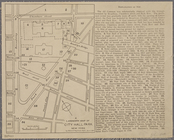
City Hall Park
Map of Brooklyn
Map of Hudson & Manhattan Rai…
Greater New York City
m
Hammond's complete map of Bro…
m
New York und Umgegend
Borough Park Company
Greater New York and its harb…
Map showing location of propo…
Map of borough of Richmond
Rand McNally & Co.'s new hand…
m
Tentative height districts, M…
m
Tentative use districts, Manh…
Block line map of the heavy v…
Williams' map of boroughs of …
Map of boroughs of Manhattan …
m
Hammond's new guide map of Ma…
m
Data for population from cens…
Grouping of troops and other …
A landmark map of City Hall P…
m
Borough of Manhattan, 300 foo…
Freight terminal map of the P…
m
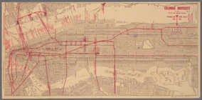
Columbia University in the Ci…
m
Rand McNally commercial map o…
Map of Morningside Park
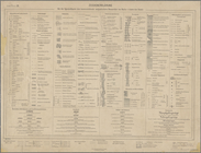
Zeichenerklärung
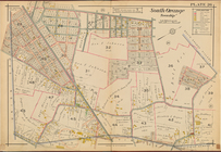
South Orange Township, Double…
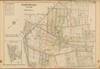
South Orange Township, Double…
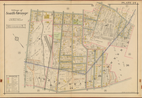
Village of South Orange, Doub…
1
2
3
4
5
6
7
8
9
10
Previous
Next
1
2
3
4
5
6
7
8
9
10
Previous
Next