Click to visit the main New York Public Library Homepage
The New York Public Library
Digital Collections
About Digital Collections
Browse
Search only public domain materials
Items
Collections
Divisions
Home
Search
Browse
About
Search only public domain materials
Items
Collections
Divisions
Digital Collections
Using Images
Using Data
Search
Filtered search
Show filters
Hide filters
Show Only Public Domain
topic
Real property
1281
Fire insurance
634
Cities & towns
633
Zoning
116
Railroads
31
More
Less
name
Sanborn Map Company
635
G.W. Bromley & Co
551
Austro-Hungarian Monarchy. Militärgeographisches Institut
457
E.B. Hyde & Co
284
Bromley, George Washington
280
More
Less
collection
Atlases of New York City
1634
Atlases of the United States
549
Spezialkarte der Osterreichisch-Ungarischen Monarchie
457
Maps of New York City and State
150
Maps of Asia
41
More
Less
place
New York (State)
1596
New York
759
Maps
359
Manhattan (New York, N.Y.)
354
New York (N.Y.)
224
More
Less
genre
x
Maps
Topographic maps
549
Atlases
541
Pamphlets
17
Index maps
13
More
Less
publisher
Sanborn Map Company
634
G.W. Bromley & Co
505
K.u.K. Militargeographisches Institut
457
E. Belcher Hyde
431
E. Belcher-Hyde
112
More
Less
division
Map Division
2839
General Research Division
23
Manuscripts and Archives Division
10
Schomburg Jean Blackwell Hutson Research and Reference Division
4
Wallach Division: Photography Collection
2
More
Less
type
cartographic
2875
text
32
still image
8
Date Range
to
2,880 results found
Filtering on:
x
Date
: 1910 - 1916
x
Genre
: Maps
Sort by:
Title
Date created
Date digitized
Sequence
m
Map of the Cedar Knolls, at B…
Map of the borough of Brookly…
m
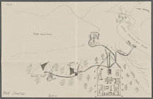
Drawing of campsite on the Li…
m
Map of the borough of Brookly…
m
Petersen's map of Brooklyn
Williams' map of Borough of B…
New York and vicinity roads a…
m
Official map covering territo…
m
Flushing Bay, Long Island, N.…
Railroads in Manhattan, Jerse…
Road map of the New York dist…
Map of property New York Dock…
Carl Schurz Park
Park between 35th and 36th St…
Birdseye view of greater New …
m
Map showing 100 miles around …
m
Riverside Park
Greater New York and Long Isl…
Map of New York City and the …
Bush Terminal, map showing bu…
Panoramic view of New York Ci…
Map of the country thirty mil…
Map of the New York City metr…
Colonial Park
City Hall Park
Map of Brooklyn
Map of Hudson & Manhattan Rai…
m
New quick reference street in…
Greater New York City
m
Hammond's complete map of Bro…
m
New York und Umgegend
Borough Park Company
Greater New York and its harb…
Map showing location of propo…
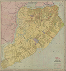
Map of borough of Richmond
Rand McNally & Co.'s new hand…
General plan of the city of H…
Diagrammatic plan for a moder…
General plan of the city of H…
Plan of the central section o…
Suggested type of layout for …
m
Tentative height districts, M…
m
Tentative use districts, Manh…
Commission on building distri…
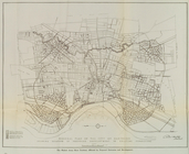
Block line map of the heavy v…
Williams' map of boroughs of …
Map of boroughs of Manhattan …
m
Hammond's new guide map of Ma…
m
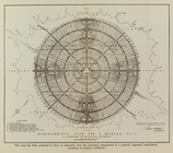
Data for population from cens…
Maps accompanying report of M…
1
2
3
4
5
6
7
8
9
10
11
12
Previous
Next
1
2
3
4
5
6
7
8
9
10
11
12
Previous
Next