Click to visit the main New York Public Library Homepage
The New York Public Library
Digital Collections
About Digital Collections
Browse
Search only public domain materials
Items
Collections
Divisions
Home
Search
Browse
About
Search only public domain materials
Items
Collections
Divisions
Digital Collections
Using Images
Using Data
Search
Filtered search
Show filters
Hide filters
Show Only Public Domain
topic
Real property
1504
Fire insurance
825
Cities & towns
740
Zoning
118
Railroads
21
More
Less
name
Sanborn Map Company
826
G.W. Bromley & Co
657
Austro-Hungarian Monarchy. Militärgeographisches Institut
458
Bromley, George Washington
383
Bromley, Walter Scott
383
More
Less
collection
Atlases of New York City
1991
Atlases of the United States
550
Spezialkarte der Osterreichisch-Ungarischen Monarchie
458
Maps of New York City and State
183
Maps of Asia
44
More
Less
place
New York (State)
1868
New York
923
Maps
374
Manhattan (New York, N.Y.)
369
Staten Island (New York, N.Y.)
269
More
Less
genre
Maps
3191
Topographic maps
551
Atlases
541
Indexes
26
Title pages
14
More
Less
publisher
Sanborn Map Company
741
G.W. Bromley & Co
611
E. Belcher Hyde
487
K.u.K. Militargeographisches Institut
458
E. Belcher-Hyde
112
More
Less
division
x
Map Division
type
cartographic
3205
text
66
still image
4
Date Range
to
3,236 results found
Filtering on:
x
Date
: 1910 - 1918
x
Division
: Map Division
Sort by:
Title
Date created
Date digitized
Sequence
m
Map of the Cedar Knolls, at B…
Map of the borough of Brookly…
m
Map of the borough of Brookly…
Hammond's complete map of New…
m
Petersen's map of Brooklyn
Map of Flatbush Meadows : sit…
Williams' map of Borough of B…
m
Metropolitan district local a…
The Evening Mail's complete m…
Tracts and farms with street …
New York and vicinity roads a…
m
Official map covering territo…
Opening Hell Gate at a cost o…
Rail terminal facilities in G…
m
Flushing Bay, Long Island, N.…
Railroads in Manhattan, Jerse…
Road map of the New York dist…
Map of property New York Dock…
Carl Schurz Park
Park between 35th and 36th St…
Birdseye view of greater New …
m
Map showing 100 miles around …
m
Riverside Park
m
Map of Manhattan showing the …
Block sketch 1679, New York C…
Greater New York and Long Isl…
m
Hammond's complete map of New…
m
Hammond's complete map of New…
Map of New York City and the …
m
Map of the borough of Brookly…
m
The Rand McNally map of the b…
Bush Terminal, map showing bu…
Panoramic view of New York Ci…
m
The five boroughs of the city…
Map of the country thirty mil…
Map of the New York City metr…
Colonial Park
Rand McNally Map of Brooklyn
City Hall Park
Map of Brooklyn
Map of Hudson & Manhattan Rai…
m
New quick reference street in…
Greater New York City
m
Hammond's complete map of Bro…
m
New York und Umgegend
Borough Park Company
Relief map of New York and vi…
Greater New York and its harb…
Map showing location of propo…
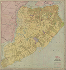
Map of borough of Richmond
1
2
3
4
5
6
7
8
9
10
…
12
13
Previous
Next
1
2
3
4
5
6
7
8
9
10
…
12
13
Previous
Next