Click to visit the main New York Public Library Homepage
The New York Public Library
Digital Collections
About Digital Collections
Browse
Search only public domain materials
Items
Collections
Divisions
Home
Search
Browse
About
Search only public domain materials
Items
Collections
Divisions
Digital Collections
Using Images
Using Data
Search
Filtered search
Show filters
Hide filters
Show Only Public Domain
topic
Real property
6195
Fire insurance
4086
Cities & towns
4000
Waterfalls
1691
Tourism
1336
More
Less
name
Sanborn Map Company
4086
Federal Art Project (New York, N.Y.)
2094
Abbott, Berenice, 1898-1991
2092
G.W. Bromley & Co
1804
E. & H.T. Anthony (Firm)
1043
More
Less
collection
Robert N. Dennis collection of stereoscopic views
8526
Atlases of New York City
6278
Changing New York
2073
New York Public Library Visual Materials
451
Detroit Publishing Company postcards
231
More
Less
place
x
New York (State)
New York
7118
New York (N.Y.)
5937
Manhattan (New York, N.Y.)
4969
Niagara Falls (N.Y. and Ont.)
2364
More
Less
genre
Photographs
11261
Stereographs
8526
Maps
6552
Postcards
374
Atlases
201
More
Less
publisher
Sanborn Map Company
4000
G.W. Bromley & Co
1756
E. Belcher Hyde
360
Baker & Record
276
Detroit Publishing Company
231
More
Less
division
Wallach Division: Photography Collection
10830
Map Division
6628
NYPL Archives
451
Milstein Division
202
Wallach Division: Picture Collection
147
More
Less
type
still image
11747
cartographic
6598
text
201
Date Range
to
18,412 results found
Filtering on:
x
Date
: 1910 - 2000
x
Place
: New York (State)
x
Rights
: Public Domain
Sort by:
Title
Date created
Date digitized
Sequence
m
Map of the Cedar Knolls, at B…
m
S. Rosenbloom & Sons, shoes
m
Rosenbloom Bros. leading book…
m
Compliments of Polosky & Staa…
m
Abraham Freidus and his assis…
Map of the borough of Brookly…
m
Union Square, 14th Street and…
Fraunces' Tavern, N.Y.C., 1777
m
The Harlem Negro
m
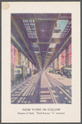
Shutters of Steel: Third Aven…
m
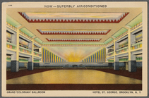
Grand "Colorama" Ballroom: Ho…
m
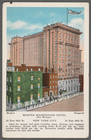
Martha Washington Hotel (for …
m
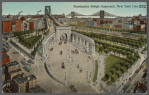
Manhattan Bridge approach, Ne…
m
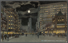
The Great White Way, New York…
m
Hammond's complete map of Bro…
Map of the borough of Brookly…
Hammond's handy reference map…
m
Map of the borough of Brookly…
Hammond's complete map of New…
Map of New York City and vici…
m
Petersen's map of Brooklyn
Map of Flatbush Meadows : sit…
Educational extension work of…
Map of the comprehensive plan…
Williams' map of Borough of B…
m
Metropolitan district local a…
The Evening Mail's complete m…
Tracts and farms with street …
m
The John Wanamaker automobile…
New York and vicinity roads a…
m
Official map covering territo…
Opening Hell Gate at a cost o…
Rail terminal facilities in G…
m
Flushing Bay, Long Island, N.…
Railroads in Manhattan, Jerse…
Map of the suburban territory…
Map of property New York Dock…
Carl Schurz Park
Brooklyn, from Rand McNally m…
Park between 35th and 36th St…
Birdseye view of greater New …
Hagstrom's map of lower New Y…
Rand McNally official 1921 au…
Hammond's handy reference map…
m
Riverside Park
m
Map of Manhattan showing the …
Map showing suggested connect…
Block sketch 1679, New York C…
m
Hammond's complete map of New…
Map of New York City and the …
1
2
3
4
5
6
7
8
9
10
…
73
74
Previous
Next
1
2
3
4
5
6
7
8
9
10
…
73
74
Previous
Next