Click to visit the main New York Public Library Homepage
The New York Public Library
Digital Collections
About Digital Collections
Browse
Search only public domain materials
Items
Collections
Divisions
Home
Search
Browse
About
Search only public domain materials
Items
Collections
Divisions
Digital Collections
Using Images
Using Data
Search
Filtered search
Show filters
Hide filters
Show Only Public Domain
topic
Real property
882
Fire insurance
392
Cities & towns
391
Zoning
116
Railroads
14
More
Less
name
Sanborn Map Company
393
G.W. Bromley & Co
323
E.B. Hyde & Co
221
Bromley, George Washington
195
Bromley, Walter Scott
195
More
Less
collection
Atlases of New York City
1137
Atlases of the United States
399
Maps of New York City and State
69
Maps of Asia
40
William J. Wilgus papers
5
More
Less
place
New York (State)
1105
New York
599
Maps
294
Manhattan (New York, N.Y.)
288
Suffolk County (N.Y.)
118
More
Less
genre
x
Maps
Atlases
395
Topographic maps
93
Index maps
9
Pamphlets
8
More
Less
publisher
Sanborn Map Company
392
E. Belcher Hyde
313
G.W. Bromley & Co
277
E. Belcher-Hyde
112
Century Atlas Co
94
More
Less
division
Map Division
1651
General Research Division
9
Manuscripts and Archives Division
8
Wallach Division: Photography Collection
2
Wallach Division: Print Collection
2
More
Less
type
cartographic
1671
text
18
still image
5
Date Range
to
1,673 results found
Filtering on:
x
Date
: 1913 - 1916
x
Genre
: Maps
Sort by:
Title
Date created
Date digitized
Sequence
m
Drawing of campsite on the Li…
New York and vicinity roads a…
m
Official map covering territo…
Road map of the New York dist…
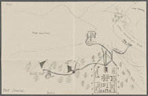
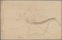
Carl Schurz Park
Park between 35th and 36th St…
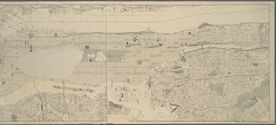
Birdseye view of greater New …
m
Map showing 100 miles around …
m
Riverside Park
Map of New York City and the …
Bush Terminal, map showing bu…
Map of the country thirty mil…
Map of the New York City metr…
Colonial Park
City Hall Park
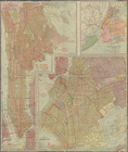
Map of Brooklyn
m
New quick reference street in…
m
Hammond's complete map of Bro…
Greater New York and its harb…
m
Tentative height districts, M…
m
Tentative use districts, Manh…
Commission on building distri…
Block line map of the heavy v…
Maps accompanying report of M…
m
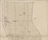
Borough of Manhattan, 300 foo…
m
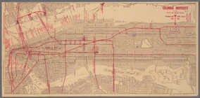
Columbia University in the Ci…
m
Rand McNally commercial map o…
Map of Morningside Park
m
Osnovnyi︠a︡ soobrazhenīi︠a︡ k…
m
Glavno-Kavkazskai͡a zh. d. Av…
City of Erie. Pennsylvania. G…
Map of Proposed Belt Railways…
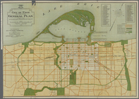
Preliminary Study for a Great…
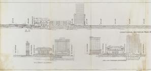
Sections and Elevations - 1st…
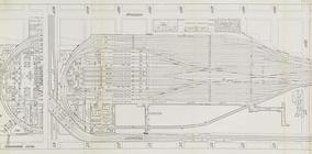
Suburban Level - 1st half.
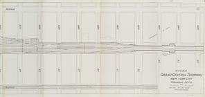
Suburban Level - 2nd half.
m
Obʺi︠a︡snitelʹnai︠a︡ zapiska …
Map, Copake (Columbia County,…
m
Reid, Harry Fielding
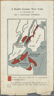
A Really Greater New York as …
Map of Cape Cod and vicinity
m
Map of New York City south of…
m
[Panoramic views of the Bronx…
[Map of] Friends' in the vici…
m
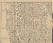
Map of Manhattan and part of …
Map of Boroughs of Manhattan …
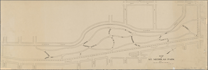
Map of Saint Nicholas Park, N…
m
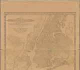
Map of New York City from Bat…
m
Rand, McNally's commercial Ma…
m
Map of the City of New York, …
1
2
3
4
5
6
7
Previous
Next
1
2
3
4
5
6
7
Previous
Next