Click to visit the main New York Public Library Homepage
The New York Public Library
Digital Collections
About Digital Collections
Browse
Search only public domain materials
Items
Collections
Divisions
Home
Search
Browse
About
Search only public domain materials
Items
Collections
Divisions
Digital Collections
Using Images
Using Data
Search
Filtered search
Show filters
Hide filters
Show Only Public Domain
topic
Parks
6
Streets
3
Buildings
2
Landowners
2
Local transit
2
More
Less
name
New York (N.Y.). Board of Estimate and Apportionment
2
Rand McNally and Company
2
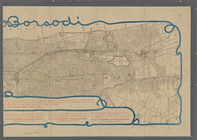
Borsodi, William
1
Byrnes, Clara
1
C.S. Hammond & Company
1
More
Less
collection
x
Maps of New York City and State
place
x
Manhattan (New York, N.Y.)
New York
18
New York (State)
18
New York (N.Y.)
7
Bronx (New York, N.Y.)
2
More
Less
genre
Maps
19
Cadastral maps
2
publisher
publisher unknown
5
Estimate and Apportionment Board
2
The Company
2
A.G. Hagstrom
1
C.S. Hammond and Company
1
More
Less
division
Map Division
19
type
cartographic
19
Date Range
to
19 results found
Filtering on:
x
Date
: 1913 - 1919
x
Place
: Manhattan (New York, N.Y.)
x
Collection
: Maps of New York City and State
For more collection details, visit the
Maps of New York City and State collection page
.
Sort by:
Title
Date created
Date digitized
Sequence
The Evening Mail's complete m…
Tracts and farms with street …
Carl Schurz Park
Park between 35th and 36th St…
Hagstrom's map of lower New Y…
m
Riverside Park
m
Map of Manhattan showing the …
Block sketch 1679, New York C…
m
Hammond's complete map of New…
Colonial Park
Rand McNally Map of Brooklyn
City Hall Park
m
Tentative height districts, M…
m
Tentative use districts, Manh…
Block line map of the heavy v…
m
Borough of Manhattan, 300 foo…
m
Rand McNally commercial map o…
Map of Morningside Park
m
Map of New York City
End of results
|
Top