Click to visit the main New York Public Library Homepage
The New York Public Library
Digital Collections
About Digital Collections
Browse
Search only public domain materials
Items
Collections
Divisions
Home
Search
Browse
About
Search only public domain materials
Items
Collections
Divisions
Digital Collections
Using Images
Using Data
Search
Filtered search
Show filters
Hide filters
Show Only Public Domain
topic
Real property
1098
Fire insurance
583
Cities & towns
499
Water supply
311
Streets
212
More
Less
name
Sanborn Map Company
583
New York (N.Y.). Board of Water Supply
310
G.W. Bromley & Co
284
Ullitz, Hugo
243
Rosenfeld, Morris, 1884-1968
173
More
Less
collection
Atlases of New York City
1224
Photographic views of New York City, 1870's-1970's, from the collections of the New York Public Library
445
Photographs of the Catskill water supply system in process of construction
310
Morris Rosenfeld Photographs
172
Collection of photographs taken by Daniel B. Austin and his associate, Adam Dove, depicting buildings, street scenes and Brooklyn and Long Island views, particularly Flatbush, Gravesend and New Utrecht, and generally for the period 1885-1914
128
More
Less
place
x
New York (State)
New York
2073
New York (N.Y.)
877
Manhattan (New York, N.Y.)
820
Maps
257
More
Less
genre
Photographs
1436
Maps
1369
Atlases
112
Postcards
97
Stereographs
95
More
Less
publisher
Sanborn Map Company
498
E. Belcher Hyde
243
G.W. Bromley & Co
236
E. Belcher-Hyde
112
Sanborn Map Co
85
More
Less
division
Map Division
1392
Milstein Division
886
General Research Division
326
Wallach Division: Photography Collection
133
NYPL Archives
116
More
Less
type
still image
1680
cartographic
1383
text
64
Date Range
to
3,088 results found
Filtering on:
x
Date
: 1913 - 1919
x
Place
: New York (State)
Sort by:
Title
Date created
Date digitized
Sequence
m
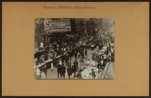
Occupations - Peddlers - Misc…
m
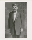
Portrait of Arthur Alfonso Sc…
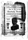
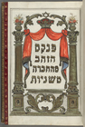
Ḥevrah Mishnayot mi-bet ha-k…
m
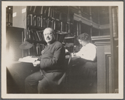
Abraham Freidus and his assis…
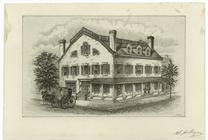
Fraunces' Tavern, N.Y.C., 1777
m
The Harlem Negro
m
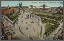
Manhattan Bridge approach, Ne…
m
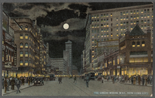
The Great White Way, New York…
Hammond's complete map of New…
Map of Flatbush Meadows : sit…
m
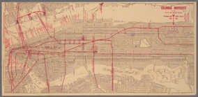
Metropolitan district local a…
The Evening Mail's complete m…
Tracts and farms with street …
New York and vicinity roads a…
m
Official map covering territo…
Opening Hell Gate at a cost o…
Rail terminal facilities in G…
Railroads in Manhattan, Jerse…
Carl Schurz Park
Park between 35th and 36th St…
Birdseye view of greater New …
Hagstrom's map of lower New Y…
m
Riverside Park
m
Map of Manhattan showing the …
Block sketch 1679, New York C…
m
Hammond's complete map of New…
Map of New York City and the …
m
Map of the borough of Brookly…
m
The Rand McNally map of the b…
Brooklyn Liberty Loan Committ…
Bush Terminal, map showing bu…
m
The five boroughs of the city…
Map of the country thirty mil…
Map of the New York City metr…
Colonial Park
Rand McNally Map of Brooklyn
City Hall Park
Map of Brooklyn
m
New quick reference street in…
m
Hammond's complete map of Bro…
Greater New York and its harb…
Plan of the great meadows of …
m
Tentative height districts, M…
m
Tentative use districts, Manh…
Commission on building distri…
Block line map of the heavy v…
Maps accompanying report of M…
m
Borough of Manhattan, 300 foo…
Freight terminal map of the P…
m
Columbia University in the Ci…
1
2
3
4
5
6
7
8
9
10
…
12
13
Previous
Next
1
2
3
4
5
6
7
8
9
10
…
12
13
Previous
Next