Click to visit the main New York Public Library Homepage
The New York Public Library
Digital Collections
About Digital Collections
Browse
Search only public domain materials
Items
Collections
Divisions
Home
Search
Browse
About
Search only public domain materials
Items
Collections
Divisions
Digital Collections
Using Images
Using Data
Search
Filtered search
Show filters
Hide filters
Show Only Public Domain
topic
Real property
615
Water supply
311
Fire insurance
294
Cities & towns
211
Zoning
118
More
Less
name
New York (N.Y.). Board of Water Supply
310
Sanborn Map Company
294
Ullitz, Hugo
208
G.W. Bromley & Co
202
New York (N.Y.). Board of Estimate and Apportionment
119
More
Less
collection
Atlases of New York City
818
Photographic views of New York City, 1870's-1970's, from the collections of the New York Public Library
345
Photographs of the Catskill water supply system in process of construction
310
Robert N. Dennis collection of stereoscopic views
95
New York Public Library Visual Materials
81
More
Less
place
x
New York (State)
New York
1522
New York (N.Y.)
570
Manhattan (New York, N.Y.)
521
Maps
145
More
Less
genre
Photographs
930
Maps
837
Stereographs
95
Postcards
43
Prints
20
More
Less
publisher
Sanborn Map Company
210
E. Belcher Hyde
208
G.W. Bromley & Co
202
Sanborn Map Co
84
The Board
76
More
Less
division
Map Division
858
Milstein Division
402
General Research Division
322
Wallach Division: Photography Collection
102
NYPL Archives
81
More
Less
type
still image
1021
cartographic
848
text
49
Date Range
to
1,887 results found
Filtering on:
x
Date
: 1915 - 1919
x
Place
: New York (State)
Sort by:
Title
Date created
Date digitized
Sequence
m
Occupations - Peddlers - Misc…
m
Portrait of Arthur Alfonso Sc…
Ḥevrah Mishnayot mi-bet ha-k…
m
The Harlem Negro
m
The Great White Way, New York…
Hammond's complete map of New…
Map of Flatbush Meadows : sit…
m
Metropolitan district local a…
The Evening Mail's complete m…
Tracts and farms with street …
New York and vicinity roads a…
Opening Hell Gate at a cost o…
Rail terminal facilities in G…
Railroads in Manhattan, Jerse…
Birdseye view of greater New …
Hagstrom's map of lower New Y…
m
Map of Manhattan showing the …
Block sketch 1679, New York C…
m
Hammond's complete map of New…
m
Map of the borough of Brookly…
m
The Rand McNally map of the b…
Brooklyn Liberty Loan Committ…
Bush Terminal, map showing bu…
m
The five boroughs of the city…
Map of the country thirty mil…
Map of the New York City metr…
Rand McNally Map of Brooklyn
m
New quick reference street in…
Plan of the great meadows of …
m
Tentative height districts, M…
m
Tentative use districts, Manh…
Commission on building distri…
Maps accompanying report of M…
m
Borough of Manhattan, 300 foo…
Freight terminal map of the P…
m
Rand McNally commercial map o…
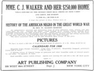
History of the American Negro…
m
Brooklyn: Fulton Street - Liv…
m
Brooklyn: Bay Ridge Parkway -…
m
Brooklyn: 41st Street - 3rd A…
m
Brooklyn: 4th Avenue - Pacifi…
m
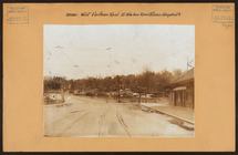
Bronx: Williamsbridge Road - …
m
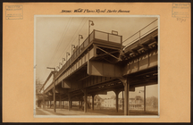
Bronx: White Plains Road - Bu…
m
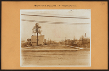
Bronx: White Plains Road - We…
m
Bronx: Fordham Road (West) - …
m
Bronx: Trinity Avenue - 158th…
m
Bronx: Soundview Avenue - Sto…
m
Bronx: Soundview Avenue - Sto…
m
Bronx: Poe Park.
m
Bronx: Jerome Avenue - Shakes…
1
2
3
4
5
6
7
8
Previous
Next
1
2
3
4
5
6
7
8
Previous
Next