Click to visit the main New York Public Library Homepage
The New York Public Library
Digital Collections
About Digital Collections
Browse
Search only public domain materials
Items
Collections
Divisions
Home
Search
Browse
About
Search only public domain materials
Items
Collections
Divisions
Digital Collections
Using Images
Using Data
Search
Filtered search
Show filters
Hide filters
Show Only Public Domain
topic
Real property
647
Fire insurance
290
Cities & towns
210
Zoning
116
Pheasants
19
More
Less
name
G.W. Bromley & Co
294
Sanborn Map Company
291
E.B. Hyde & Co
228
Ullitz, Hugo
204
Hyde, Merritt B
118
More
Less
collection
Atlases of New York City
902
Atlases of the United States
261
Maps of New York City and State
80
Maps of Asia
38
A monograph of the pheasants
19
More
Less
place
New York (State)
848
New York
636
Manhattan (New York, N.Y.)
214
Maps
183
Staten Island (New York, N.Y.)
173
More
Less
genre
Maps
1298
Atlases
256
Indexes
12
Prints
8
Illustrations
7
More
Less
publisher
E. Belcher Hyde
322
G.W. Bromley & Co
294
Sanborn Map Company
211
Century Atlas Co
94
Sanborn Map Co
80
More
Less
division
Map Division
1283
General Research Division
23
Schomburg Jean Blackwell Hutson Research and Reference Division
4
Wallach Division: Photography Collection
2
Wallach Division: Print Collection
2
More
Less
type
x
cartographic
text
28
still image
4
Date Range
to
1,316 results found
Filtering on:
x
Date
: 1915 - 1919
x
Type
: cartographic
Sort by:
Title
Date created
Date digitized
Sequence
Hammond's complete map of New…
Map of Flatbush Meadows : sit…
m
Metropolitan district local a…
The Evening Mail's complete m…
Tracts and farms with street …
New York and vicinity roads a…
Opening Hell Gate at a cost o…
Rail terminal facilities in G…
Railroads in Manhattan, Jerse…
Road map of the New York dist…
Birdseye view of greater New …
m
Map showing 100 miles around …
Hagstrom's map of lower New Y…
m
Map of Manhattan showing the …
Block sketch 1679, New York C…
Wall St. New York City, U.S.A…
m
Hammond's complete map of New…
m
Hammond's complete map of New…
m
Map of the borough of Brookly…
m
The Rand McNally map of the b…
Brooklyn Liberty Loan Committ…
Bush Terminal, map showing bu…
m
The five boroughs of the city…
Map of the country thirty mil…
Map of the New York City metr…
Rand McNally Map of Brooklyn
m
New quick reference street in…
Relief map of New York and vi…
Plan of the great meadows of …
m
Tentative height districts, M…
m
Tentative use districts, Manh…
Map of borough of Queens
Commission on building distri…
Maps accompanying report of M…
m
Borough of Manhattan, 300 foo…
Freight terminal map of the P…
m
Rand McNally commercial map o…
m
New York City subway map with…
Map showing comparison betwee…
Cessières
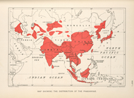
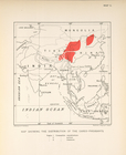
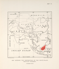
Map showing the distribution …
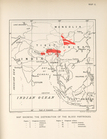
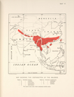
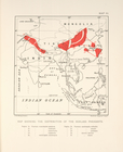
Map showing the distribution …
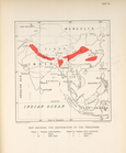
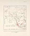
Map showing the distribution …
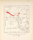
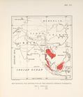
Map showing the distribution …
Map showing the distribution …
Map showing the distribution …
Map showing the distrubution …
Map showing the distribution …
Map showing the distribution …
Map showing the distrubution …
1
2
3
4
5
6
Previous
Next
1
2
3
4
5
6
Previous
Next