Click to visit the main New York Public Library Homepage
The New York Public Library
Digital Collections
About Digital Collections
Browse
Search only public domain materials
Items
Collections
Divisions
Home
Search
Browse
About
Search only public domain materials
Items
Collections
Divisions
Digital Collections
Using Images
Using Data
Search
Filtered search
Show filters
Hide filters
Show Only Public Domain
topic
Real property
5284
Fire insurance
3550
Cities & towns
3469
Maps
268
Zoning
225
More
Less
name
Sanborn Map Company
3563
G.W. Bromley & Co
1621
New York (N.Y.). Board of Estimate and Apportionment
336
E.B. Hyde & Co
265
Ullitz, Hugo
237
More
Less
collection
Atlases of New York City
6170
Atlases of the United States
363
Maps of New York City and State
180
Maps of Asia
55
Cigarette cards
51
More
Less
place
New York (State)
5658
New York
1808
Manhattan (New York, N.Y.)
1292
New York (N.Y.)
992
Bronx (New York, N.Y.)
268
More
Less
genre
x
Maps
Atlases
357
Advertisements
52
Advertising cards
51
Cards
51
More
Less
publisher
Sanborn Map Company
3472
G.W. Bromley & Co
1621
E. Belcher Hyde
357
New York (N.Y.). Board of Estimate and Apportionment
182
M.B. Brown Printing & Binding Co.,
108
More
Less
division
Map Division
6799
George Arents Collection
51
Manuscripts and Archives Division
41
General Research Division
35
Schomburg Jean Blackwell Hutson Research and Reference Division
9
More
Less
type
cartographic
6944
text
133
still image
74
Date Range
to
6,954 results found
Filtering on:
x
Date
: 1915 - 1967
x
Genre
: Maps
Sort by:
Title
Date created
Date digitized
Sequence
Paris, ses monuments : guide …
m
Knickerbocker Village
m
Maps
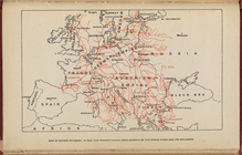
Map of Europe, showing in Red…
m
Il dirigibile "Norge" alla sc…
m
Drawing of campsite on the Li…
m
Visitor's Map of Florence
m
Map of Rome
m
Italian State Tourist Departm…
m
Hammond's complete map of Bro…
Map of the borough of Brookly…
Hammond's handy reference map…
m
Freight map of the metropolit…
Hammond's complete map of New…
Map of New York City and vici…
Map of Flatbush Meadows : sit…
Educational extension work of…
Map of the comprehensive plan…
m
Metropolitan district local a…
The Evening Mail's complete m…
Tracts and farms with street …
m
The John Wanamaker automobile…
New York and vicinity roads a…
Opening Hell Gate at a cost o…
Rail terminal facilities in G…
Railroads in Manhattan, Jerse…
Map of the suburban territory…
Road map of the New York dist…
Brooklyn, from Rand McNally m…
Birdseye view of greater New …
m
Map showing 100 miles around …
Geroicheskiĭ pokhod
Hagstrom's map of lower New Y…
Rand McNally official 1921 au…
Hammond's handy reference map…
m
Map of Manhattan showing the …
Map showing suggested connect…
Block sketch 1679, New York C…
Wall St. New York City, U.S.A…
Most extraordinary [camera sh…
m
Hammond's complete map of New…
m
Hammond's complete map of New…
m
Map of the borough of Brookly…
m
The Rand McNally map of the b…
Brooklyn Liberty Loan Committ…
Bush Terminal, map showing bu…
Map of the borough of Brookly…
m
Map showing 50 miles around N…
m
The five boroughs of the city…
Map of the country thirty mil…
1
2
3
4
5
6
7
8
9
10
…
27
28
Previous
Next
1
2
3
4
5
6
7
8
9
10
…
27
28
Previous
Next