Click to visit the main New York Public Library Homepage
The New York Public Library
Digital Collections
About Digital Collections
Browse
Search only public domain materials
Items
Collections
Divisions
Home
Search
Browse
About
Search only public domain materials
Items
Collections
Divisions
Digital Collections
Using Images
Using Data
Search
Filtered search
Show filters
Hide filters
Show Only Public Domain
topic
Real property
568
Fire insurance
299
Cities & towns
218
Railroads
22
Railroads, Elevated
16
More
Less
name
Sanborn Map Company
309
G.W. Bromley & Co
266
Bromley, George Washington
181
Bromley, Walter Scott
181
E.B. Hyde & Co
158
More
Less
collection
Atlases of New York City
657
Atlases of the United States
175
Maps of New York City and State
115
A monograph of the pheasants
12
The lure of Africa
4
More
Less
place
New York (State)
628
New York
407
Staten Island (New York, N.Y.)
173
Suffolk County (N.Y.)
118
New York (N.Y.)
107
More
Less
genre
x
Maps
Atlases
170
Pamphlets
6
Guidebooks
5
Index maps
4
More
Less
publisher
G.W. Bromley & Co
266
Sanborn Map Company
218
E. Belcher Hyde
210
Sanborn Map Co
80
G.M. Hopkins (Firm)
42
More
Less
division
Map Division
949
General Research Division
21
Schomburg Jean Blackwell Hutson Research and Reference Division
7
Billy Rose Theatre Division
1
Dorot Jewish Division
1
type
cartographic
977
text
16
still image
7
Date Range
to
979 results found
Filtering on:
x
Date
: 1917 - 1922
x
Genre
: Maps
Sort by:
Title
Date created
Date digitized
Sequence
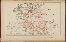
Map of Europe, showing in Red…
m
Hammond's complete map of Bro…
Map of the borough of Brookly…
Hammond's handy reference map…
m
Freight map of the metropolit…
Hammond's complete map of New…
Map of New York City and vici…
Map of Flatbush Meadows : sit…
Educational extension work of…
Map of the comprehensive plan…
m
Metropolitan district local a…
The Evening Mail's complete m…
Tracts and farms with street …
Opening Hell Gate at a cost o…
Rail terminal facilities in G…
Railroads in Manhattan, Jerse…
Map of the suburban territory…
Brooklyn, from Rand McNally m…
Hagstrom's map of lower New Y…
Rand McNally official 1921 au…
Hammond's handy reference map…
m
Map of Manhattan showing the …
Map showing suggested connect…
Block sketch 1679, New York C…
Wall St. New York City, U.S.A…
Most extraordinary [camera sh…
m
Hammond's complete map of New…
m
Hammond's complete map of New…
m
Map of the borough of Brookly…
m
The Rand McNally map of the b…
Brooklyn Liberty Loan Committ…
Map of the borough of Brookly…
m
Map showing 50 miles around N…
m
The five boroughs of the city…
Port of New York Authority : …
Rand McNally Map of Brooklyn
m
Proposed belt lines for the P…
Street guide of Brooklyn : wi…
American Automobile Associati…
Rand Mcnally official detaile…
Relief map of New York and vi…
m
Rand McNally official motor g…
m
Map of the borough of Brookly…
Transportation lines connecti…
Plan of the great meadows of …
m
The Wanamaker diary map of Ne…
Map of borough of Queens
m
Hagstrom's map of upper New Y…
The Narrows tunnel : chart of…
Proposed location of the Narr…
1
2
3
4
Previous
Next
1
2
3
4
Previous
Next