Click to visit the main New York Public Library Homepage
The New York Public Library
Digital Collections
About Digital Collections
Browse
Search only public domain materials
Items
Collections
Divisions
Home
Search
Browse
About
Search only public domain materials
Items
Collections
Divisions
Digital Collections
Using Images
Using Data
Search
Filtered search
Show filters
Hide filters
Show Only Public Domain
topic
Real property
1276
Fire insurance
219
Cities & towns
218
Zoning
109
Maps
88
More
Less
name
G.W. Bromley & Co
959
Sanborn Map Company
229
Fairchild Aerial Camera Corporation
127
New York (N.Y.). Bureau of Engineering
127
Tuttle, Arthur S. (Arthur Smith), 1865-1949
127
More
Less
collection
Atlases of New York City
1620
Atlases of the United States
143
Maps of New York City and State
100
A monograph of the pheasants
12
City of Alexandria town planning scheme
3
More
Less
place
New York (State)
1439
New York
1217
Manhattan (New York, N.Y.)
889
New York (N.Y.)
338
New Jersey
113
More
Less
genre
x
Maps
Atlases
139
Index maps
21
Pamphlets
5
Guidebooks
4
More
Less
publisher
G.W. Bromley & Co
959
Sanborn Map Company
218
M.B. Brown Printing & Binding Co.,
108
E. Belcher Hyde
94
New York (N.Y.). Board of Estimate and Apportionment
73
More
Less
division
Map Division
1869
General Research Division
22
Schomburg Jean Blackwell Hutson Research and Reference Division
4
Rare Book Division
2
Billy Rose Theatre Division
1
More
Less
type
cartographic
1897
text
16
still image
8
Date Range
to
1,899 results found
Filtering on:
x
Date
: 1918 - 1930
x
Genre
: Maps
Sort by:
Title
Date created
Date digitized
Sequence
Paris, ses monuments : guide …
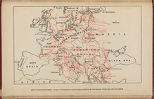
Map of Europe, showing in Red…
m
Il dirigibile "Norge" alla sc…
m
Hammond's complete map of Bro…
Map of the borough of Brookly…
Hammond's handy reference map…
m
Freight map of the metropolit…
Map of New York City and vici…
Educational extension work of…
Map of the comprehensive plan…
The Evening Mail's complete m…
m
The John Wanamaker automobile…
Rail terminal facilities in G…
Railroads in Manhattan, Jerse…
Map of the suburban territory…
Brooklyn, from Rand McNally m…
Hagstrom's map of lower New Y…
Rand McNally official 1921 au…
Hammond's handy reference map…
Map showing suggested connect…
Wall St. New York City, U.S.A…
Most extraordinary [camera sh…
Brooklyn Liberty Loan Committ…
Map of the borough of Brookly…
m
Map showing 50 miles around N…
Port of New York Authority : …
m
Proposed belt lines for the P…
Hagstrom's map of 50 mile rad…
Street guide of Brooklyn : wi…
American Automobile Associati…
Rand Mcnally official detaile…
m
Rand McNally official motor g…
m
Map of the borough of Brookly…
Transportation lines connecti…
m
The Wanamaker diary map of Ne…
m
Hagstrom's map of upper New Y…
The Narrows tunnel : chart of…
Proposed location of the Narr…
Hagstrom's New York house-num…
m
Financial district map of New…
Map of the borough of Manhatt…
Freight terminal map of the P…
Block no. 86 : confidential r…
m
Street guide of Manhattan and…
Greater New York's Census dis…
m
Hudson River vehicular tunnel…
Hagstrom's map of ... New Yor…
m
Map of original grants and fa…
Chief Points of Interest in L…
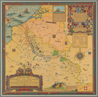
The great war map of battle l…
1
2
3
4
5
6
7
8
Previous
Next
1
2
3
4
5
6
7
8
Previous
Next