Click to visit the main New York Public Library Homepage
The New York Public Library
Digital Collections
About Digital Collections
Browse
Search only public domain materials
Items
Collections
Divisions
Home
Search
Browse
About
Search only public domain materials
Items
Collections
Divisions
Digital Collections
Using Images
Using Data
Search
Filtered search
Show filters
Hide filters
Show Only Public Domain
topic
Real property
948
Fire insurance
112
Religious facilities
112
Cities & towns
111
Dwellings
55
More
Less
name
G.W. Bromley & Co
787
Sanborn Map Company
112
Bromley, George Washington
91
Bromley, Walter Scott
91
E.B. Hyde & Co
46
More
Less
collection
Atlases of New York City
947
Robert N. Dennis collection of stereoscopic views
256
New York Public Library Visual Materials
43
Maps of New York City and State
41
Historical postcards of New York City
24
More
Less
place
x
New York (State)
New York
1203
Manhattan (New York, N.Y.)
962
New York (N.Y.)
405
Bronx (New York, N.Y.)
91
More
Less
genre
Maps
962
Photographs
302
Stereographs
256
Postcards
24
Index maps
19
More
Less
publisher
G.W. Bromley & Co
787
Sanborn Map Company
111
E. Belcher Hyde
44
The Company
9
E. Belcher Hyde Map Co
4
More
Less
division
Map Division
988
Wallach Division: Photography Collection
256
NYPL Archives
43
Wallach Division: Picture Collection
25
Schomburg Jean Blackwell Hutson Research and Reference Division
5
More
Less
type
cartographic
983
still image
338
text
42
Date Range
to
1,331 results found
Filtering on:
x
Date
: 1920 - 1929
x
Place
: New York (State)
x
Rights
: Public Domain
Sort by:
Title
Date created
Date digitized
Sequence
m
Martha Washington Hotel (for …
m
Hammond's complete map of Bro…
Map of the borough of Brookly…
Hammond's handy reference map…
Map of New York City and vici…
Educational extension work of…
Map of the comprehensive plan…
m
The John Wanamaker automobile…
Map of the suburban territory…
Brooklyn, from Rand McNally m…
Rand McNally official 1921 au…
Hammond's handy reference map…
Map showing suggested connect…
Map of the borough of Brookly…
Port of New York Authority : …
m
Proposed belt lines for the P…
Hagstrom's map of 50 mile rad…
Street guide of Brooklyn : wi…
American Automobile Associati…
Rand Mcnally official detaile…
m
Rand McNally official motor g…
m
Map of the borough of Brookly…
Transportation lines connecti…
m
The Wanamaker diary map of Ne…
m
Hagstrom's map of upper New Y…
The Narrows tunnel : chart of…
Proposed location of the Narr…
Hagstrom's New York house-num…
m
Financial district map of New…
Map of the borough of Manhatt…
Block no. 86 : confidential r…
m
Street guide of Manhattan and…
Greater New York's Census dis…
m
Hudson River vehicular tunnel…
Hagstrom's map of ... New Yor…
History of the American Negro…
m
Map of original grants and fa…
Sky-line of New York City
m
Pease & Elliman's catalog of …
m
Pease & Elliman's catalog of …
m
Hagstrom's map of Brooklyn (N…
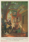
Here they used to sit in the …
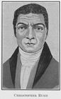
Christopher Rush; [A man who …
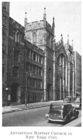
Abyssinian Baptist Church in …
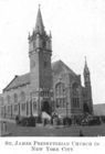
St. James Presbyterian Church…
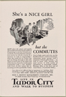
She's a NICE GIRL, but she CO…
m
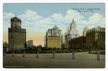
Battery Park looking north, N…
m
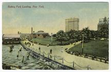
Battery Park Landing, New York
m
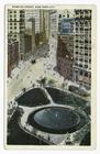
Bowling Green, New York City
m
Washington and Bowling Green …
1
2
3
4
5
6
Previous
Next
1
2
3
4
5
6
Previous
Next