Click to visit the main New York Public Library Homepage
The New York Public Library
Digital Collections
About Digital Collections
Browse
Search only public domain materials
Items
Collections
Divisions
Home
Search
Browse
About
Search only public domain materials
Items
Collections
Divisions
Digital Collections
Using Images
Using Data
Search
Filtered search
Show filters
Hide filters
Show Only Public Domain
topic
Real property
847
Libraries
671
Branch libraries
518
Educational facilities
436
Elevated railroads
419
More
Less
name
Sperr, Percy Loomis, 1890-1964
1222
G.W. Bromley & Co
787
New York Public Library
669
New York Public Library. Branch Libraries
503
New Jersey Interstate Bridge and Tunnel Commission
144
More
Less
collection
Photographic views of New York City, 1870's-1970's, from the collections of the New York Public Library
2655
Atlases of New York City
947
New York Public Library Visual Materials
665
Robert N. Dennis collection of stereoscopic views
247
Photographs of the construction of the Holland Tunnel, 1919-1927
144
More
Less
place
x
New York
New York (State)
5052
New York (N.Y.)
3744
Manhattan (New York, N.Y.)
2380
Brooklyn (New York, N.Y.)
380
More
Less
genre
Photographs
3996
Maps
957
Stereographs
247
Postcards
26
Portraits
24
More
Less
publisher
G.W. Bromley & Co
787
New York (N.Y.). Board of Estimate and Apportionment
74
E. Belcher Hyde
44
Board of Estimate and Apportionment
37
The Company
8
More
Less
division
Milstein Division
2765
Map Division
985
NYPL Archives
666
Wallach Division: Photography Collection
390
General Research Division
152
More
Less
type
still image
4069
cartographic
979
text
50
Date Range
to
5,058 results found
Filtering on:
x
Date
: 1920 - 1929
x
Place
: New York
Sort by:
Title
Date created
Date digitized
Sequence
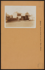
View of Harlem barbershop
m
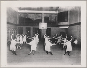
Dance Class at the Y.M.H.A.
m
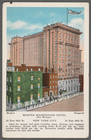
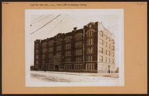
Martha Washington Hotel (for …
m
Hammond's complete map of Bro…
Map of the borough of Brookly…
Hammond's handy reference map…
Map of New York City and vici…
Educational extension work of…
Map of the comprehensive plan…
m
The John Wanamaker automobile…
Map of the suburban territory…
Brooklyn, from Rand McNally m…
Hammond's handy reference map…
Map showing suggested connect…
Map of the borough of Brookly…
Port of New York Authority : …
m
Proposed belt lines for the P…
Street guide of Brooklyn : wi…
American Automobile Associati…
Rand Mcnally official detaile…
m
Rand McNally official motor g…
m
Map of the borough of Brookly…
Transportation lines connecti…
m
Brooklyn: Erasmus Street - Ro…
m
Brooklyn: Empire Boulevard - …
m
Brooklyn: Elderts Lane - Jama…
m
Brooklyn: Eastern Parkway - S…
m
Brooklyn: Eastern Parkway - W…
m
Brooklyn: New York Avenue (Ea…
m
Brooklyn: New York Avenue (Ea…
m
Brooklyn: Dupont Street - Man…
m
The Wanamaker diary map of Ne…
m
Hagstrom's map of upper New Y…
The Narrows tunnel : chart of…
Proposed location of the Narr…
Hagstrom's New York house-num…
m
Financial district map of New…
Map of the borough of Manhatt…
Block no. 86 : confidential r…
m
Street guide of Manhattan and…
Greater New York's Census dis…
m
Hudson River vehicular tunnel…
Hagstrom's map of ... New Yor…
Library School of The New Yor…
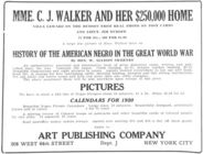
History of the American Negro…
m
Map of original grants and fa…
m
Manhattan: Inwood Hill Park.
m
Manhattan: Inwood Hill Park.
m
Manhattan: Inwood Hill Park.
m
Brooklyn: Cropsey Avenue - Ba…
1
2
3
4
5
6
7
8
9
10
…
20
21
Previous
Next
1
2
3
4
5
6
7
8
9
10
…
20
21
Previous
Next