Click to visit the main New York Public Library Homepage
The New York Public Library
Digital Collections
About Digital Collections
Browse
Search only public domain materials
Items
Collections
Divisions
Home
Search
Browse
About
Search only public domain materials
Items
Collections
Divisions
Digital Collections
Using Images
Using Data
Search
Filtered search
Show filters
Hide filters
Show Only Public Domain
topic
Real property
4231
Fire insurance
3260
Cities & towns
3259
Maps
178
Zoning
109
More
Less
name
Sanborn Map Company
3260
G.W. Bromley & Co
964
New York World's Fair (1939-1940 : New York, N.Y.)
19
E.B. Hyde & Co
4
Hagstrom Company
4
More
Less
collection
Atlases of New York City
4340
Maps of New York City and State
24
New York World's Fair 1939 and 1940 Incorporated records
18
Robert Moses papers
2
William J. Wilgus papers
2
More
Less
place
x
New York (State)
New York
945
Manhattan (New York, N.Y.)
790
New York (N.Y.)
183
Bronx (New York, N.Y.)
178
More
Less
genre
x
Maps
Index maps
22
Plans
16
Indexes
5
Mass transit
2
More
Less
publisher
Sanborn Map Company
3259
G.W. Bromley & Co
964
New York (N.Y.). Board of Estimate and Apportionment
73
Board of Estimate and Apportionment
36
E. Belcher Hyde Map Co
4
More
Less
division
Map Division
4364
Manuscripts and Archives Division
23
General Research Division
2
type
cartographic
4388
text
9
still image
3
Date Range
to
4,389 results found
Filtering on:
x
Date
: 1922 - 1950
x
Genre
: Maps
x
Place
: New York (State)
Sort by:
Title
Date created
Date digitized
Sequence
m
Knickerbocker Village
m
Hammond's complete map of Bro…
Map of the borough of Brookly…
Map of the comprehensive plan…
m
The John Wanamaker automobile…
Map showing suggested connect…
Hagstrom's map of 50 mile rad…
m
Map of the borough of Brookly…
Transportation lines connecti…
The Narrows tunnel : chart of…
Proposed location of the Narr…
Hagstrom's New York house-num…
m
Hudson River vehicular tunnel…
Hagstrom's map of ... New Yor…
m
Map of original grants and fa…
New York City with proposed B…
Brooklyn-Battery Bridge Proje…
Map of Proposed Belt Railways…
Preliminary Study for a Great…
m
Hagstrom's map of Queens N.Y.…
m
Hagstrom's map of Brooklyn (N…
m
Shell street guide of Brookly…
m
Hagstom's map of Long Island …
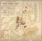
Industrial map of New York Ci…
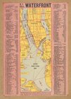
N.Y. City's waterfront.
City of New Manhattan : propo…
m
Map of routes to the Holland …
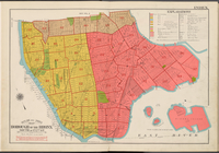
Outline and Index Map, Boroug…
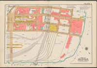
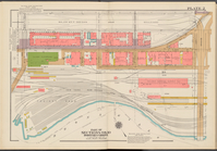
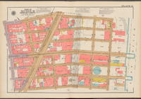
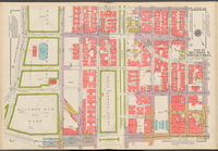
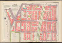
Double Page Plate No. 1, Part…
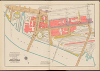
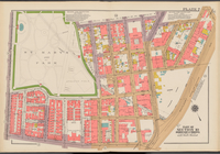
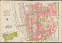
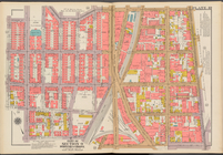
Double Page Plate No. 2, Part…
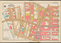
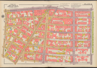
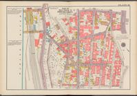
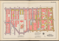
Double Page Plate No. 3, Part…
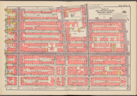
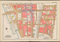
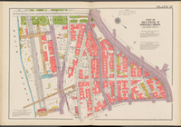
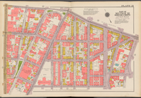
Double Page Plate No. 4, Part…
Double Page Plate No. 5, Part…
Double Page Plate No. 6, Part…
Double Page Plate No. 7, Part…
Double Page Plate No. 8, Part…
Double Page Plate 9, Part of …
Double Page Plate No. 10, Par…
Double Page Plate No. 11, Par…
Double Page Plate No. 12, Par…
Double Page Plate No. 13, Par…
Double Page Plate No. 14, Par…
Double Page Plate No. 15, Par…
Double Page Plate No. 16, Par…
Double Page Plate No. 17, Par…
Double Page Plate No. 18, Par…
Double Page Plate No. 19, Par…
Double Page Plate No. 20, Par…
Double Page Plate No. 21, Par…
Double Page Plate No. 22, Par…
1
2
3
4
5
6
7
8
9
10
…
17
18
Previous
Next
1
2
3
4
5
6
7
8
9
10
…
17
18
Previous
Next