Click to visit the main New York Public Library Homepage
The New York Public Library
Digital Collections
About Digital Collections
Browse
Search only public domain materials
Items
Collections
Divisions
Home
Search
Browse
About
Search only public domain materials
Items
Collections
Divisions
Digital Collections
Using Images
Using Data
Search
Filtered search
Show filters
Hide filters
Show Only Public Domain
topic
Real property
3741
Cities & towns
3183
Fire insurance
3149
Waterfalls
1941
Parks
1919
More
Less
name
Buttolph, Frank, 1850-1924
3369
Sanborn Map Company
3151
United States. Farm Security Administration
2315
Federal Art Project (New York, N.Y.)
2253
Abbott, Berenice, 1898-1991
2252
More
Less
collection
Robert N. Dennis collection of stereoscopic views
25856
Atlases of New York City
3847
The Buttolph collection of menus
3369
Detroit Publishing Company postcards
3234
Farm Security Administration Photographs
2251
More
Less
place
New York (State)
14465
New York (N.Y.)
6374
New York
4373
Massachusetts
4202
Manhattan (New York, N.Y.)
3795
More
Less
genre
Photographs
31465
Stereographs
25856
Maps
3885
Menus
3370
Postcards
3328
More
Less
publisher
Detroit Publishing Company
3234
Sanborn Map Company
3151
Kilburn Brothers
726
G.W. Bromley & Co
591
Baker & Record
276
More
Less
division
Wallach Division: Photography Collection
33538
Map Division
3898
Rare Book Division
3383
Dorot Jewish Division
1680
Schomburg Manuscripts, Archives and Rare Books Division
1070
More
Less
type
still image
40669
text
5622
cartographic
3900
notated music
32
three dimensional object
26
Date Range
to
45,931 results found
Filtering on:
x
Date
: 1930 - 1969
x
Rights
: Public Domain
Sort by:
Title
Date created
Date digitized
Sequence
Results 1751 - 1800
m
Map 21 - Richmond
m
Map 20 - Richmond
m
Map 19 - Queens
m
Map 18 - Brooklyn and Queens
m
Map 17 - Queens and Brooklyn
m
Map 16 - Manhattan and Brookl…
m
Map 15 - Queens
m
Map 14 - Queens
m
Map 13 - Brooklyn and Queens
m
Map 12 - Manhattan and Brookl…
m
Map 11 - Queens
m
Map 10 - Queens
m
Map 9 - Manhattan, Brooklyn, …
m
Map 8 - Manhattan, Brooklyn, …
m
Map 7 - Bronx and Queens
m
Map 6 - Manhattan, Bronx, and…
m
Map 5 - Manhattan
m
Map 4 - Bronx
m
Map 2 - Bronx
m
Map 1 - Manhattan and Bronx
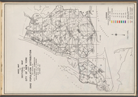
Index map and legend
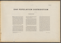
1940 population distribution:…
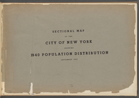
Sectional map of the City of …
m
Tempo of the City: I, Fifth A…
m
Consolidated Edison powerhous…
m
Harlem Street: II, 422-424 Le…
m
Old Post Office, Broadway and…
m
Flam and Flam, 165 East 121st…
m
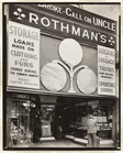
Rothman's Pawn Shop, 149 Eigh…
m
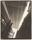
Canyon, Broadway and Exchange…
m
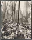
Theoline, Pier 11 or 12, East…
m
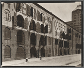
Warehouse, Water and Dock Str…
m
St. Mark's Church (Cloister),…
m
Union Square, 14th Street and…
m
Triborough Bridge, East 125th…
m
William Goldberg, 771 Broadway
Promotional photograph of Gle…
m
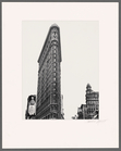
Flatiron building, 23rd Stree…
m
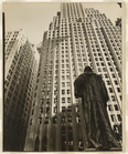
John Watts statue, From Trini…
m
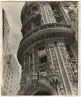
Facade: Alwyn Court, 174-182 …
m
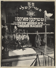
Chicken Market, 55 Hester Str…
m
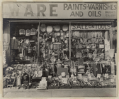
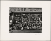
Hardware Store, 316 Bowery
m
Fourth Avenue, No. 154
m
El Second and Third Avenue Li…
m
Ferry, Central Railroad of Ne…
m
Murray Hill Hotel, From Park …
m
Warehouse, Water and Dock Str…
m
Gasoline station, Tremont Ave…
m
Gasoline station, Tremont Ave…
m
Hardware Store, 316 Bowery
1
2
…
5
6
7
8
9
10
11
12
…
183
184
Previous
Next
1
2
…
5
6
7
8
9
10
11
12
…
183
184
Previous
Next