Click to visit the main New York Public Library Homepage
The New York Public Library
Digital Collections
About Digital Collections
Browse
Search only public domain materials
Items
Collections
Divisions
Home
Search
Browse
About
Search only public domain materials
Items
Collections
Divisions
Digital Collections
Using Images
Using Data
Search
Filtered search
Show filters
Hide filters
Show Only Public Domain
topic
Real property
3529
Cities & towns
3148
Fire insurance
3148
Maps
180
Historic sites
55
More
Less
name
Sanborn Map Company
3150
G.W. Bromley & Co
380
New York (N.Y.). Department of City Planning
122
New York (N.Y.). Board of Estimate and Apportionment
109
Ashworth, Irving F
86
More
Less
collection
Atlases of New York City
3827
Cigarette cards
51
Maps of North America
24
New York World's Fair 1939 and 1940 Incorporated records
18
Maps of Asia
17
More
Less
place
New York (State)
3557
New York (N.Y.)
651
Manhattan (New York, N.Y.)
206
Bronx (New York, N.Y.)
179
Great Britain
50
More
Less
genre
Maps
3987
Advertisements
51
Advertising cards
51
Cards
51
Cigarette cards
51
More
Less
publisher
Sanborn Map Company
3150
G.W. Bromley & Co
380
New York (N.Y.). Board of Estimate and Apportionment
73
New York (N.Y.). Dept. of City Planning
37
The Board,
36
More
Less
division
Map Division
3891
George Arents Collection
51
Manuscripts and Archives Division
37
General Research Division
10
Milstein Division
7
More
Less
type
x
cartographic
text
115
still image
60
Date Range
to
4,007 results found
Filtering on:
x
Date
: 1936 - 1992
x
Type
: cartographic
Sort by:
Title
Date created
Date digitized
Sequence
Track map of the trolley line…
m
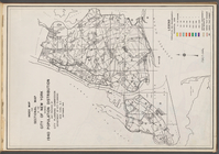
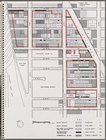
Map 35 - Richmond
m
Map 34 - Richmond
m
Map 33 - Richmond
m
Map 32 - Richmond
m
Map 31 - Queens
m
Map 30 - Brooklyn and Queens
m
Map 29 - Brooklyn and Queens
m
Map 28 - Brooklyn
m
Map 27 - Richmond
m
Map 26 - Richmond
m
Map 25 - Queens
m
Map 24 - Brooklyn and Queens
m
Map 23 - Brooklyn
m
Map 22 - Brooklyn
m
Map 21 - Richmond
m
Map 20 - Richmond
m
Map 19 - Queens
m
Map 18 - Brooklyn and Queens
m
Map 17 - Queens and Brooklyn
m
Map 16 - Manhattan and Brookl…
m
Map 15 - Queens
m
Map 14 - Queens
m
Map 13 - Brooklyn and Queens
m
Map 12 - Manhattan and Brookl…
m
Map 11 - Queens
m
Map 10 - Queens
m
Map 9 - Manhattan, Brooklyn, …
m
Map 8 - Manhattan, Brooklyn, …
m
Map 7 - Bronx and Queens
m
Map 6 - Manhattan, Bronx, and…
m
Map 5 - Manhattan
m
Map 4 - Bronx
m
Map 2 - Bronx
m
Map 1 - Manhattan and Bronx
Index map and legend
m
Map 3 - Manhattan and Bronx
m
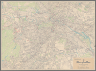
Olympia stadtplan von Berlin
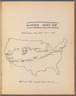
Hitch-hiking trip July - Oct.…
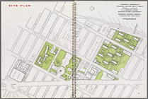
Site plan, [Page 16 and 17]
Map illustrating structures n…
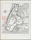
New York City with proposed B…
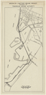
Brooklyn-Battery Bridge Proje…
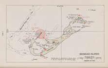
Bermuda Islands
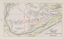
Bermuda Island. Hamilton
m
Various Views of St. Domingue
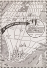
Map showing "52 Gramercy Park…
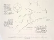
A draft domonstrateing....
Carte hydrogéologique, Républ…
Express level - 1st half
1
2
3
4
5
6
7
8
9
10
…
16
17
Previous
Next
1
2
3
4
5
6
7
8
9
10
…
16
17
Previous
Next