Click to visit the main New York Public Library Homepage
The New York Public Library
Digital Collections
About Digital Collections
Browse
Search only public domain materials
Items
Collections
Divisions
Home
Search
Browse
About
Search only public domain materials
Items
Collections
Divisions
Digital Collections
Using Images
Using Data
Search
Filtered search
Show filters
Hide filters
Show Only Public Domain
topic
Population
36
Exhibitions
12
114th Infantry
1
Campaigns
1
Central business districts
1
More
Less
name
Hospital Council of Greater New York
36
New York (N.Y.). City Planning Commission
36
New York (N.Y.). Department of City Planning
36
New York World's Fair (1939-1940 : New York, N.Y.)
12
Boesch, William E
1
More
Less
collection
Atlases of New York City
36
New York World's Fair 1939 and 1940 Incorporated records
12
Maps of New York City and State
4
Scrapbooks of New York City views
3
Atlases of the United States
1
More
Less
place
New York (N.Y.)
39
New York (State)
15
New York
13
Manhattan (New York, N.Y.)
2
United States
2
More
Less
genre
Maps
58
Plans
11
Clippings
3
Photographs
3
Atlases
1
More
Less
publisher
Army and Navy Pub. Co
1
Holiday [magazine, 1947]
1
National Lithograph Company
1
New Orleans Association of Commerce
1
Published by Hagstrom Company Incorporated
1
More
Less
division
Map Division
42
Manuscripts and Archives Division
12
Milstein Division
4
General Research Division
2
Berg Collection
1
type
x
cartographic
text
37
still image
2
Date Range
to
61 results found
Filtering on:
x
Date
: 1945 - 1947
x
Type
: cartographic
Sort by:
Title
Date created
Date digitized
Sequence
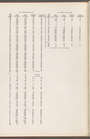
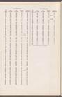
m
Map 35 - Richmond
m
Map 34 - Richmond
m
Map 33 - Richmond
m
Map 32 - Richmond
m
Map 31 - Queens
m
Map 30 - Brooklyn and Queens
m
Map 29 - Brooklyn and Queens
m
Map 28 - Brooklyn
m
Map 27 - Richmond
m
Map 26 - Richmond
m
Map 25 - Queens
m
Map 24 - Brooklyn and Queens
m
Map 23 - Brooklyn
m
Map 22 - Brooklyn
m
Map 21 - Richmond
m
Map 20 - Richmond
m
Map 19 - Queens
m
Map 18 - Brooklyn and Queens
m
Map 17 - Queens and Brooklyn
m
Map 16 - Manhattan and Brookl…
m
Map 15 - Queens
m
Map 14 - Queens
m
Map 13 - Brooklyn and Queens
m
Map 12 - Manhattan and Brookl…
m
Map 11 - Queens
m
Map 10 - Queens
m
Map 9 - Manhattan, Brooklyn, …
m
Map 8 - Manhattan, Brooklyn, …
m
Map 7 - Bronx and Queens
m
Map 6 - Manhattan, Bronx, and…
m
Map 5 - Manhattan
m
Map 4 - Bronx
m
Map 2 - Bronx
m
Map 1 - Manhattan and Bronx
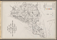
Index map and legend
m
Map 3 - Manhattan and Bronx
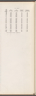
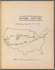
Hitch-hiking trip July - Oct.…
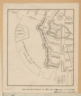
Map of the Battery in 1786 an…
General views, W, 39th St.
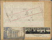
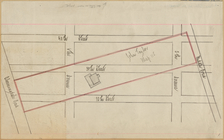
Map of 7 Washington Sq.
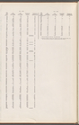
m
With the 114th in the ETO: A …
m
Hagstrom's map of Queens N.Y.…
m
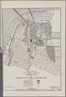
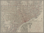
Map of the business district …
Plan of development, frontisp…
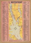
N.Y. City's waterfront.
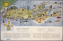
Long Island: an interpretive …
City of New York City Plannin…
New National authentic map of…
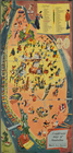
A sight-seers map of Manhatta…
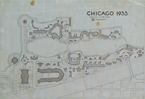
Chicago 1933