Click to visit the main New York Public Library Homepage
The New York Public Library
Digital Collections
About Digital Collections
Browse
Search only public domain materials
Items
Collections
Divisions
Home
Search
Browse
About
Search only public domain materials
Items
Collections
Divisions
Digital Collections
Using Images
Using Data
Search
Filtered search
Show filters
Hide filters
Show Only Public Domain
topic
Exhibitions
20
Railroads
7
Transportation
6
History
4
Housing development
3
More
Less
name
Nicolaus Germanus, active 15th century
27
Ptolemy, 2nd cent
27
New York World's Fair (1939-1940 : New York, N.Y.)
20
Grand Central Terminal (New York, N.Y.)
16
Conewago Canal Company
2
More
Less
collection
Bancker plans
948
Renaissance and medieval manuscripts collection
27
William J. Wilgus papers
22
New York World's Fair 1939 and 1940 Incorporated records
20
Century Company records
14
More
Less
place
New York
33
New York (State)
32
New York (N.Y.)
9
United States
8
Africa
3
More
Less
genre
Maps
1078
Surveys
946
land surveys
834
Documents
125
Manuscripts
27
More
Less
publisher
Charles Francis Press
2
Triborough bridge authority
2
Fort Dearborn Pub. Co
1
G.W. & C.B. Colton
1
J. Ottens
1
division
x
Manuscripts and Archives Division
type
x
cartographic
text
180
still image
37
Date Range
to
1,082 results found
Filtering on:
x
Division
: Manuscripts and Archives Division
x
Type
: cartographic
Sort by:
Title
Date created
Date digitized
Sequence
m
H.M.S. Aeolus and H.M.S. Norw…
m
Map of the East Side of the N…
m
Detroit du Magellan et de ses…
m
Plano.: de la Ysla de Sn. Jua…
Map of the seat of the War in…
m
Abbington and Fitzroy Roads
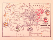
Standard Railway Time (outlin…
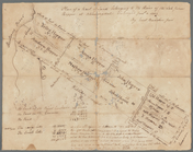
Plan of Conewago Canal
m
Lots on the north east side o…
m
Anne Street
m
Four lots near North Church
m
Francis Johnson dispute with …
m
Lots near Amity Street, Broad…
Plan of the town of York Haven
m
Webber and Van Arden
Memo showing plan of new stre…
Map. Manhattan's Railroad ent…
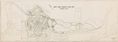
New York World's Fair 1939. G…
m
1801 December 21
m
1801 December 21
Map 10 overhead foot bridges …
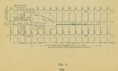
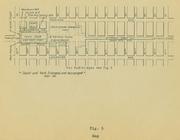
Map depot and yard (figure 5)
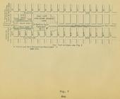
Map station and yard (figure …
Map. Manhattan's Railroad ent…
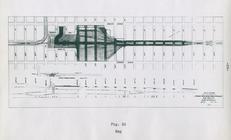
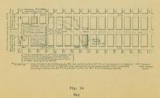
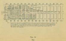
Map (figure 14)
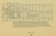
Map (figure 17)
Map (figure 19)
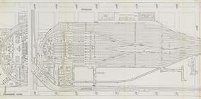
Suburban Level - 1st half.
Suburban Level - 2nd half.
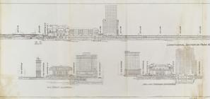
Sections and Elevations - 1st…
Express level - 1st half
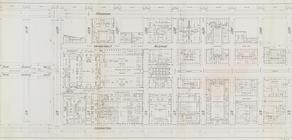
Street Level - 1st half
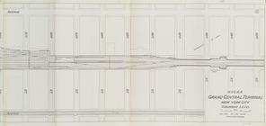
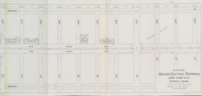
Street Level - 2nd half
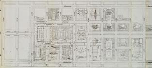
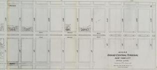
Office level left side
Office level right side
m
Map of Little Bloomingdale
Nieuwe kaart van Suriname : v…
m
Bloomingdale
m
Bloomingdale Road to the Comm…
m
Bloomingdale - four mile stone
m
Bloomingdale Road
m
Lot on Bloomingdale Road
m
Thomas Cadle's land at Bloomi…
m
Richard Cunningham's ground a…
m
Plan of twelve acres on the e…
m
Plot of farm bounded by N. Ri…
m
Hopper Farm, showing divisions
m
The late John Hopper's farm a…
m
Bloomingdale
m
Homestead at Bloomingdale
1
2
3
4
5
Previous
Next
1
2
3
4
5
Previous
Next