Click to visit the main New York Public Library Homepage
The New York Public Library
Digital Collections
About Digital Collections
Browse
Search only public domain materials
Items
Collections
Divisions
Home
Search
Browse
About
Search only public domain materials
Items
Collections
Divisions
Digital Collections
Using Images
Using Data
Search
Filtered keyword search
Show filters
Hide filters
Show Only Public Domain
topic
Real property
144
Fire insurance
61
Maps
52
Description and travel
45
Geology
22
More
Less
name
Geological Survey (U.S.)
52
E. Robinson Co
47
Pidgeon, R. H. (Roger H.)
47
Beers, F. W. (Frederick W.)
45
G.M. Hopkins & Co
42
More
Less
collection
Atlases of the United States
298
place
x
New Jersey
Jersey City
104
Jersey City (N.J.)
103
Essex County
47
Essex County (N.J.)
47
More
Less
genre
x
Atlases
Maps
298
publisher
The Suvery
52
E. Robinson
47
G.M. Hopkins (Firm)
42
I.B. Culver & Co
32
Spielmann & Brush,
29
More
Less
division
x
Map Division
type
cartographic
298
Date Range
to
298 results found for:
x
map
Filtering on:
x
Division
: Map Division
x
Genre
: Atlases
x
Place
: New Jersey
Sort by:
Relevance
Title
Date created
Date digitized
Sequence
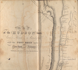
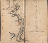
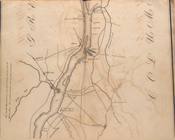
Map
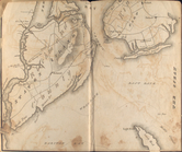
of the Hudson ... from Sandy Hook to New
note:
… to Early
Maps
of the Middle
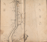
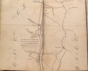
Map
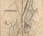
of the Hudson ... from New York Harbor
note:
… to Early
Maps
of the Middle
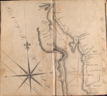
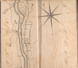
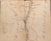
Map
of the Hudson ... from Spuyten Duyvil
note:
… to Early
Maps
of the Middle
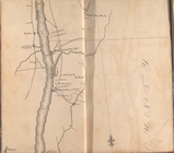
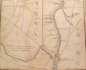
Map
of the Hudson ... from Tarrytown
note:
… to Early
Maps
of the Middle
Map
of the Hudson ... from Peekskill to site
note:
… to Early
Maps
of the Middle
Map
of the Hudson ... from Newburgh
note:
… to Early
Maps
of the Middle
Map
of the Hudson ... from Poughkeepsie to P
note:
… to Early
Maps
of the Middle
Map
of the Hudson ... from Rhynbeck
note:
… to Early
Maps
of the Middle
Map
of the Hudson ... from Germantown
note:
… to Early
Maps
of the Middle
Map
of the Hudson ... from Coxackie
note:
… to Early
Maps
of the Middle
Map
of the Hudson ... from Castleton to Troy
note:
… to Early
Maps
of the Middle
Map
of the Hudson ... from Lansingburgh
note:
… to Early
Maps
of the Middle
Map
of the Hudson ... from Bemiss' Heights
note:
… to Early
Maps
of the Middle
Map
of the Hudson ... from Ft. Miller
note:
… to Early
Maps
of the Middle
Explanations for the Atlas ; …
The Census of the States of N…
The Census of the States of N…
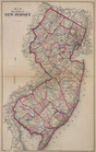
Map
of The State of New Jersey
Topographical
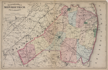
Map
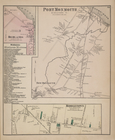
of Monmouth Co., New Jersey.
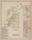
Matawan Business Notices. ; M…
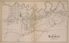
Plan of Matawan [Village]
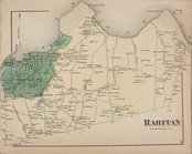
Raritan [Township]
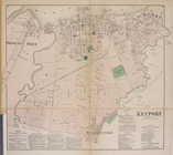
Keyport [Village]; Keyport Bu…
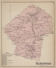
Marlboro Business Notices. ; …
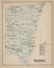
Holmdel Business Directory. ;…
Holmdel [Village]; Marlboro […
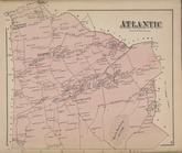
Atlantic [Township]
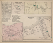
Highlands [Village]; Middleto…
Navesink [Village]; Parkervil…
Redbank Business Directory. ;…
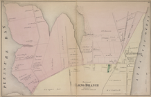
Long Beach Business Notices. …
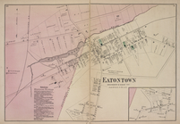
Eatontown Business Notices. ;…
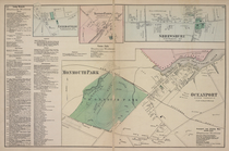
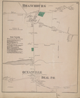
Branchburg [Village]; Ocean T…
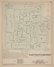
Fair View Cemetery [Village]
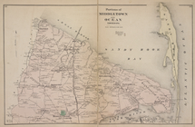
Portions of Middletown and Oc…
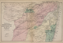
Portions of Middletown, Shrew…
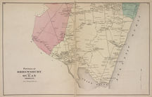
Portions of Shrewsbury and Oc…
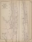
Seabright & Monmouth Beach Pr…
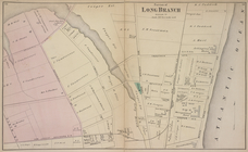
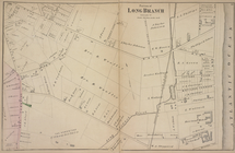
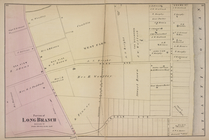
Portion of Long Branch [Villa…
Atlas of Monmouth co., New Je…
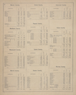
Table of Contents.
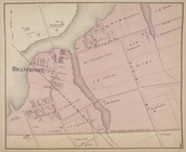
Branchport [Village]
Portion of Long Branch [Villa…
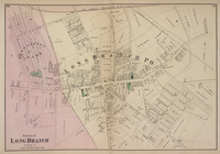
Portion of Long Branch [Villa…
Portion of Long Branch [Villa…
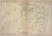
Portion of Long Branch [Villa…
Portion of Long Branch [Villa…
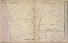
Portion of Long Branch [Villa…
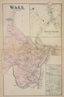
Wall [Township]; Squan Villag…
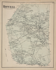
Howell [Township]
1
2
Previous
Next
1
2
Previous
Next