Click to visit the main New York Public Library Homepage
The New York Public Library
Digital Collections
About Digital Collections
Browse
Search only public domain materials
Items
Collections
Divisions
Home
Search
Browse
About
Search only public domain materials
Items
Collections
Divisions
Digital Collections
Using Images
Using Data
Search
Filtered keyword search
Show filters
Hide filters
Show Only Public Domain
topic
Real property
8
City planning
6
Landowners
6
Library sites
6
School districts
4
More
Less
name
Ohman, August R
4
Webster, Joseph O. B
3
Burr family
1
Burr, Isaac
1
Emerson, William, 1801-1868
1
More
Less
collection
Maps of New York City and State
26
place
x
New York
New York (State)
26
New York (N.Y.)
18
Manhattan (New York, N.Y.)
16
Brooklyn (New York, N.Y.)
5
More
Less
genre
x
Manuscript maps
Maps
26
Facsimiles
3
Cadastral maps
2
publisher
producer not identified
8
Department of Public Works
2
publisher not identified
2
publisher unknown
2
B.F. Stevens
1
More
Less
division
x
Map Division
type
cartographic
26
Date Range
to
26 results found for:
x
map
Filtering on:
x
Division
: Map Division
x
Genre
: Manuscript maps
x
Place
: New York
Sort by:
Relevance
Title
Date created
Date digitized
Sequence
m
Map
of part of New York City : area
note:
Manuscript
map
labeled "Population
map
no
m
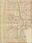
1907 Library
map
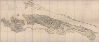
of Manhattan, City of New York
note:
A black and white
Map
of Manhattan, City
m
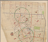
Population and school attendance
map
abstract:
Portion of black and white
map
showing
m
1905 Library
map
of Manhattan, City of New York
abstract:
A black and white
Map
of Manhattan, City
m
1907 Library
map
of Manhattan, City of New York
abstract:
A black and white
Map
of Manhattan, City
m
1906 Library
map
of Manhattan, City of New York
note:
A black and white
Map
of Manhattan, City
Plan of streets etc. on the L…
note:
… catalog of the
Map
m
Map
showing steam, cable, and horse roads
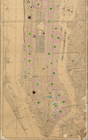
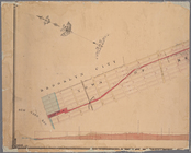
Block distribution of childre…
abstract:
Manuscript
map
showing number of children
Proposed Harlem River Drive f…
collection:
Maps
of New York City and State
Vingboons
map
of Manhattan, 1639
note:
Pictorial
map
showing buildings
m
Library
map
1908
abstract:
…
map
New York
Map
of New York City between 135th
m
Map
showing part of the city bounded by West
collection:
Map
showing part of the city bounded by West 10
m
Map
and profile of the New York and Sea Beach
note:
… catalog of the
Map
m
… manuscript
map
of New York
m
Map
of the route of the New York and Sea Beach
note:
… catalog of the
Map
Diagram showing location of u…
collection:
Maps
of New York City and State
m
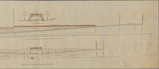
Profile of Riverside Drive fr…
note:
Sheet 2 shows
map
of area bounded by 97th
m
Plan of the Harlem River Driv…
collection:
Maps
of New York City and State
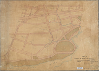
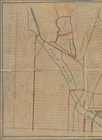
Property in the towns of Cast…
note:
Map
is bound by Richmond Road (Victory Blvd
Map
of property belonging to the heirs
note:
… catalog of the
Map
Map
of property in the 19th ward of the city
m
27th assembly district
collection:
Maps
of New York City and State
New-York and vicinity as prop…
topic:
Manuscript
maps
A plott of ye situations of t…
note:
Facsimile of manuscript
map
.
End of results
|
Top