Click to visit the main New York Public Library Homepage
The New York Public Library
Digital Collections
About Digital Collections
Browse
Search only public domain materials
Items
Collections
Divisions
Home
Search
Browse
About
Search only public domain materials
Items
Collections
Divisions
Digital Collections
Using Images
Using Data
Search
Filtered keyword search
Show filters
Hide filters
Show Only Public Domain
topic
Real property
23
Landowners
15
City planning
12
Buildings
7
Library sites
6
More
Less
name
Ohman, August R
4
Webster, Joseph O. B
3
Couzens, M. K
2
Van Etten, L. E
2
Astoin, Felix
1
More
Less
collection
Maps of New York City and State
60
place
x
New York (State)
New York (N.Y.)
32
Manhattan (New York, N.Y.)
29
New York
26
Brooklyn (New York, N.Y.)
5
More
Less
genre
x
Manuscript maps
Maps
60
Cadastral maps
14
Facsimiles
4
Drawings
1
More
Less
publisher
producer not identified
11
publisher not identified
3
Department of Public Works
2
New York
2
publisher unknown
2
More
Less
division
x
Map Division
type
cartographic
60
Date Range
to
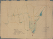
60 results found for:
x
map
Filtering on:
x
Division
: Map Division
x
Genre
: Manuscript maps
x
Place
: New York (State)
Sort by:
Relevance
Title
Date created
Date digitized
Sequence
m
Map
of part of New York City : area
note:
Manuscript
map
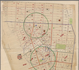
labeled "Population
map
no
m
1907 Library
map
of Manhattan, City of New York
note:
A black and white
Map
of Manhattan, City
m
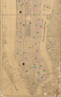
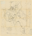
Population and school attendance
map
abstract:
Portion of black and white
map
showing
m
1905 Library
map
of Manhattan, City of New York
abstract:
A black and white
Map
of Manhattan, City
m
1907 Library
map
of Manhattan, City of New York
abstract:
A black and white
Map
of Manhattan, City
m
1906 Library
map
of Manhattan, City of New York
note:
A black and white
Map
of Manhattan, City
Map
of New York, New England
note:
Photocopy of a manuscript
map
, hand colored.
Plan of streets etc. on the L…
note:
… catalog of the
Map
Map
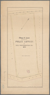
of Getty Square, Yonkers
note:
NYPL
Map
Div. copy
Manuscript
map
of corner of Hudson Street
m
Map
showing steam, cable, and horse roads
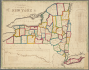
Map
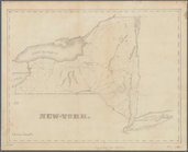
of the State of New York
note:
Mapping
the Nation (NEH grant, 2015-2018)…
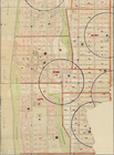
Block distribution of childre…
abstract:
Manuscript
map
showing number of children
New-York
note:
Mapping
the Nation (NEH grant, 2015-2018)…
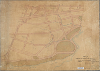
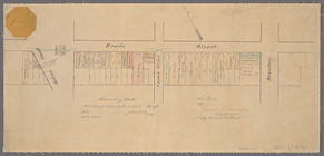
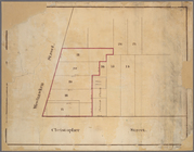
Rye Park: [New York]
note:
Map
shows streets names, lots
Map
of Shelter Island showing location
note:
Mapping
the Nation (NEH grant, 2015-2018)…
Paving
map
[Reade Street from Hudson Street
note:
… at top left corner of
map
.
Proposed Harlem River Drive f…
collection:
Maps
of New York City and State
Manuscript
map
of corner of Crosby Street
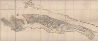
Vingboons
map
of Manhattan, 1639
note:
Pictorial
map
showing buildings
m
Library
map
1908
abstract:
…
map
New York
m
Manuscript
map
of New York City between
Map
of New York City between 135th
m
Map
showing part of the city bounded by West
collection:
Map
showing part of the city bounded by West 10
m
Map
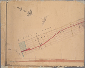
and profile of the New York and Sea Beach
note:
… catalog of the
Map
Pencil sketch of Rochester, N…
note:
Mapping
the Nation (NEH grant, 2015-2018)…
[Profile of 56th St. from Sev…
collection:
Maps
of New York City and State
m
… manuscript
map
of New York
Manuscript
map
of "building" and "vault" near
Manuscript
map
of building at the corner
Map
of the village of Lyon Mountain, Clinton
note:
Mapping
the Nation (NEH grant, 2015-2018)…
m
Map
of Dunkirk
note:
Mapping
the Nation (NEH grant, 2015-2018)…
m
Map
of the route of the New York and Sea Beach
note:
… catalog of the
Map
m
Manuscript
maps
of block bounded by Grand
note:
Copy of ward
map
.
Diagram showing location of u…
collection:
Maps
of New York City and State
m
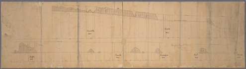
Profile of Riverside Drive fr…
note:
Sheet 2 shows
map
of area bounded by 97th
Map
of land belonging to Felix Astoin
note:
Mapping
the Nation (NEH grant, 2015-2018)…
m
Plan of the Harlem River Driv…
collection:
Maps
of New York City and State
Plan of High Bridge Park : pr…
collection:
Maps
of New York City and State
Manuscript
map
of lots at corner
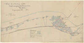
Map
of a portion of the Chateaugay Ore & Iron Co.'s
note:
Mapping
the Nation (NEH grant, 2015-2018)…
m
Map
of part of the state of New-York
note:
Mapping
the Nation (NEH grant, 2015-2018)…
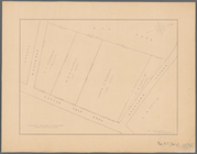
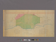
Property in the towns of Cast…
note:
Map
is bound by Richmond Road (Victory Blvd
Map
of property belonging to the heirs
note:
… catalog of the
Map
Map
of lands in the town of Yonkers
note:
Mapping
the Nation (NEH grant, 2015-2018)…
Map
of property known as Knollwood Annex
note:
Mapping
the Nation (NEH grant, 2015-2018)…
Manuscript
map
of the section bounded by Grand
m
Castle Ridge, Tarrytown, West…
note:
Map
shows blocks and lot numbers (some
m
Proposed extension of Convent…
collection:
Maps
of New York City and State
Map
of Knollwood, Elmsford, Westchester
note:
Manuscript base
map
includes signature of N.F