Click to visit the main New York Public Library Homepage
The New York Public Library
Digital Collections
About Digital Collections
Browse
Search only public domain materials
Items
Collections
Divisions
Home
Search
Browse
About
Search only public domain materials
Items
Collections
Divisions
Digital Collections
Using Images
Using Data
Search
Filtered keyword search
Show filters
Hide filters
Show Only Public Domain
topic
x
Harbors
Nautical charts
46
Coasts
6
Navigation
4
Charts, diagrams, etc
1
More
Less
name
United States Coast Survey
30
Bache, A. D. (Alexander Dallas), 1806-1867
25
Whiting, Henry L
10
Alden, James, 1810-1877
7
Yeager, E. (Edward)
6
More
Less
collection
Maps of North America
42
Maps of New York City and State
6
place
Massachusetts
11
California
7
New York (State)
5
North Carolina
5
Florida
4
More
Less
genre
x
Nautical charts
Maps
48
Bathymetric maps
18
Portolan charts
1
publisher
U.S. Coast Survey Office
11
U.S. Coast Survey
9
United States Coast Survey
5
publisher not identified
4
Coast Survey Office
3
More
Less
division
x
Map Division
type
cartographic
48
still image
1
Date Range
to
48 results found for:
x
map
Filtering on:
x
Division
: Map Division
x
Genre
: Nautical charts
x
Topic
: Harbors
Sort by:
Relevance
Title
Date created
Date digitized
Sequence
Map
of parts
note:
Mapping
the Nation (NEH grant, 2015-2018)…
Charleston harbour, S. Ca. : …
note:
Mapping
the Nation (NEH grant, 2015-2018)…
Harbor of Michigan City, Indi…
note:
… and carto-bibliography of
maps
, entry 693
Plan of the entrance into Cap…
note:
Mapping
the Nation (NEH grant, 2015-2018)…
Reconnaissance of Olympia Har…
note:
NYPL
Map
Div. copy has accession no
Survey of the entrance to Mil…
note:
… and carto-bibliography of
maps
, entry 693
Reconnaissance of Trinidad Ba…
note:
NYPL
Map
Div. copy has accession no
Map
of Buffalo Harbor, N.Y., August 1854
note:
Mapping
the Nation (NEH grant, 2015-2018)…
Harbor of Pass Christian, Mis…
note:
Mapping
the Nation (NEH grant, 2015-2018)…
Geo. W. Eldridge's chart B: N…
note:
Mapping
the Nation (NEH grant, 2015-2018)…
Reconnaissance of Catalina Ha…
note:
NYPL
Map
Div. copy has accession no
Asher & Adams'
map
of the bays, harbors
image:
psnypl_
map
_292
Preliminary chart of San Pedr…
note:
NYPL
Map
Div. copy has accession no
Sketch of West Pier, Oswego H…
note:
Mapping
the Nation (NEH grant, 2015-2018)…
Coastal chart of the Massachu…
note:
Mapping
the Nation (NEH grant, 2015-2018)…
City and harbor of Portland, …
note:
…"This
map
Preliminary chart of Plymouth…
note:
Mapping
the Nation (NEH grant, 2015-2018)…
Erie Harbor, Pa.
note:
… catalog of the
Map
Preliminary surveys of harbor…
note:
NYPL
Map
Div. copy has accession no
The Harbor of New Bedford
note:
… "Harbor
map
no." in upper
Preliminary sketch of Beaufor…
note:
Mapping
the Nation (NEH grant, 2015-2018)…
Reconnaissance of Port Royal …
note:
Mapping
the Nation (NEH grant, 2015-2018)…
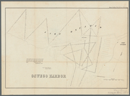
Oswego Harbor, 33d Congress, …
note:
… of
map
.
Key West Harbor and its appro…
note:
NYPL
Map
Div. copy has accession no
Reconnaissance of Duwamish Ba…
note:
… catalog of the
Map
m
Charleston Harbour and the ad…
note:
Mapping
the Nation (NEH grant, 2015-2018)…
Preliminary chart of Ipswich …
note:
Mapping
the Nation (NEH grant, 2015-2018)…
Beaufort Harbour, North Carol…
note:
Mapping
the Nation (NEH grant, 2015-2018)…
Preliminary chart of Portsmou…
note:
Mapping
the Nation (NEH grant, 2015-2018)…
St. Louis Bay and Shieldsboro…
note:
Mapping
the Nation (NEH grant, 2015-2018)…
Norfolk harbor, Virginia : fr…
note:
Mapping
the Nation (NEH grant, 2015-2018)…
Preliminary chart of Winyah B…
note:
Mapping
the Nation (NEH grant, 2015-2018)…
The harbor of Wood's Hole, Ma…
note:
Mapping
the Nation (NEH grant, 2015-2018)…
Coast chart from Cape Hattera…
note:
Mapping
the Nation (NEH grant, 2015-2018)…
Preliminary chart of Bass Riv…
note:
Mapping
the Nation (NEH grant, 2015-2018)…
A chart of New York Harbour :…
note:
LC
Maps
of North America, 1750-1789, 1232
Reconnaissance of the harbors…
note:
NYPL
Map
Div. copy has accession no
St. Mary's River and Fernandi…
note:
Mapping
the Nation (NEH grant, 2015-2018)…
Preliminary chart of Key-West…
note:
Mapping
the Nation (NEH grant, 2015-2018)…
The harbor of New Bedford
note:
Mapping
the Nation (NEH grant, 2015-2018)…
Preliminary chart of Beaufort…
note:
Mapping
the Nation (NEH grant, 2015-2018)…
The harbor of New Bedford
note:
Mapping
the Nation (NEH grant, 2015-2018)…
Boston Harbor, Massachusetts:…
note:
Mapping
the Nation (NEH grant, 2015-2018)…
1889, Larchmont Harbor, N.Y.:…
note:
Mapping
the Nation (NEH grant, 2015-2018)…
Boston Harbor, Massachusetts
note:
Mapping
the Nation (NEH grant, 2015-2018)…
Plan of Amelia Island in East…
note:
Taken from De Brahm's
Map
of South Carolina
Preliminary survey of harbors…
note:
Mapping
the Nation (NEH grant, 2015-2018)…
Chart of the coast of Califor…
note:
Mapping
the Nation (NEH grant, 2015-2018)…
End of results
|
Top