Click to visit the main New York Public Library Homepage
The New York Public Library
Digital Collections
About Digital Collections
Browse
Search only public domain materials
Items
Collections
Divisions
Home
Search
Browse
About
Search only public domain materials
Items
Collections
Divisions
Digital Collections
Using Images
Using Data
Search
Filtered keyword search
Show filters
Hide filters
Show Only Public Domain
topic
Real property
537
Landowners
375
Administrative and political divisions
72
Real propery auctions
67
Railroads
25
More
Less
name
G.W. Bromley & Co
52
Bourquin, F. (Frederick), 1808-
34
James Bleecker & Sons
34
Worley & Bracher
29
Warner & Foote
28
More
Less
collection
Maps of North America
292
Maps of New York City and State
183
Collection of broadside real estate maps announcing auctions of lots in early 19th century New York City
67
Atlases of New York City
52
place
New York (State)
246
New York
102
Manhattan (New York, N.Y.)
83
New York (N.Y.)
76
United States
69
More
Less
genre
x
Cadastral maps
Maps
594
Manuscript maps
28
Illustrations
13
Topographic maps
6
More
Less
publisher
publisher not identified
98
G. W. Bromley & Co
52
Published by Warner & Foote
22
J.B. Beers & Co
7
Warner & Foote
6
More
Less
division
x
Map Division
type
cartographic
589
still image
20
text
9
Date Range
to
Looking for one of these collections?
Maps of North America
3,345 items
Maps of New York City and State
2,059 items
594 results found for:
x
map
Filtering on:
x
Division
: Map Division
x
Genre
: Cadastral maps
x
Rights
: Public Domain
Sort by:
Relevance
Title
Date created
Date digitized
Sequence
m
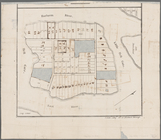
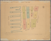
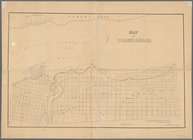
Property identification
map
of Inwood Hill
note:
Blueprint of
map
, indicating property owners
m
Brooklyn City Hall
abstract:
Cadastral
map
showing area surrounding
Milford in 1646: [Connecticut]
note:
Cadastral
map
showing property ownership.
m
Map
of Blackburn's addition to Ontario, San
note:
NYPL
Map
Div. copy is black on blue, covered
Information
map
, Hd. Qrs, 20th A.C., June
note:
… similar
map
. This
map
Allen's outline
map
of Ottumwa, Iowa
note:
… catalog of the
Map
Map
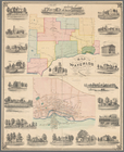
of Winter Park, Orange Co., Florida …
note:
NYPL
Map
Div. copy
m
Map
of Henry County, Missouri …
note:
… catalog of the
Map
Map
of Wild-Wood Beach
note:
Cadastral
map
showing streets, block
Map
of South Waukegan showing
note:
Title from: NYPL's Dictionary catalog of the
Map
Map
of Great Barn Island, New York, showing
note:
Title, for
map
of place now known as Wards
Map
of Jersey City, [New Jersey]
note:
Mapping
the Nation (NEH grant, 2015-2018)…
Map
of the town of Waterloo, Seneca County, N
note:
Town
map
shows
Official
map
of San Francisco
note:
NYPL
Map
Div. copy mounted on muslin, text
New indexed
map
of Omaha and suburbs
note:
NYPL
Map
Div. copy has accession no
Plan of the village of Lima o…
note:
NYPL
Map
Div. copy includes manuscript
Mulberry Bend District.
Map
bounded
m
Real-estate
map
of Chicago …
note:
… catalog of the
Map
A plan of Greenville, Norwich…
note:
Mapping
the Nation (NEH grant, 2015-2018)…
m
Wright's
map
of Kansas City, Missouri
note:
NYPL
Map
Div. copy disssected into 2 sheets
Map
of St. Francois County, Missouri …
note:
… catalog of the
Map
m
Map
of Cass County, Missouri …
note:
… catalog of the
Map
La Mesa Colony : San Diego Co…
note:
NYPL
Map
Div. copy
Map
of Baker City, Oregon …
note:
Lewis & Dryden, Printing Co.,
Map
engs.
Map
of the City of San Jose …
note:
… catalog of the
Map
Map
of the Melrose addition to Roanoke City
note:
Prepared by G. Wm. Baist,
Map
Publisher.
Map
of the city of Tacoma …
note:
… catalog of the
Map
m
Map
of Columbiana County, Ohio, 1860 …
note:
… along center of
map
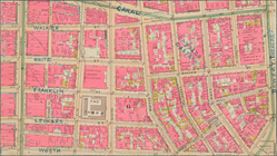
Map
of the City of New York
abstract:
… flat with
map
.
Map
of Bar Harbor, Maine, 1895
note:
Cadastral
map
showing streets, buildings
Map
of the town of Raynham, Bristol County
note:
by H.F. Walling, supt. of the state
map
.
m
Map
of Crawford County, Iowa …
note:
… catalog of the
Map
Map
of Warren County, Pennsylvania
note:
Mapping
the Nation (NEH grant, 2015-2018)…
Map
of part of Monroe County, Michigan
note:
… catalog of the
Map
m
Map
of the town of Norton, Bristol County
note:
by H.F. Walling, supt. of the state
map
.
Map
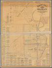
of Olean, New York
note:
Mapping
the Nation (NEH grant, 2015-2018)…
m
Map
of New York City from Battery
collection:
Map
of New York City from Battery to 29
The city of Boca Grande, Lee …
note:
Mapping
the Nation (NEH grant, 2015-2018)…
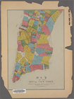
Land register
map
of the City and County of New
Map
of the flats above Albany
note:
This
map
also appeared in: Mrs. Grant
m
The City of Stockton and vici…
note:
… catalog of the
Map
Plat of the town of Elmhurst,…
note:
Mapping
the Nation (NEH grant, 2015-2018)…
Springfield, Greene County, M…
note:
NYPL
Map
Div. copy stamped: "Incoorporated
Map
of Lake Park, Georgia …
note:
NYPL
Map
Div. copy includes manuscript
Map
of Getty Square, Yonkers
note:
NYPL
Map
Div. copy
m
Map
of Clasons Point
note:
Mapping
the Nation (NEH grant, 2015-2018)…
Map
of Ogdensburgh
note:
this
map
of Ogdensburgh has been
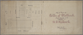
Map
of property in the town of Flatbush, Kings
abstract:
Cadastral
map
bound
m
Map
of Waverly Park lots located at Waverly
note:
Includes text, and an ancillary
map
of part
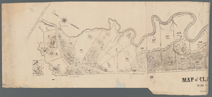
Manuscript
map
of the area west and south
note:
Differs from similar
map
. Lacks a title
1
2
3
Previous
Next
1
2
3
Previous
Next