Click to visit the main New York Public Library Homepage
The New York Public Library
Digital Collections
About Digital Collections
Browse
Search only public domain materials
Items
Collections
Divisions
Home
Search
Browse
About
Search only public domain materials
Items
Collections
Divisions
Digital Collections
Using Images
Using Data
Search
Filtered keyword search
Show filters
Hide filters
Show Only Public Domain
topic
x
City planning
Geology
3
Charts, diagrams, etc
2
Waterfronts
2
Buildings
1
More
Less
name
Webster, Joseph O. B
3
Serrell, James E
1
Serrell, James E., 1820-1892
1
collection
Maps of New York City and State
12
place
New York (N.Y.)
12
New York (State)
12
Manhattan (New York, N.Y.)
11
New York
6
Bronx (New York, N.Y.)
1
More
Less
genre
x
Manuscript maps
Maps
12
publisher
Department of Public Works
2
producer not identified
2
New York
1
division
x
Map Division
type
cartographic
12
Date Range
to
12 results found for:
x
map
Filtering on:
x
Division
: Map Division
x
Genre
: Manuscript maps
x
Topic
: City planning
Sort by:
Relevance
Title
Date created
Date digitized
Sequence
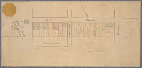
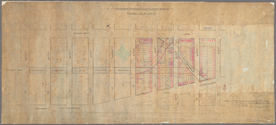
Paving
map
[Reade Street from Hudson Street
note:
… at top left corner of
map
.
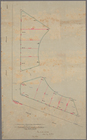
Proposed Harlem River Drive f…
collection:
Maps
of New York City and State
Manuscript
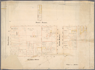
map
of corner of Crosby Street
m
Manuscript
map
of New York City between
m
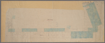
Map
showing part of the city bounded by West
collection:
Map
showing part of the city bounded by West 10
Manuscript
map
of building at the corner
Diagram showing location of u…
collection:
Maps
of New York City and State
m
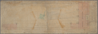
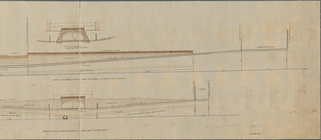
Profile of Riverside Drive fr…
note:
Sheet 2 shows
map
of area bounded by 97th
m
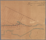
Plan of the Harlem River Driv…
collection:
Maps
of New York City and State
Manuscript
map
of the section bounded by Grand
m
Proposed extension of Convent…
collection:
Maps
of New York City and State
New-York and vicinity as prop…
topic:
Manuscript
maps
End of results
|
Top