Click to visit the main New York Public Library Homepage
The New York Public Library
Digital Collections
About Digital Collections
Browse
Search only public domain materials
Items
Collections
Divisions
Home
Search
Browse
About
Search only public domain materials
Items
Collections
Divisions
Digital Collections
Using Images
Using Data
Search
Filtered keyword search
Show filters
Hide filters
Show Only Public Domain
topic
Real property
10578
Fire insurance
5290
Cities & towns
4996
City planning
1084
Social conditions
942
More
Less
name
Sanborn Map Company
5093
G.W. Bromley & Co
2475
New York (N.Y.). City Planning Commission
978
M.I.T. Press
942
Bromley, George Washington
830
More
Less
collection
Atlases of New York City
11380
Atlases of the United States
3652
Maps of North America
3345
Maps of New York City and State
2052
Lawrence H. Slaughter Collection of English maps, charts, globes, books and atlases
1215
More
Less
place
New York (State)
12829
New York
4738
New York (N.Y.)
3293
Manhattan (New York, N.Y.)
2182
Brooklyn (New York, N.Y.)
1149
More
Less
genre
x
Maps
Atlases
3581
Topographic maps
1050
Cadastral maps
594
Nautical charts
394
More
Less
publisher
Sanborn Map Company
5129
G.W. Bromley & Co
2297
MIT Press
942
K.u.K. Militargeographisches Institut
773
E. Belcher Hyde
770
More
Less
division
x
Map Division
type
cartographic
22130
still image
1186
text
322
Date Range
to
Looking for one of these collections?
Atlases of New York City
11,722 items
Atlases of the United States
3,868 items
Maps of North America
3,345 items
Maps of New York City and State
2,059 items
Lawrence H. Slaughter Collection of English maps, charts, globes, books and atlases
1,252 items
Spezialkarte der Osterreichisch-Ungarischen Monarchie
774 items
23,265 results found for:
x
map
Filtering on:
x
Division
: Map Division
x
Genre
: Maps
Sort by:
Relevance
Title
Date created
Date digitized
Sequence
Results 22501 - 22550
m
Peremptory Sale, by order of …
collection:
Maps
of New York City and State
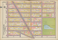
Plate 5
m
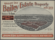
Absolute Sale without reserve…
collection:
Maps
of New York City and State
Plate 6
Plate 7
Plate 8
Bounded by Plymouth Street, W…
topic:
Maps
m
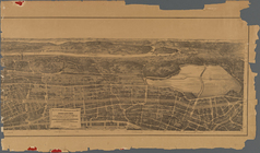
Birds eye view of that portio…
note:
LC Panoramic
maps
(2nd ed.), 540
Plate 9
Plate 10
Plate 11
Plate 12
Plate 13
Bounded by 60th St., Seventh …
topic:
Maps
Bounded by Mackay Pl., 1st Av…
topic:
Maps
Plate 14
Plate 15
Bounded by 58th Street, West …
topic:
Maps
Bounded by 72nd Street, 22nd …
topic:
Maps
Valuable property to be sold …
collection:
Collection of broadside real estate
maps
Bounded by Terrace Place, 11t…
topic:
Maps
Bounded by Winthrop Street, (…
topic:
Maps
Plate 16
Plate 17
Outline of Robinson's Real Es…
m
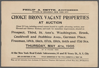
Choice Bronx Vacant Propertie…
collection:
Maps
of New York City and State
Bounded by (New York Bay Pier…
topic:
Maps
Plate 18
Vrbium Londini et West-Monast…
collection:
Maps
of Europe
Plate 19
Prospect Park Bounded by (Ins…
topic:
Maps
Bounded by Park Place, East N…
topic:
Maps
Plate 20
Bounded by Linwood St., Cozin…
topic:
Maps
Bounded by Stanley Ave., Mill…
topic:
Maps
Plate 21
Plate 22
m
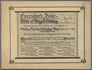
Executor's Sale: Estate of Ma…
collection:
Maps
of New York City and State
Plate 23
Plate 24
Coney Island. Bounded by Cana…
topic:
Maps
Bounded by Avenue V., Knapp S…
topic:
Maps
Bounded by Avenue P., E. 31st…
topic:
Maps
Plate 25
Bounded by Rockaway Avenue, R…
topic:
Maps
Bounded by Avenue D., Ralph A…
topic:
Maps
Plate 26
Plate 27
Plate 28
Plate 29
1
2
…
85
86
87
88
89
90
91
92
93
94
Previous
Next
1
2
…
85
86
87
88
89
90
91
92
93
94
Previous
Next