Click to visit the main New York Public Library Homepage
The New York Public Library
Digital Collections
About Digital Collections
Browse
Search only public domain materials
Items
Collections
Divisions
Home
Search
Browse
About
Search only public domain materials
Items
Collections
Divisions
Digital Collections
Using Images
Using Data
Search
Filtered keyword search
Show filters
Hide filters
Show Only Public Domain
topic
Population
38
name
x
New York (N.Y.). Department of City Planning
Ashworth, Irving F
87
Hospital Council of Greater New York
38
New York (N.Y.). City Planning Commission
38
collection
Atlases of New York City
125
place
New York (N.Y.)
125
genre
Maps
122
Atlases
2
Book covers
1
Title pages
1
pages (components)
1
publisher
New York (N.Y.). Dept. of City Planning
37
division
x
Map Division
type
cartographic
122
text
38
Date Range
to
125 results found for:
x
map
Filtering on:
x
Division
: Map Division
x
Name
: New York (N.Y.). Department of City Planning
Sort by:
Relevance
Title
Date created
Date digitized
Sequence
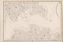
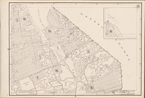
Height Zoning
Map
. City of New York.
note:
On each
map
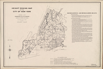
Height Zoning
Map
. City of New York. 1953.
note:
On each
map
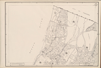
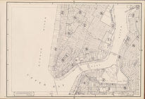
Height Zoning
Map
Section No. 1
note:
On each
map
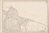
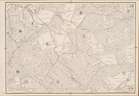
Height Zoning
Map
Section No. 2
note:
On each
map
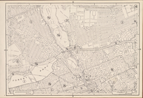
Height Zoning
Map
Section No. 3
note:
On each
map
Height Zoning
Map
Section No. 4
note:
On each
map
Height Zoning
Map
Section No. 5
note:
On each
map
Height Zoning
Map
Section No. 6
note:
On each
map
Height Zoning
Map
Section No. 7
note:
On each
map
Height Zoning
Map
Section No. 8
note:
On each
map
Height Zoning
Map
Section No. 9
note:
On each
map
Height Zoning
Map
Section No. 10
note:
On each
map
Height Zoning
Map
Section No. 11
note:
On each
map
Height Zoning
Map
Section No. 12
note:
On each
map
Height Zoning
Map
Section No. 13
note:
On each
map
Height Zoning
Map
Section No. 14
note:
On each
map
Height Zoning
Map
Section No. 15
note:
On each
map
Height Zoning
Map
Section No. 16
note:
On each
map
Height Zoning
Map
Section No. 17
note:
On each
map
Height Zoning
Map
Section No. 18
note:
On each
map
Height Zoning
Map
Section No. 19
note:
On each
map
Height Zoning
Map
Section No. 20
note:
On each
map
Height Zoning
Map
Section No. 21
note:
On each
map
Height Zoning
Map
Section No. 22
note:
On each
map
Height Zoning
Map
Section No. 23
note:
On each
map
Height Zoning
Map
Section No. 24
note:
On each
map
Height Zoning
Map
Section No. 25
note:
On each
map
Height Zoning
Map
Section No. 26
note:
On each
map
Height Zoning
Map
Section No. 27
note:
On each
map
Height Zoning
Map
Section No. 28
note:
On each
map
Height Zoning
Map
Section No. 29
note:
On each
map
Height Zoning
Map
Section No. 30
note:
On each
map
Height Zoning
Map
Section No. 31
note:
On each
map
Height Zoning
Map
Section No. 32
note:
On each
map
Height Zoning
Map
Section No. 33
note:
On each
map
Height Zoning
Map
Section No. 34
note:
On each
map
Height Zoning
Map
Section No. 35
note:
On each
map
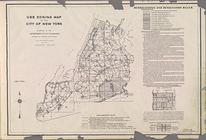
Use Zoning
Map
. City of New York. 1953
Use Zoning
Map
. City of New York.
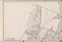
Use Zoning
Map
Section No. 1
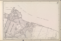
Use Zoning
Map
Section No. 2
Use Zoning
Map
Section No. 3
Use Zoning
Map
Section No. 4
Use Zoning
Map
Section No. 5
Use Zoning
Map
Section No. 6
Use Zoning
Map
Section No. 7
Use Zoning
Map
Section No. 8
Use Zoning
Map
Section No. 9
Use Zoning
Map
Section No. 10
Use Zoning
Map
Section No. 11