Click to visit the main New York Public Library Homepage
The New York Public Library
Digital Collections
About Digital Collections
Browse
Search only public domain materials
Items
Collections
Divisions
Home
Search
Browse
About
Search only public domain materials
Items
Collections
Divisions
Digital Collections
Using Images
Using Data
Search
Filtered keyword search
Show filters
Hide filters
Show Only Public Domain
topic
x
Real property
Fire insurance
105
Landowners
83
Real propery auctions
67
Buildings
5
More
Less
name
G.W. Bromley & Co
1617
Bromley, George Washington
405
Bromley, Walter Scott
404
Perris, William
128
James Bleecker & Sons
34
More
Less
collection
Atlases of New York City
1746
Collection of broadside real estate maps announcing auctions of lots in early 19th century New York City
67
Maps of New York City and State
25
place
x
Manhattan (New York, N.Y.)
New York (State)
1838
New York
1629
New York (N.Y.)
313
United States
67
More
Less
genre
Maps
1784
Cadastral maps
80
Index maps
43
Indexes
35
Title pages
22
More
Less
publisher
G.W. Bromley & Co
1569
William Perris
105
G.W. Bromley
49
Lith. by Korff Brothers
23
William Perris, Civil Engineer
23
More
Less
division
x
Map Division
type
cartographic
1826
text
66
still image
1
Date Range
to
1,838 results found for:
x
map
Filtering on:
x
Division
: Map Division
x
Place
: Manhattan (New York, N.Y.)
x
Topic
: Real property
Sort by:
Relevance
Title
Date created
Date digitized
Sequence
m
Property identification
map
of Inwood Hill
note:
Blueprint of
map
, indicating property owners
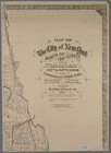
Map
of the City of New York
abstract:
… flat with
map
.
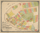
m
Map
of the original grants of village lots
image:
psnypl_
map
_275
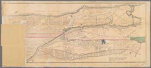
m
Map
of New York City from Battery
collection:
Map
of New York City from Battery to 29
Vingboons
map
of Manhattan, 1639
note:
Pictorial
map
showing buildings
Map
of New York City between 135th
m
Map
of the city of New-York extending
note:
Haskell, D.C. Manhattan
maps
, 945
Map
of New York City above 119th Street
m
Map
of the City of New York north
note:
Map
within decorative border.
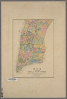
Outline and Index
Map
of Volume One
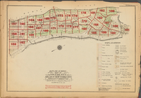
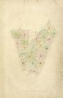
Plate 186: [Inwood Park, with…
Property nos. 43, 45, and 47 …
collection:
Maps
of New York City and State
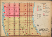
Block no. 86 : confidential r…
collection:
Maps
of New York City and State
…
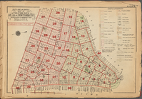
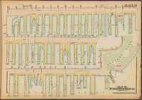
Map
of Borough
m
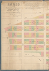
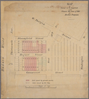
Lands of the Harlaem Canal Co…
collection:
Maps
of New York City and State
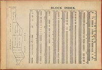
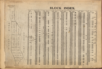
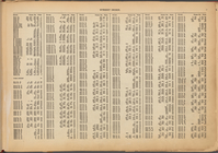
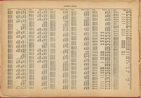
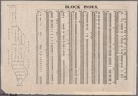
Block Index
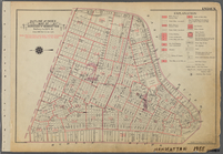
Outline and Index
Map
of Borough
Outline and Index
Map
of Volume Three
Outline and Index
Map
of Borough
Outline and Index
Map
of Volume Four
Outline and Index
Map
of Volume Two
Outline and Index
Map
of Volume Five
Outline and Index
Map
of Volume Three
Outline and Index
Map
of Borough
Outline and Index
Map
of Volume Four
Outline and Index
Map
of Volume One
Outline and Index
Map
of Volume Five
Outline and Index
Map
of Volume Two
Map
of land to be acquired under Chapter 191
Map
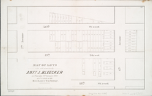
of lots to be sold at auction by Anty
Map
of the City of New York
abstract:
… of the old farm
map
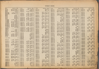
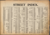
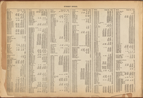
Street Index: [Water Street -…
Block Index
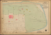
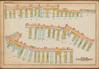
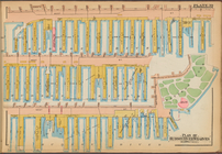
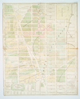
Plate 40: Plan of East River …
Street Index: [Abington Squar…
Street Index: [Abington Squar…
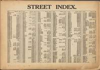
Street Index: [80th Street E.…
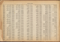
Street Index: [Haven Avenue -…
Table for Corrections
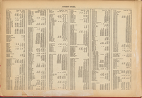
Street Index: [Water Street -…
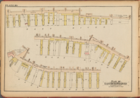
Plate 39: Plan of Hudson Rive…
Street Index: [80th Street E.…
Notice of Corrections and Sup…
Street Index: [Haven Avenue -…
Plate 39: Plan of Hudson Rive…
Plate 40: Plan of East River …
Block Index [With the Manhattan
map
on the left]
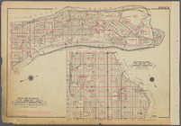
Index: Borough of Manhattan, …
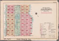
collection:
Outline and Index
Map
of Atlas of New
Index
Map
Map
of the real estate in the city of New
note:
… to Early
Maps
of the Middle
1
2
3
4
5
6
7
8
Previous
Next
1
2
3
4
5
6
7
8
Previous
Next