Click to visit the main New York Public Library Homepage
The New York Public Library
Digital Collections
About Digital Collections
Browse
Search only public domain materials
Items
Collections
Divisions
Home
Search
Browse
About
Search only public domain materials
Items
Collections
Divisions
Digital Collections
Using Images
Using Data
Search
Filtered keyword search
Show filters
Hide filters
Show Only Public Domain
topic
x
Nautical charts
Harbors
70
Coasts
60
Navigation
31
Rivers
8
More
Less
name
United States Coast Survey
198
Bache, A. D. (Alexander Dallas), 1806-1867
170
Mathiot, G
47
Alden, James, 1810-1877
31
Maffitt, John Newland, 1819-1886
24
More
Less
collection
Maps of North America
252
Lawrence H. Slaughter Collection of English maps, charts, globes, books and atlases
68
Maps of New York City and State
30
Maps of the Oceans
12
John H. Levine Collection
6
More
Less
place
Atlantic Ocean
38
Massachusetts
31
New Jersey
31
Virginia
31
Maps
30
More
Less
genre
Maps
374
Nautical charts
218
Bathymetric maps
100
Illustrations
4
Prints
3
More
Less
publisher
U.S. Coast Survey
95
U.S. Coast Survey Office
51
United States Coast Survey
21
publisher not identified
9
The Survey
6
More
Less
division
x
Map Division
type
cartographic
374
still image
9
text
2
Date Range
to
Looking for this collection?
Maps of North America
3,345 items
375 results found for:
x
map
Filtering on:
x
Division
: Map Division
x
Rights
: Public Domain
x
Topic
: Nautical charts
Sort by:
Relevance
Title
Date created
Date digitized
Sequence
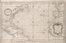
Carte reduite de l'Ocean occi…
Pacific Ocean showing part of…
Plan of the bay and island of…
note:
Mapping
the Nation (NEH grant, 2015-2018)…
Bowles's new pocket
map
of the Atlantic
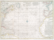
A chart of the Atlantic or We…
note:
… pasted on verso of
map
Nantucket Sound: western part
note:
Mapping
the Nation (NEH grant, 2015-2018)…
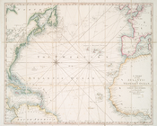
A new chart of the vast Atlan…
note:
…. Popples great
map
..."…
Map
of parts
note:
Mapping
the Nation (NEH grant, 2015-2018)…
Hawaiian or Sandwich Islands
note:
… catalog of the
Map
Coast chart no. 48, Cape Fear…
note:
Mapping
the Nation (NEH grant, 2015-2018)…
Unfinished proof of Narragans…
note:
Mapping
the Nation (NEH grant, 2015-2018)…
Charleston harbour, S. Ca. : …
note:
Mapping
the Nation (NEH grant, 2015-2018)…
Chart of the mouth of Susqueh…
collection:
Maps
of North America
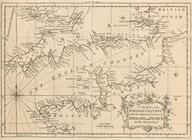
A chart of the English Channe…
image:
psnypl_
map
_294
Chart of a part of the Gulf o…
note:
Title from:NYPL's Dictionary catalog of the
Map
Map
of the Harbor of New York
Chart of the entrance to Ches…
note:
… to Early
Maps
of the Middle
Part of New England, New York…
collection:
Maps
of North America
To the members of the Nautica…
note:
NYPL copy in
Map
Div. 00-364 uncolored.
Preliminary chart of Hampton …
note:
Mapping
the Nation (NEH grant, 2015-2018)…
Approximate cotidal lines of …
note:
Mapping
the Nation (NEH grant, 2015-2018)…
Rhode - Island, 2e feuille
note:
Mapping
the Nation (NEH grant, 2015-2018)…
Atlantic Coast, Chesapeake en…
note:
Mapping
the Nation (NEH grant, 2015-2018)…
Sketch of the coast of North …
note:
Mapping
the Nation (NEH grant, 2015-2018)…
Chart of Lake Ontario
note:
Mapping
the Nation (NEH grant, 2015-2018)…
m
Map
of the portion of the Connecticut River between
note:
Map
in 6 segments, 2 on each sheet.
Map
of the coast of Massachusetts and Rhode Island
note:
Includes notes and 1 inset
map
: "Harbor
Nieuwe Werelt kaert
image:
ps_
map
_cd7_081
Pas caarte van Nieu Nederlandt
note:
Variant ed. of Burden, P.D.
Mapping
A
map
and chart of those parts of the Bay
note:
… to Early
Maps
of the Middle
A
map
and chart of those parts of the Bay
note:
Mapping
the Nation (NEH grant, 2015-2018)…
m
Sable Island
A chart of the Atlantic Ocean…
note:
… to Early
Maps
of the Middle
New York Harbor and entrance …
note:
Map
is annotated with color to show beacons
Mar del nort
note:
… to Early
Maps
of the Middle
Chart of the mouth of Susqueh…
note:
Includes inset
map
Harbor of Michigan City, Indi…
note:
… and carto-bibliography of
maps
, entry 693
Map
of Sacramento River and bay of San
note:
… catalog of the
Map
Reconnaissance of Hatteras In…
note:
Mapping
the Nation (NEH grant, 2015-2018)…
Carta particolare della nuoua…
note:
Mapping
the Nation (NEH grant, 2015-2018)…
Plan of the entrance into Cap…
note:
Mapping
the Nation (NEH grant, 2015-2018)…
Sketch F, no. 6, showing the …
note:
Mapping
the Nation (NEH grant, 2015-2018)…
A draught of New York from th…
note:
… to Early
Maps
of the Middle
Nautical chart of Little Egg …
note:
… to Early
Maps
of the Middle
Pas caerte van Nieu Nederland…
collection:
… of English
maps
, charts
Bay and harbor of New York
collection:
Maps
of New York City and State
Reconnaissance of the entranc…
note:
Mapping
the Nation (NEH grant, 2015-2018)…
Preliminary chart of the sea …
note:
Mapping
the Nation (NEH grant, 2015-2018)…
Tybee Bay and Calibogue Sound…
note:
Mapping
the Nation (NEH grant, 2015-2018)…
Sketch showing the progress o…
note:
Mapping
the Nation (NEH grant, 2015-2018)…
1
2
Previous
Next
1
2
Previous
Next