Click to visit the main New York Public Library Homepage
The New York Public Library
Digital Collections
About Digital Collections
Browse
Search only public domain materials
Items
Collections
Divisions
Home
Search
Browse
About
Search only public domain materials
Items
Collections
Divisions
Digital Collections
Using Images
Using Data
Search
Filtered keyword search
Show filters
Hide filters
Show Only Public Domain
topic
Real property
10889
Fire insurance
5305
Cities & towns
5007
Administrative and political divisions
903
Railroads
772
More
Less
name
Sanborn Map Company
5108
G.W. Bromley & Co
2551
Bromley, George Washington
857
Bromley, Walter Scott
856
Austro-Hungarian Monarchy. Militärgeographisches Institut
774
More
Less
collection
Atlases of New York City
10230
Atlases of the United States
3839
Maps of North America
3343
Maps of New York City and State
2052
Lawrence H. Slaughter Collection of English maps, charts, globes, books and atlases
1248
More
Less
place
New York (State)
12097
New York
3808
Manhattan (New York, N.Y.)
2239
New York (N.Y.)
2100
Brooklyn (New York, N.Y.)
1212
More
Less
genre
Maps
21878
Atlases
3761
Topographic maps
1050
Cadastral maps
594
Nautical charts
394
More
Less
publisher
Sanborn Map Company
5145
G.W. Bromley & Co
2371
E. Belcher Hyde
807
K.u.K. Militargeographisches Institut
774
publisher not identified
452
More
Less
division
x
Map Division
type
cartographic
21822
text
746
still image
280
Date Range
to
Looking for one of these collections?
Atlases of New York City
11,722 items
Atlases of the United States
3,868 items
Maps of North America
3,345 items
Maps of New York City and State
2,059 items
Lawrence H. Slaughter Collection of English maps, charts, globes, books and atlases
1,252 items
Spezialkarte der Osterreichisch-Ungarischen Monarchie
774 items
22,402 results found for:
x
map
Filtering on:
x
Division
: Map Division
x
Rights
: Public Domain
Sort by:
Relevance
Title
Date created
Date digitized
Sequence
m
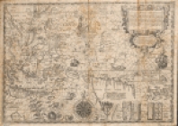
Het nievwe licht der zeevaert…
Map
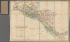
of Central America including
A chart of Delaware Bay and R…
note:
Copy in
Map
Div. 00-498: Emmet Collection.
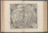
Orbis terrae compendiosa desc…
note:
Shirley, R.W.
Mapping
of the world, 157
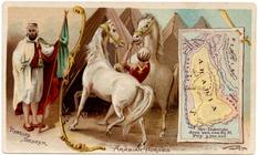
Arabia.
image:
ps_
map
_177
Florida.
image:
ps_
map
_174
A
map
of the icy sea in which
note:
Jolly, D.C.,
Maps
in British periodicals, pt.1
Zeichenerklärung
Septentrionalium Terrarum des…
America Septentrionalis.
note:
… of the
map
.
A chart of the world : exhibi…
note:
… to Early
Maps
of the Middle
m
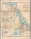
Carta dell' Egitto, Sudan, Ma…
collection:
Maps
of Africa
Map
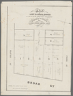
of lots & buildings as shewn
New York province.
Map
of the country
image:
ps_
map
_195
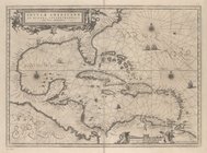
Insulae Americanae in Oceano …
collection:
Maps
of North and South America
m
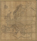
A new
map
of Europe …
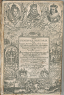
The generall historie of Virg…
note:
Map
Div. copy: Autographs in ink on t.p
Baltimore.
note:
… to Early
Maps
of the Middle
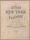
Atlas of New York and vicinit…
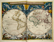
Nova et accuratissima totius …
image:
psnypl_
map
_233
Insulae Moluccæ ...
image:
psnypl_
map
_241
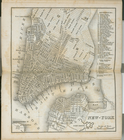
New-York.
note:
… to Early
Maps
of the Middle
Table of Contents
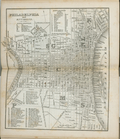
Philadelphia and environs.
note:
… to Early
Maps
of the Middle
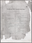
Table of Air-line Distances
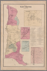
Plate 5:
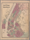
Map
of New York and vicinity
Plate 6: Plan of New York and…
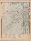
Plate 9: Tremont : Town of We…
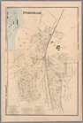
Plate 11: Fordham
Plate 13: West Farms, Westche…
Plate 15: Wakefield : Town & …
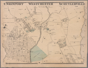
Plate 16: Unionport - Westche…
Plate 17:
Map
of the Woodlawn Cemetery
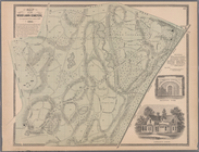
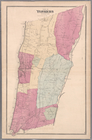
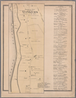
Plate 19: Town of Yonkers, We…
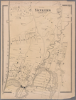
Plate 20: Yonkers, Westcheste…
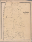
Plate 21: Town of Yonkers, We…
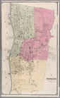
Plate 23: Yonkers, Westcheste…
Plate 24: Northern part of To…
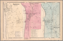
Plate 26: Hastings upon Hudso…
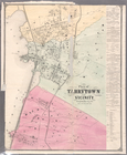
Plate 28: Plan of Tarrytown a…
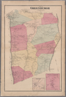
Plate 30: Town of Greenburgh,…
Plate 32: Town of East Cheste…
Plate 34: Mount Vernon, Westc…
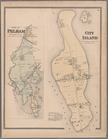
Plate 35: City Island, Pelham…
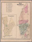
Plate 36: Town of New Rochell…
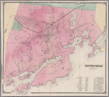
Plate 38: New Rochelle, Westc…
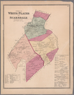
Plate 39: Towns of White Plai…
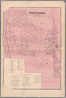
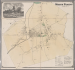
Plate 41: White Plains, Westc…
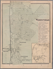
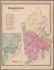
Plate 42: Town of Mamaroneck,…
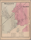
Plate 43: Mamaroneck, Westche…
1
2
3
4
5
6
7
8
9
10
…
89
90
Previous
Next
1
2
3
4
5
6
7
8
9
10
…
89
90
Previous
Next