Click to visit the main New York Public Library Homepage
The New York Public Library
Digital Collections
About Digital Collections
Browse
Search only public domain materials
Items
Collections
Divisions
Home
Search
Browse
About
Search only public domain materials
Items
Collections
Divisions
Digital Collections
Using Images
Using Data
Search
Filtered keyword search
Show filters
Hide filters
Show Only Public Domain
topic
x
Landowners
Real property
162
Administrative and political divisions
54
Railroads
26
Villages
14
More
Less
name
Smith, Robert Pearsall, 1827-1898
25
Dripps, M. (Matthew)
18
J.B. Beers & Co
10
Gillette, John E
7
French, J. H. (John Homer), 1824-1888
6
More
Less
collection
x
Maps of New York City and State
place
New York (State)
209
New York
63
New York (N.Y.)
43
Manhattan (New York, N.Y.)
23
Brooklyn (New York, N.Y.)
22
More
Less
genre
Maps
215
Cadastral maps
117
Manuscript maps
15
Facsimiles
3
Road maps
2
More
Less
publisher
publisher not identified
24
M. Dripps
14
J.B. Beers & Co
10
Hyde & Company
5
J.H. French
4
More
Less
division
x
Map Division
type
cartographic
214
still image
6
text
3
Date Range
to
Looking for this collection?
Maps of New York City and State
2,059 items
215 results found for:
x
map
Filtering on:
x
Division
: Map Division
x
Collection
: a1a9d830-c5a6-012f-00ec-58d385a7bc34
x
Topic
: Landowners
Sort by:
Relevance
Title
Date created
Date digitized
Sequence
m
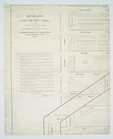
Property identification
map
of Inwood Hill
note:
Blueprint of
map
, indicating property owners
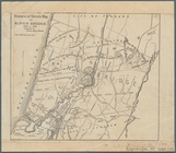
m
Beers' new
map
of Staten Island : from
Map
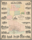
of the town of Waterloo, Seneca County, N
note:
Town
map
shows
Map
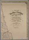
of the City of New York
abstract:
… flat with
map
.
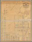
Map
of Olean, New York
note:
Mapping
the Nation (NEH grant, 2015-2018)…
Plan of streets etc. on the L…
note:
… catalog of the
Map
Map
of 465 valuable building lots
note:
… to Early
Maps
of the Middle
Map
of the flats above Albany
note:
This
map
also appeared in: Mrs. Grant
Map
of Getty Square, Yonkers
note:
NYPL
Map
Div. copy
Map
showing the Adirondack Lake regions
note:
Segments of
map
separately numbered: 15 --16
Map
of Ogdensburgh
note:
this
map
of Ogdensburgh has been
m
Map
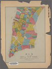
of Tarrytown, Irvington etc, Westchester
note:
Maps
show landowners, roards, railroads
Map
shewing a plan for the widening and opening
Map
of the province
note:
Photocopy of a manuscript
map
dated: 10th
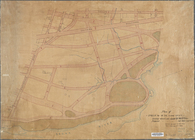
Rye Park: [New York]
note:
Map
shows streets names, lots
Map
of the homestead of the late
note:
… catalog of the
Map
Map
of Old Jan's land & the Bogardus
Map
of New York City between 135th
m
Map
showing part of the city bounded by West
collection:
Map
showing part of the city bounded by West 10
m
Map
of the City of New York north
note:
Map
within decorative border.
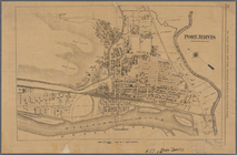
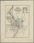
Port Jervis
note:
Map
shows streets, railroads, locations
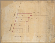
Block no. 86 : confidential r…
collection:
Maps
of New York City and State
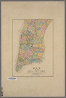
Map
of Rockland Co
note:
County
map
, showing cities and towns
m
Map
of the southern part of West-Chester
note:
Cadastral
map
showing property owners
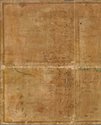
Map
of lands in the city of New York, lying
note:
NYPL copy imperfect: right half of the
map
Historical sketch
map
of Kings Bridge
note:
Mapping
the Nation (NEH grant, 2015-2018)…
m
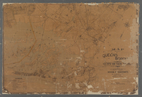
Map
of the Queens Boro[ugh], city of New
note:
… catalog of the
Map
m
Map
of the 23rd ward, New York City
note:
… catalog of the
Map
m
Map
of the village of Astoria, Queens Co. L.I.
note:
… catalog of the
Map
Map
showing the old farms : from 4th to 28th
note:
… to Early
Maps
of the Middle
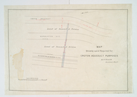
Map
showing land required for Croton
note:
… to Early
Maps
of the Middle
Map
of 150 lots of ground situate
Map
of land to be acquired under Chapter 191
m
Map
of original grants and farms
image:
psnypl_
map
_306
Map
of the village of Peekskill, Westchester
note:
… to Early
Maps
of the Middle
Hempstead
note:
…
map
of the counties
Map
of land belonging to Felix Astoin
note:
Mapping
the Nation (NEH grant, 2015-2018)…
Map
of French & English grants on Lake
note:
Mapping
the Nation (NEH grant, 2015-2018)…
m
Map
showing the injury to the property
note:
… catalog of the
Map
Town & village of Seneca Fall…
note:
Town
map
shows
m
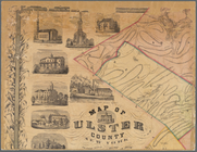
Map
of Ulster County, New York
note:
County
map
showing cities and towns, rural
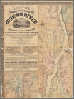
m
Lloyd's topographical
map
of the Hudson
note:
Wall
map
.
m
Map
of Clinton Co., New York
note:
NYPL
Map
Div. copy
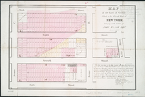
Map
of the village of Flushing, Queens County, L
note:
Inset:
Map
of the town of Flushing
Map
of the Rutger's Farm as it existed
note:
Cadastral
map
covering predominantly
Map
of the City of New York
abstract:
… of the old farm
map
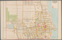
Nyack
note:
Mapping
the Nation (NEH grant, 2015-2018)…
Map
of the city of Rochester
note:
Mapping
the Nation (NEH grant, 2015-2018)…
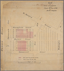
Manuscript
map
of lots at corner
m
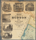
Map
of the City of Hudson, N.Y.
note:
Mapping
the Nation (NEH grant, 2015-2018)…