Click to visit the main New York Public Library Homepage
The New York Public Library
Digital Collections
About Digital Collections
Browse
Search only public domain materials
Items
Collections
Divisions
Home
Search
Browse
About
Search only public domain materials
Items
Collections
Divisions
Digital Collections
Using Images
Using Data
Search
Filtered keyword search
Show filters
Hide filters
Show Only Public Domain
topic
x
Real property
Fire insurance
5198
Cities & towns
5007
Landowners
482
Business enterprises
468
More
Less
name
Sanborn Map Company
5103
G.W. Bromley & Co
2177
Ullitz, Hugo
606
E.B. Hyde & Co
545
E. Belcher Hyde Map Company
488
More
Less
collection
Atlases of New York City
8329
Atlases of the United States
1830
Maps of North America
359
Maps of New York City and State
299
Collection of broadside real estate maps announcing auctions of lots in early 19th century New York City
67
More
Less
place
New York (State)
10267
New York
2975
Manhattan (New York, N.Y.)
1838
New York (N.Y.)
821
Brooklyn (New York, N.Y.)
811
More
Less
genre
Maps
10578
Atlases
1827
Cadastral maps
537
Indexes
126
Title pages
74
More
Less
publisher
Sanborn Map Company
5009
G.W. Bromley & Co
1997
E. Belcher Hyde
425
E. Robinson Co
246
F. W. Beers & Co
148
More
Less
division
x
Map Division
type
cartographic
10651
text
324
still image
33
Date Range
to
Looking for one of these collections?
Atlases of New York City
11,722 items
Maps of North America
3,345 items
Maps of New York City and State
2,059 items
10,889 results found for:
x
map
Filtering on:
x
Division
: Map Division
x
Topic
: Real property
Sort by:
Relevance
Title
Date created
Date digitized
Sequence
Map
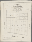
of lots & buildings as shewn
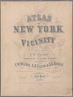
Atlas of New York and vicinit…
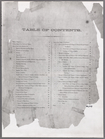
Table of Contents
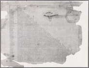
Table of Air-line Distances
Plate 5:
Map
of New York and vicinity
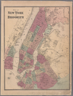
Plate 6: Plan of New York and…
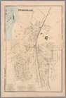
Plate 9: Tremont : Town of We…
Plate 11: Fordham
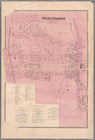
Plate 13: West Farms, Westche…
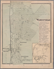
Plate 15: Wakefield : Town & …
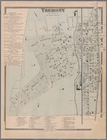
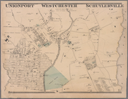
Plate 16: Unionport - Westche…
Plate 17:
Map
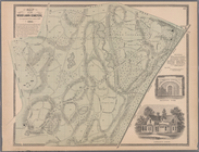
of the Woodlawn Cemetery
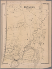
Plate 19: Town of Yonkers, We…
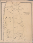
Plate 20: Yonkers, Westcheste…
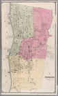
Plate 21: Town of Yonkers, We…
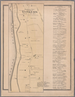
Plate 23: Yonkers, Westcheste…
Plate 24: Northern part of To…
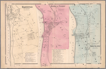
Plate 26: Hastings upon Hudso…
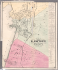
Plate 28: Plan of Tarrytown a…
Plate 30: Town of Greenburgh,…
Plate 32: Town of East Cheste…
Plate 34: Mount Vernon, Westc…
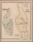
Plate 35: City Island, Pelham…
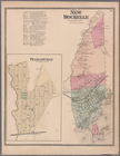
Plate 36: Town of New Rochell…
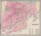
Plate 38: New Rochelle, Westc…
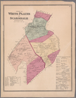
Plate 39: Towns of White Plai…
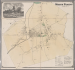
Plate 41: White Plains, Westc…
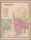
Plate 42: Town of Mamaroneck,…
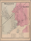
Plate 43: Mamaroneck, Westche…
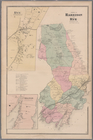
Plate 29: Towns of Harrison a…
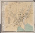
Plate 47: Port Chester, Westc…
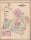
Plate 48: Town of Mt. Pleasan…
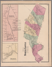
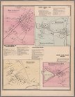
Plate 49: Town of North Castl…
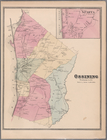
Plate 50: Ossining, Westchest…
Plate 52: Sing Sing, Town of …
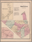
Plate 53: Town of Newcastle, …
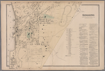
Plate 54: Mount Kisco - Bedfo…
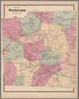
Plate 55: Town of Bedford, We…
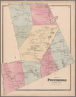
Plate 56: Town of Poundridge,…
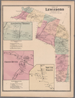
Plate 57: Town of Lewisboro, …
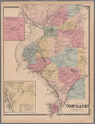
Plate 58: Town of Cortlandt, …
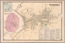
Plate 60: Peekskill, Westches…
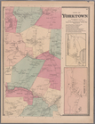
Plate 61: Town of Yorktown, W…
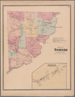
Plate 62: Town of Somers, Wes…
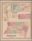
Plate 63: Town of North Salem…
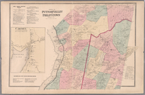
Plate 65: Towns of Putnam Val…
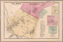
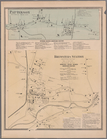
Plate 67: Cold Spring - Nelso…
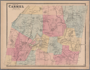
Plate 68: Town of Carmel, Put…
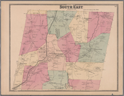
Plate 69: Town of South East,…
Plate 70: Patterson, Town of …
1
2
3
4
5
6
7
8
9
10
…
43
44
Previous
Next
1
2
3
4
5
6
7
8
9
10
…
43
44
Previous
Next