Click to visit the main New York Public Library Homepage
The New York Public Library
Digital Collections
About Digital Collections
Browse
Search only public domain materials
Items
Collections
Divisions
Home
Search
Browse
About
Search only public domain materials
Items
Collections
Divisions
Digital Collections
Using Images
Using Data
Search
Filtered keyword search
Show filters
Hide filters
Show Only Public Domain
topic
City planning
944
Social conditions
942
History
100
Real property
33
Landowners
25
More
Less
name
M.I.T. Press
942
New York (N.Y.). City Planning Commission
942
Montanus, Arnoldus, 1625?-1683
97
Ogilby, John, 1600-1676
97
United States. War Department. Office of P.R.R. Surveys
10
More
Less
collection
Atlases of New York City
950
Lawrence H. Slaughter Collection of English maps, charts, globes, books and atlases
114
Maps of North America
93
Maps of New York City and State
27
Atlases, gazetteers, guidebooks and other books
20
More
Less
place
New York (State)
966
New York (N.Y.)
956
New York
950
America
97
West Indies, British
97
More
Less
genre
Maps
1186
Illustrations
40
Aerial views
29
Cadastral maps
20
Diagrams
13
More
Less
publisher
MIT Press
942
Printed by the author, and are to be had at his house
97
War Dept., U.S. Pacific Rail Road Explorations & Surveys
8
publisher not identified
7
Printed for Robert Sayer, No. 53, Fleet-Street
5
More
Less
division
x
Map Division
type
x
still image
cartographic
123
text
33
Date Range
to
Looking for this collection?
Lawrence H. Slaughter Collection of English maps, charts, globes, books and atlases
1,252 items
1,222 results found for:
x
map
Filtering on:
x
Division
: Map Division
x
Type
: still image
Sort by:
Relevance
Title
Date created
Date digitized
Sequence
Portugal.
image:
ps_
map
_179
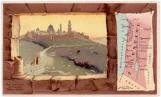
Palestine.
image:
ps_
map
_180
Florida.
image:
ps_
map
_174
Denmark.
image:
ps_
map
_178
Indian Territory [Oklahoma].
image:
ps_
map
_175
Title page
image:
ps_
map
_191
Allen's outline
map
of Ottumwa, Iowa
note:
… catalog of the
Map
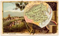
Chinese Empire.
image:
ps_
map
_181
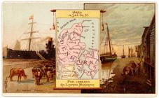
New York.
image:
ps_
map
_176
Map
of the territory of Idaho
note:
Mapping
the Nation (NEH grant, 2015-2018)…
Key
map
Key
map
Key
map
Key
map
Key
map
Map
Scale New York City Planning
m
Map
of Columbiana County, Ohio, 1860 …
note:
… along center of
map
Arabia.
image:
ps_
map
_177
Map
of the city of San Francisco
note:
… catalog of the
Map
Octagonal
map
of the environs of Richmond
note:
Mapping
the Nation (NEH grant, 2015-2018)…
Colton's
map
of Oregon & Washington
note:
… catalog of the
Map
Map
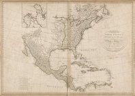
of North America, published under
Plan of the city of Philadelp…
note:
NYPL
Map
Div. copy: margins trimmed; sheet 51
City planning commission
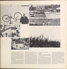
Brooklyn
Brooklyn (cont.)
Brooklyn (cont.)
Brooklyn (cont.)
Brooklyn
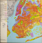
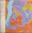
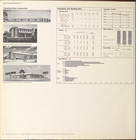
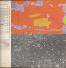
Brooklyn land use policy
Brooklyn neighborhood improve…
Brooklyn public schools
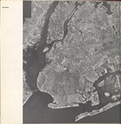
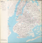
Brooklyn Topography
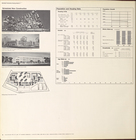
Cover Page
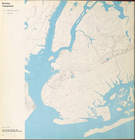
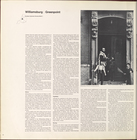
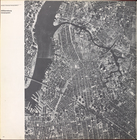
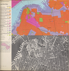
Williamsburg, Greenpoint.
Williamsburg, Greenpoint. (co…
Williamsburg, Greenpoint. (co…
Williamsburg, Greenpoint. (co…
Williamsburg, Greenpoint. (co…
Williamsburg, Greenpoint. (co…
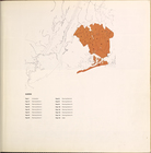
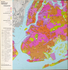
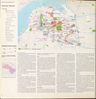
Land use policy
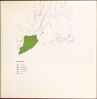
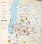
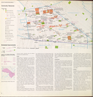
Community resources
Community resources data
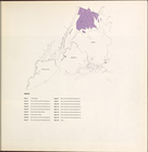
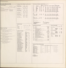
Scheduled new construction
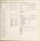
Land use policy
Community resources
Community resources data
Scheduled new construction
Land use policy
Community resources
1
2
3
4
5
Previous
Next
1
2
3
4
5
Previous
Next