Click to visit the main New York Public Library Homepage
The New York Public Library
Digital Collections
About Digital Collections
Browse
Search only public domain materials
Items
Collections
Divisions
Home
Search
Browse
About
Search only public domain materials
Items
Collections
Divisions
Digital Collections
Using Images
Using Data
Search
Filtered keyword search
Show filters
Hide filters
Show Only Public Domain
topic
Real property
10889
Fire insurance
5305
Cities & towns
5007
City planning
1087
Social conditions
942
More
Less
name
Sanborn Map Company
5108
G.W. Bromley & Co
2551
New York (N.Y.). City Planning Commission
980
M.I.T. Press
942
Bromley, George Washington
857
More
Less
collection
Atlases of New York City
11592
Atlases of the United States
3839
Maps of North America
3345
Maps of New York City and State
2057
Lawrence H. Slaughter Collection of English maps, charts, globes, books and atlases
1248
More
Less
place
New York (State)
13151
New York
4862
New York (N.Y.)
3351
Manhattan (New York, N.Y.)
2239
Brooklyn (New York, N.Y.)
1212
More
Less
genre
Maps
23265
Atlases
3762
Topographic maps
1050
Cadastral maps
594
Nautical charts
394
More
Less
publisher
Sanborn Map Company
5145
G.W. Bromley & Co
2371
MIT Press
942
E. Belcher Hyde
807
K.u.K. Militargeographisches Institut
774
More
Less
division
x
Map Division
type
cartographic
22270
still image
1222
text
755
Date Range
to
Looking for one of these collections?
Atlases of New York City
11,722 items
Atlases of the United States
3,868 items
Maps of North America
3,345 items
Maps of New York City and State
2,059 items
Lawrence H. Slaughter Collection of English maps, charts, globes, books and atlases
1,252 items
Spezialkarte der Osterreichisch-Ungarischen Monarchie
774 items
23,798 results found for:
x
map
Filtering on:
x
Division
: Map Division
Sort by:
Relevance
Title
Date created
Date digitized
Sequence
Results 501 - 550
Index
Map
Index
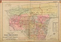
Atlas of the Oranges embracin…
m
Town site of La Gloria: looki…
collection:
Maps
of North America
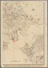
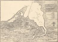
Upper Manhattan, comprising t…
collection:
Maps
of New York City and State
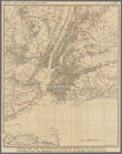
The lower end of Manhattan Is…
collection:
Maps
of New York City and State
The southeastern part of the …
collection:
Maps
of New York City and State
The southwestern part of the …
collection:
Maps
of New York City and State
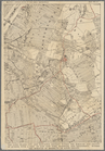
The northwesterly part of the…
collection:
Maps
of New York City and State
The district of Pelham Neck, …
collection:
Maps
of New York City and State
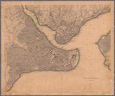
Southeastern part of the boro…
collection:
Maps
of New York City and State
Werpoes, a village of the Man…
collection:
Maps
of New York City and State
Yorkville and East Harlem in …
collection:
Maps
of New York City and State
Southern part of the borough …
collection:
Maps
of New York City and State
The Long Island City and Newt…
collection:
Maps
of New York City and State
Greater New York and contigou…
collection:
Maps
of New York City and State
Constantinople, 1840
collection:
Maps
of Asia
St. Johann im Pongau
Colton's railroad & township
map
of the state
note:
Mapping
the Nation (NEH grant, 2015-2018)…
Economic and geologic
map
of the state
note:
NYPL
Map
Div. copy has accession no
Preliminary geologic
map
of Albany
note:
… from the road
map
m
Map
of Long Island and the southern part
note:
Map
also shows New York City, and part
Economic and geologic
map
of the state
note:
NYPL
Map
Div. copy has accession no
Map
of the state of New York
note:
Mapping
the Nation (NEH grant, 2015-2018)…
Map
of the rail roads of the State
note:
Mapping
the Nation (NEH grant, 2015-2018)…
Economic and geologic
map
of the state
note:
NYPL
Map
Div. copy has accession no
m
Map
of the southern part of West-Chester
note:
Cadastral
map
showing property owners
m
Map
of Ulster County, New York
note:
Mapping
the Nation (NEH grant, 2015-2018)…
Map
of the rail-roads of the State
note:
Map
within decorative border.
Map
of the rail roads of the state
note:
Map
within decorative border.
Map
shewing the location of the N.Y
note:
Mapping
the Nation (NEH grant, 2015-2018)…
m
Map
of Washington County, New York
note:
Mapping
the Nation (NEH grant, 2015-2018)…
aert vande Svyd Rivier in Nie…
image:
psnypl_
map
_285
A perspective view of Lake Ge…
note:
… on
map
.Includes keys to places
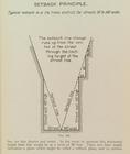
Setback principle
image:
ps_
map
_164
Map
showing locations of Delafield
note:
Missing small section of
map
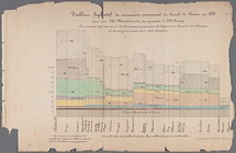
Tableau figuratif du mouvemen…
East India Islands
Map
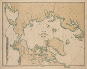
of the North Polar Region
Map
of Port Hudson and Vicinity …
Carte hydrogéologique, Républ…
note:
In lower left margin:
Map
no. 3604(F
A new
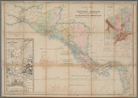
map
of Central America shewing
A
map
of the world from the best
note:
… to Early
Maps
of the Middle
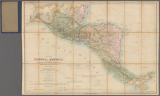
Map
of Central America including
A
map
of the icy sea in which
note:
Jolly, D.C.,
Maps
in British periodicals, pt.1
m
Afro American travel
map
m
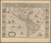
Americae nova tabula
note:
Mapping
the Nation (NEH grant, 2015-2018) …
Carte de l'Amerique
note:
Mapping
the Nation (NEH grant, 2015-2018)…
Pencil sketch of part of Xien…
abstract:
Manuscript
map
created for the "1959
Ville de Savannakhet
abstract:
Manuscript
map
created for the "1959
1
2
3
4
5
6
7
8
9
10
…
95
96
Previous
Next
1
2
3
4
5
6
7
8
9
10
…
95
96
Previous
Next