Click to visit the main New York Public Library Homepage
The New York Public Library
Digital Collections
About Digital Collections
Browse
Search only public domain materials
Items
Collections
Divisions
Home
Search
Browse
About
Search only public domain materials
Items
Collections
Divisions
Digital Collections
Using Images
Using Data
Search
Filtered keyword search
Show filters
Hide filters
Show Only Public Domain
topic
Real property
10889
Fire insurance
5305
Cities & towns
5007
City planning
1087
Social conditions
942
More
Less
name
Sanborn Map Company
5108
G.W. Bromley & Co
2551
New York (N.Y.). City Planning Commission
980
M.I.T. Press
942
Bromley, George Washington
857
More
Less
collection
Atlases of New York City
11592
Atlases of the United States
3839
Maps of North America
3345
Maps of New York City and State
2057
Lawrence H. Slaughter Collection of English maps, charts, globes, books and atlases
1248
More
Less
place
New York (State)
13151
New York
4862
New York (N.Y.)
3351
Manhattan (New York, N.Y.)
2239
Brooklyn (New York, N.Y.)
1212
More
Less
genre
Maps
23265
Atlases
3762
Topographic maps
1050
Cadastral maps
594
Nautical charts
394
More
Less
publisher
Sanborn Map Company
5145
G.W. Bromley & Co
2371
MIT Press
942
E. Belcher Hyde
807
K.u.K. Militargeographisches Institut
774
More
Less
division
x
Map Division
type
cartographic
22270
still image
1222
text
755
Date Range
to
Looking for one of these collections?
Atlases of New York City
11,722 items
Atlases of the United States
3,868 items
Maps of North America
3,345 items
Maps of New York City and State
2,059 items
Lawrence H. Slaughter Collection of English maps, charts, globes, books and atlases
1,252 items
Spezialkarte der Osterreichisch-Ungarischen Monarchie
774 items
23,798 results found for:
x
map
Filtering on:
x
Division
: Map Division
Sort by:
Relevance
Title
Date created
Date digitized
Sequence
Results 22251 - 22300
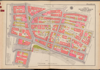
Double Page Plate No. 14, Par…
topic:
Maps
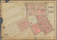
Double Page Plate No. 15, Par…
topic:
Maps
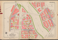
Double Page Plate No. 23, Par…
topic:
Maps
Bounded by W. 14th Street, Ni…
Double Page Plate No. 27, Par…
topic:
Maps
m
Map
of Cambria Co., Pennsylvania …
note:
NYPL
Map
Div. copy in 4 sheets, 71 x 63 cm
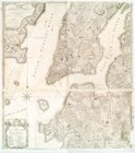
A chart of the sea coasts of …
note:
… consisting of
maps
by Wit
m
A
map
of South Carolina and a part
note:
NYPL
Map
Div. copy imperfect: lacking 2
Map
of Washington Co., Pennsylvania …
note:
NYPL
Map
Div. copy on 2 sheets, east
Preliminary surveys of harbor…
note:
NYPL
Map
Div. copy has accession no
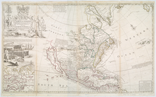
This
map
of North America according to ye
note:
…. Bowles, print &
map
This
map
of North America according to ye
note:
…. Bowles, print &
map
…; [
Map
bounded by Harold
Military
map
of Nebraska and Dakota …
note:
… catalog of the
Map
D'Engelze volkplanting in Vir…
note:
… to Early
Maps
of the Middle
m
A
map
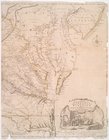
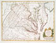
of the most inhabited part of Virginia
note:
…. This
map
is most humbly
The English Empire in America…
note:
… to Early
Maps
of the Middle
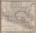
Mexico, or, New Spain : divid…
note:
… to Early
Maps
of the Middle
A
map
of the most inhabited part of Virginia
note:
… to Early
Maps
of the Middle
m
Map
of the district of Maine, Massachusetts
note:
Mapping
the Nation (NEH grant, 2015-2018)…
America, N.W. Coast, Strait o…
note:
NYPL
Map
Div. copy has accession no
…, Jamaica; [
Map
bounded
m
A chart of the harbour of Rho…
note:
NYPL
Map
Div. copy is divided into 2 sheets, 54
Plat of a survey of land "for…
note:
… and carto-bibliography of
maps
, entry 495
m
Post route
map
of the state of Minnesota, …
note:
… catalog of the
Map
Map
of the territories of Michigan
note:
Mapping
the Nation (NEH grant, 2015-2018)…
Private claims at Michilimack…
note:
… of the printed
maps
of Michigan
Entrance to Columbia River, O…
note:
… catalog of the
Map
Map
showing a portion of the boundaries
note:
… to Early
Maps
of the Middle
Topographical
map
of the city and county of New
note:
… to Early
Maps
of the Middle
m
Map
of Pennsylvania
note:
… to Early
Maps
of the Middle
Nova tabula geographica compl…
note:
NYPL. Dictionary catalog of the
Map
North America from the French…
note:
Copy in
Map
Div. 97-6220: Lawrence H
Phelps's national
map
of the United
note:
… to Early
Maps
of the Middle
Mouth of Chester River : (Har…
note:
In upper left margin: Harbor
map
no.
m
Plan of the city of New York …
note:
… to Early
Maps
of the Middle
m
Map
of an exploring expedition to the Rocky
m
Military
map
of Nebraska and Dakota
note:
Mapping
the Nation (NEH grant, 2015-2018)…
Part of the boundary between …
note:
…"Though the
map
m
National
map
of the territory of the United
note:
Mapping
the Nation (NEH grant, 2015-2018)…
Territory of Dakota
note:
NYPL
Map
Div. copy has accession no
m
New
map
of Burlington County
note:
Mapping
the Nation (NEH grant, 2015-2018)…
The Harbor of New Bedford
note:
… "Harbor
map
no." in upper
New sectional
map
of the state of Illinois …
note:
Mapping
the Nation (NEH grant, 2015-2018)…
A draught of West Florida : f…
note:
Mapping
the Nation (NEH grant, 2015-2018)…
Map
exhibiting the routes between Fort
note:
Mapping
the Nation (NEH grant, 2015-2018)…
Geological and topographical
map
note:
Mapping
the Nation (NEH grant, 2015-2018)…
Reconnaissance of Smith's or …
note:
… catalog of the
Map
Map
of the rail roads of the state
note:
Map
within decorative border.
Map
of Richland, Oswego Co. N.Y.
note:
Cadastral
map
of the Town (township
1
2
…
87
88
89
90
91
92
93
94
95
96
Previous
Next
1
2
…
87
88
89
90
91
92
93
94
95
96
Previous
Next