Click to visit the main New York Public Library Homepage
The New York Public Library
Digital Collections
About Digital Collections
Browse
Search only public domain materials
Items
Collections
Divisions
Home
Search
Browse
About
Search only public domain materials
Items
Collections
Divisions
Digital Collections
Using Images
Using Data
Search
Filtered keyword search
Show filters
Hide filters
Show Only Public Domain
topic
Real property
10889
Fire insurance
5305
Cities & towns
5007
City planning
1087
Social conditions
942
More
Less
name
Sanborn Map Company
5108
G.W. Bromley & Co
2551
New York (N.Y.). City Planning Commission
980
M.I.T. Press
942
Bromley, George Washington
857
More
Less
collection
Atlases of New York City
11592
Atlases of the United States
3839
Maps of North America
3345
Maps of New York City and State
2057
Lawrence H. Slaughter Collection of English maps, charts, globes, books and atlases
1248
More
Less
place
New York (State)
13151
New York
4862
New York (N.Y.)
3351
Manhattan (New York, N.Y.)
2239
Brooklyn (New York, N.Y.)
1212
More
Less
genre
Maps
23265
Atlases
3762
Topographic maps
1050
Cadastral maps
594
Nautical charts
394
More
Less
publisher
Sanborn Map Company
5145
G.W. Bromley & Co
2371
MIT Press
942
E. Belcher Hyde
807
K.u.K. Militargeographisches Institut
774
More
Less
division
x
Map Division
type
cartographic
22270
still image
1222
text
755
Date Range
to
Looking for one of these collections?
Atlases of New York City
11,722 items
Atlases of the United States
3,868 items
Maps of North America
3,345 items
Maps of New York City and State
2,059 items
Lawrence H. Slaughter Collection of English maps, charts, globes, books and atlases
1,252 items
Spezialkarte der Osterreichisch-Ungarischen Monarchie
774 items
23,798 results found for:
x
map
Filtering on:
x
Division
: Map Division
Sort by:
Relevance
Title
Date created
Date digitized
Sequence
m
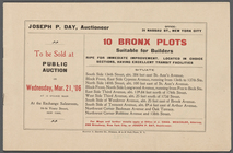
10 Bronx Plots suitable for B…
collection:
Maps
of New York City and State
101st St. & 102nd St. and the…
collection:
Maps
of New York City and State
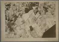
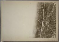
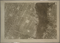
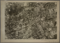
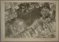
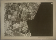
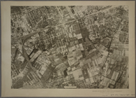
10A - N.Y. City (Aerial Set).
note:
Maps
numbered from 1A-D to 35 A-B.
10B - N.Y. City (Aerial Set).
note:
Maps
numbered from 1A-D to 35 A-B.
10C - N.Y. City (Aerial Set).
note:
Maps
numbered from 1A-D to 35 A-B.
10D - N.Y. City (Aerial Set).
note:
Maps
numbered from 1A-D to 35 A-B.
11A - N.Y. City (Aerial Set).
note:
Maps
numbered from 1A-D to 35 A-B.
11B - N.Y. City (Aerial Set).
note:
Maps
numbered from 1A-D to 35 A-B.
11C - N.Y. City (Aerial Set).
note:
Maps
numbered from 1A-D to 35 A-B.
11D - N.Y. City (Aerial Set).
note:
Maps
numbered from 1A-D to 35 A-B.
11th ward showing its 28 elec…
note:
NYPL
Map
Div. copy has accession no
m
12,000 Square Miles around Ne…
collection:
Maps
of New York City and State
12A - N.Y. City (Aerial Set).
note:
Maps
numbered from 1A-D to 35 A-B.
12B - N.Y. City (Aerial Set).
note:
Maps
numbered from 1A-D to 35 A-B.
12C - N.Y. City (Aerial Set).
note:
Maps
numbered from 1A-D to 35 A-B.
12D - N.Y. City (Aerial Set).
note:
Maps
numbered from 1A-D to 35 A-B.
13 lots of ground to be sold …
collection:
Collection of broadside real estate
maps
13A - N.Y. City (Aerial Set).
note:
Maps
numbered from 1A-D to 35 A-B.
13B - N.Y. City (Aerial Set).
note:
Maps
numbered from 1A-D to 35 A-B.
13C - N.Y. City (Aerial Set).
note:
Maps
numbered from 1A-D to 35 A-B.
13D - N.Y. City (Aerial Set).
note:
Maps
numbered from 1A-D to 35 A-B.
m
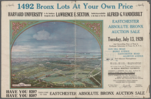
1492 Bronx Lots At Your Own P…
collection:
Maps
of New York City and State
14A - N.Y. City (Aerial Set).
note:
Maps
numbered from 1A-D to 35 A-B.
14B - N.Y. City (Aerial Set).
note:
Maps
numbered from 1A-D to 35 A-B.
14C - N.Y. City (Aerial Set).
note:
Maps
numbered from 1A-D to 35 A-B.
14D - N.Y. City (Aerial Set).
note:
Maps
numbered from 1A-D to 35 A-B.
15A - N.Y. City (Aerial Set).
note:
Maps
numbered from 1A-D to 35 A-B.
15B - N.Y. City (Aerial Set).
note:
Maps
numbered from 1A-D to 35 A-B.
15C - N.Y. City (Aerial Set).
note:
Maps
numbered from 1A-D to 35 A-B.
15D - N.Y. City (Aerial Set).
note:
Maps
numbered from 1A-D to 35 A-B.
m
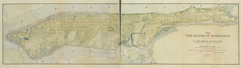
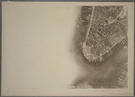
1609. The island of Manhattan…
image:
ps_
map
_cd3_36
16A - N.Y. City (Aerial Set).
note:
Maps
numbered from 1A-D to 35 A-B.
16B - N.Y. City (Aerial Set).
note:
Maps
numbered from 1A-D to 35 A-B.
16C - N.Y. City (Aerial Set).
note:
Maps
numbered from 1A-D to 35 A-B.
16D - N.Y. City (Aerial Set).
note:
Maps
numbered from 1A-D to 35 A-B.
17A - N.Y. City (Aerial Set).
note:
Maps
numbered from 1A-D to 35 A-B.
17B - N.Y. City (Aerial Set).
note:
Maps
numbered from 1A-D to 35 A-B.
17C - N.Y. City (Aerial Set).
note:
Maps
numbered from 1A-D to 35 A-B.
17D - N.Y. City (Aerial Set).
note:
Maps
numbered from 1A-D to 35 A-B.
180 lots on the Marsellis Tra…
note:
…
Maps
, 7463 Girard Ave
1841, showing the dates of th…
note:
… to Early
Maps
of the Middle
1863, West Point: [New York]
note:
Mapping
the Nation (NEH grant, 2015-2018)…
1889, Larchmont Harbor, N.Y.:…
note:
Mapping
the Nation (NEH grant, 2015-2018)…
1892 Tallapoosa, Ga., Haralso…
note:
Mapping
the Nation (NEH grant, 2015-2018)…
1892, Harrison's
map
of Jersey City
note:
Mapping
the Nation (NEH grant, 2015-2018)…
m
1896 Connecticut River, Conn.…
note:
Map
in 6 segments, 2 on each sheet.
1899 Railroad
map
of Ohio …
note:
… catalog of the
Map
18A - N.Y. City (Aerial Set).
note:
Maps
numbered from 1A-D to 35 A-B.
18B - N.Y. City (Aerial Set).
note:
Maps
numbered from 1A-D to 35 A-B.
18C - N.Y. City (Aerial Set).
note:
Maps
numbered from 1A-D to 35 A-B.
1
2
3
4
5
6
7
8
9
10
…
95
96
Previous
Next
1
2
3
4
5
6
7
8
9
10
…
95
96
Previous
Next