Click to visit the main New York Public Library Homepage
The New York Public Library
Digital Collections
About Digital Collections
Browse
Search only public domain materials
Items
Collections
Divisions
Home
Search
Browse
About
Search only public domain materials
Items
Collections
Divisions
Digital Collections
Using Images
Using Data
Search
Filtered keyword search
Show filters
Hide filters
Show Only Public Domain
topic
Hydrology
4
Lakes
3
Explorations and surveys
2
Mountain passes
2
Pacific railroads
2
More
Less
name
Birge, E. A. (Edward Asahel), 1851-1950
4
Wisconsin Geological and Natural History Survey
4
Smith, Leonard S. (Leonard Sewall), 1864-1947
3
Parke, John G
2
Siebert, Selmar
2
More
Less
collection
Maps of North America
11
Maps of New York City and State
2
place
Wisconsin
5
United States
4
New York
2
New York (State)
2
Sierra Nevada (Calif. and Nev.)
2
More
Less
genre
x
Maps
Diagrams
11
Bathymetric maps
4
Charts
2
Geological cross-sections
2
More
Less
publisher
Wisconsin Geological and Natural History Survey
4
A.Y. Lee
1
California State Mining Bureau
1
G. Hayward Lith. [1 Platt] St.,
1
Moore, Benjamin & Co
1
More
Less
division
x
Map Division
type
x
still image
cartographic
12
Date Range
to
13 results found for:
x
Diagrams
Filtering on:
x
Division
: Map Division
x
Genre
: Maps
x
Type
: still image
Sort by:
Relevance
Title
Date created
Date digitized
Sequence
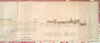
Profile of lower part of Crot…
Map of the Forest Hill Divide…
abstract:
… and cross-section
diagrams
.
The Narrows tunnel : chart of…
Hydrographic map of the Chain…
Barometric profile of the rou…
Bird's-eye view of the Conema…
topic:
Charts,
diagrams
, etc.
Hydrographic map of Elkhart L…
Hydrographic map of Green Lak…
Hydrographic map of Delavan a…
California (Los Angeles Co.) …
abstract:
…
diagram
.
Map of the Gogebic Iron Range…
Map and profile of the Cañada…
Map and profile of the Tejon …
End of results
|
Top