Click to visit the main New York Public Library Homepage
The New York Public Library
Digital Collections
About Digital Collections
Browse
Search only public domain materials
Items
Collections
Divisions
Home
Search
Browse
About
Search only public domain materials
Items
Collections
Divisions
Digital Collections
Using Images
Using Data
Search
Filtered keyword search
Show filters
Hide filters
Show Only Public Domain
topic
x
Streets
Railroads
15
Railroads, Elevated
15
Local transit
13
Administrative and political divisions
12
More
Less
name
J.B. Beers & Co
6
C.S. Hammond & Company
3
G.W. & C.B. Colton & Co
3
Laine & Healy
3
Matthews-Northrup Works
3
More
Less
collection
Maps of New York City and State
31
Maps of North America
4
place
New York (State)
31
New York
27
Brooklyn (New York, N.Y.)
21
New York (N.Y.)
14
Manhattan (New York, N.Y.)
12
More
Less
genre
Maps
35
Mass transit
2
Road maps
2
Cadastral maps
1
Manuscript maps
1
publisher
G.W. & C.B. Colton & Co
3
Laine & Healy
3
Brooklyn Daily Eagle
2
J.B. Beers & Co
2
Matthews-Northrup Works
2
More
Less
division
x
Map Division
type
cartographic
35
Date Range
to
35 results found for:
x
Street railroads
Filtering on:
x
Division
: Map Division
x
Topic
: Streets
Sort by:
Relevance
Title
Date created
Date digitized
Sequence
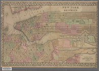
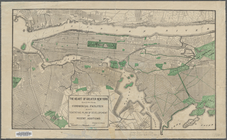
Rand McNally & Co.'s new hand…
abstract:
…
streets
, elevated
m
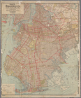
Hagstrom's map of Brooklyn (N…
note:
Includes
street
index.
m
…
street
: showing new
note:
Street
directory, police stations, post
m
Street
guide of Manhattan and the Bronx …
note:
… of interest, and
streets
.
County map of the state of Ca…
abstract:
…
railroads
, cities, and towns;
street
names, docks
m
New quick reference
street
indexed map
note:
…
railroads
and trolley lines.
m
Topographical map of New York…
note:
th
Street
Plan of New York &c.
note:
…,
railroads
,
street
names
City guide
note:
Includes
street
index for Manhattan
Gould's official map of the c…
abstract:
Shows
streets
m
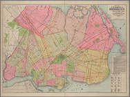
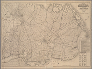
Hammond's complete map of Bro…
note:
Shows
railroads
, elevated
railroads
, subways
m
Hammond's complete map of Bro…
note:
Shows
railroads
, elevated
railroads
, subways
Massachusetts and Rhode Island
note:
Shows roads,
railroads
, counties, cities
New York and Brooklyn
note:
… and sixteenth
street
, and part of Brooklyn ; shows
streets
Guide map of the borough of B…
abstract:
Shows
streets
Brooklyn and vicinity
note:
…,
streets
, ferry lines, and elevated
railroads
. Also
m
Map of the borough of Brookly…
note:
…
railroads
, trolleys, tunnels
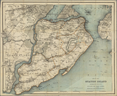
Map of Staten Island, Richmon…
abstract:
…, roads,
railroads
m
Map of the enlarged city of B…
note:
…, elevated
railroads
Map of the enlarged city of B…
note:
…, elevated
railroads
m
Colton's new indexed map of t…
abstract:
… to
streets
and surface
railroads
; does not include
m
Map of Staten Island, Richmon…
abstract:
Shows township boundaries, roads,
railroads
Map of the southern part of t…
note:
Shows
railroads
, elevated lines, ferries
m
Map of Kings County, includin…
topic:
Streets
Map of the enlarged city of B…
note:
…, and elevated
railroad
lines
The heart of greater New York…
note:
… and proposed
streets
and piers
Map of the borough of Brookly…
abstract:
… and elevated
railroad
lines.
m
Map of the enlarged city of B…
note:
… and elevated
railroad
lines.
m
Hagstom's map of Long Island …
topic:
Streets
Williams' map of boroughs of …
note:
Shows
railroads
, subway and elevated
Price, Lee & Co's. new map of…
note:
Shows city wards,
streets
, and
railroads
.
Map of the northern part of t…
abstract:
Shows
railroads
, ferries, ward boundaries
m
… to 97th
Streets
note:
… of 96th
Street
from
railroad
to West End Avenue.
m
Map of the northern part of t…
abstract:
Shows
railroads
, ferries, ward boundaries
m
… and Brooklyn with
street
note:
… as
railroad
stations.
End of results
|
Top