Click to visit the main New York Public Library Homepage
The New York Public Library
Digital Collections
About Digital Collections
Browse
Search only public domain materials
Items
Collections
Divisions
Home
Search
Browse
About
Search only public domain materials
Items
Collections
Divisions
Digital Collections
Using Images
Using Data
Search
Filtered keyword search
Show filters
Hide filters
Show Only Public Domain
topic
History
100
Nautical charts
45
Railroads
27
Real property
27
Administrative and political divisions
18
More
Less
name
United States Coast Survey
39
American Civil War (1861-1865)
31
Bache, A. D. (Alexander Dallas), 1806-1867
29
United States. Army. Corps of Topographical Engineers
18
Smith, John, 1580-1631
14
More
Less
collection
Maps of North America
304
Lawrence H. Slaughter Collection of English maps, charts, globes, books and atlases
127
John H. Levine Collection
17
Atlases of New York City
13
Atlases of the United States
3
More
Less
place
Virginia
273
United States
73
Maryland
71
Middle Atlantic States
41
North Carolina
41
More
Less
genre
Maps
470
Nautical charts
22
Bathymetric maps
18
Military maps
11
Cadastral maps
10
More
Less
publisher
publisher not identified
17
U.S. Coast Survey Office
16
U.S. Coast Survey
14
s.n.,
12
Corps of Topographical Engineers
9
More
Less
division
x
Map Division
type
cartographic
468
text
5
still image
3
Date Range
to
470 results found for:
x
Virginia
Filtering on:
x
Division
: Map Division
Sort by:
Relevance
Title
Date created
Date digitized
Sequence
Results 251 - 300
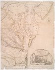
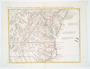
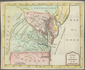
The state of
Virginia
: from the best
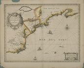
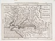
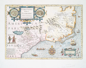
Nova Anglia, Novum Belgium, et
Virginia
.
m
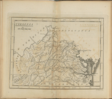
Vicinity of the Rapidan and R…
m
Dec. 13th Positions of Humphr…
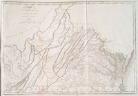
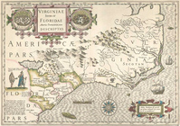
A map of the most inhabited part of
Virginia
note:
Described in: Fry & Jefferson map of
Virginia
Rappahannock River,
Virginia
…
Map of the battlefield of Fre…
collection:
Virginia
D'Engelze volkplanting in Vir…
collection:
Virginia
m
A map of the most inhabited part of
Virginia
note:
Described in: Fry & Jefferson map of
Virginia
A map of the most inhabited part of
Virginia
note:
Described in: Fry & Jefferson map of
Virginia
[Pla]n of the Siege of Yorkto…
collection:
Virginia
…, North Carolina,
Virginia
… Jersey, with
Virginia
Virginia
and Maryland
… Orientale della
Virginia
, e
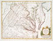
A new map of
Virginia
, Mary-land
Carta particolare della
Virginia
Vecchia e
Nova
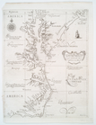
Virginiae
tabvla
abstract:
Based on John Smith's map of
Virginia
… Jersey, with
Virginia
Virginiae
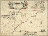
partis australis, et Floridae
note:
Covers Atlantic Coast from
Virginia
Virginiae
item et Floridae Americae
note:
… on the left, and a
Virginia
… orientale della
Virginia
, e
A new map of
Virginia
from the best
The North End Mines : field …
abstract:
Shows
Virginia
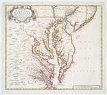
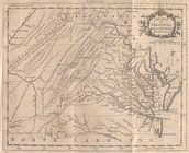
Map of
Virginia
, Maryland, Delaware
…,
Virginia
…
Battle of Rappahannock Statio…
…, Maryland,
Virginia
, North
Sketch exhibiting the approac…
collection:
Virginia
…, Maryland,
Virginia
&c
note:
Sames, J.W. Index of Kentucky &
Virginia
maps
…, Maryland, and
Virginia
note:
…, and eastern
Virginia
.
Virginia
et Nova Francia
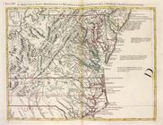
A map of the states of
Virginia
, North Carolina
Map of
Virginia
, Maryland and Delaware …
Colton's map of
Virginia
, Maryland
Map of the frontiers of the n…
note:
…,
Virginia
, and Ohio.
m
….
Virginia
& Fort Monroe
A map of the most inhabited part of
Virginia
note:
Described in: Fry & Jefferson map of
Virginia
Virginia
, Maryland, Pennsilvania, east & west New
Carte de la Virginie et du Ma…
Albemarle and Chesapeake Cana…
m
Sketch of the battle of Frede…
Virginiae
item et Floridae Americae
note:
… on the left, and a
Virginia
A general map of the middle B…
Virginia
…, New Iarsey,
Virginia
… and a portion of
Virginia
Petersburg and Five Forks : f…
collection:
Virginia
Map of a portion of
Virginia
Map of Richmond, Va. : and su…
collection:
Virginia
1
2
Previous
Next
1
2
Previous
Next