Click to visit the main New York Public Library Homepage
The New York Public Library
Digital Collections
About Digital Collections
Browse
Search only public domain materials
Items
Collections
Divisions
Home
Search
Browse
About
Search only public domain materials
Items
Collections
Divisions
Digital Collections
Using Images
Using Data
Search
Filtered keyword search
Show filters
Hide filters
Show Only Public Domain
topic
Administrative and political divisions
663
Railroads
558
Real property
395
Landowners
316
Roads
121
More
Less
name
Rand McNally and Company
105
United States. General Land Office
74
Bien, Julius, 1826-1909
71
Julius Bien & Co
71
G.W. & C.B. Colton & Co
66
More
Less
collection
Maps of North America
1589
Maps of New York City and State
706
Atlases of the United States
83
Lawrence H. Slaughter Collection of English maps, charts, globes, books and atlases
21
Maps of Asia
10
More
Less
place
New York (State)
662
New York (N.Y.)
272
New York
260
United States
214
Massachusetts
172
More
Less
genre
Maps
2428
Cadastral maps
280
Topographic maps
96
Geological maps
92
Manuscript maps
89
More
Less
publisher
publisher not identified
169
G.W. & C.B. Colton & Co
49
G.M. Hopkins (Firm)
42
Rand, McNally & Co
40
General Land Office
38
More
Less
division
x
Map Division
type
cartographic
2429
still image
65
text
39
Date Range
to
2,430 results found for:
x
Colors
Filtering on:
x
Division
: Map Division
Sort by:
Relevance
Title
Date created
Date digitized
Sequence
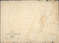
Adirondack survey, Sketch in
colors
showing
Geological map of Potter Coun…
abstract:
…, and available in
color
. At head
Map of Chicago and its wester…
note:
Colors
indicate wards within the city
Map of the railroads of Conne…
note:
… in distinguishing
colors
.
Map of Garret Nostrand's farm…
note:
…, with additional
colors
.
… represented in
colors
)…
Map of the railroads of Conne…
abstract:
…
colors
.
Map of the United States of N…
note:
… by hachures. Two
colors
Map of southern Butler County…
abstract:
… available in
color
. At head
Plan of Boston proper, showin…
note:
… and layout by
colored
Map of Boston for 1874: publi…
note:
Shows in various
colors
the lands
Preliminary geological map of…
abstract:
… of
colors
. "Pl. V"--Upper
Geological map of Fayette Cou…
abstract:
… in
color
. At head
m
Map of Long Island and adjace…
note:
… in different
colors
.
Geological map of Potter Coun…
abstract:
… in
color
, and available
Geological map of Alabama
note:
Includes "explanation" key to
colors
Geological map of Allegheny C…
abstract:
… available in
color
. At head
Map of North Allegheny, showi…
abstract:
… available in
color
. At head
Geological map of the route e…
note:
Includes index of
colors
as a key
Map of Beaver County showing …
abstract:
… available in
color
. At head
The Louisiana State Universit…
Geological map of the environ…
note:
… available in
color
. At head
Triassic formation: including…
note:
Includes a table of
colors
and 6 sections.
m
Official map of south-west po…
note:
…"
Colored
by E. M. Sleator, 529 Shotwell St
Plan of the city of Philadelp…
note:
Fill
color
by hand
Substances minérales utiles d…
note:
color
Map of New York City above 11…
note:
…
coloring
. The grand
Map of the City of Wilmington…
Bayfield & Ashland Counties i…
note:
…
coloring
of selected
m
Rand, McNally & Co.'s new ind…
note:
… 1]
colored
in orange & brown; [copy 2]
colored
Map of New York, New England,…
note:
Photocopy of a manuscript map, hand
colored
.
Map of Georgia
abstract:
…, D.C. Includes
color
New Hampshire & Vermont
note:
Outline
color
Map of Massachusetts, Connect…
note:
Colored
by county; borders of states in red.
Topographical plan showing po…
abstract:
…. The
color
is a pale pink
m
1907 Library map of Manhattan…
abstract:
…, hand
colored
Driving chart of Hartford and…
note:
… hand
colored
.
Map showing lands of the Iron…
note:
Ink and
colored
crayon drawing
m
Map of Kings County: showing …
note:
… in
colored
lead.
Eagle Harbor Copper Co, and E…
note:
… and
color
pencil; has
m
Map of Connecticut
note:
Coloring
highlights the state boundary.
Map of the city of Washington…
note:
… and deaths of
colored
persons
Historical sketch of the rebe…
note:
Indicates by
colored
lines the "limits
Map of the city of Washington…
m
Population and school attenda…
abstract:
… with stickers, and
color
pencil
Massachusetts with Connecticu…
note:
Outline
color
.
Map of the city of Worcester …
note:
… are
colored
red; tracks
Map of the New York world's f…
note:
Lith.
Colored
.
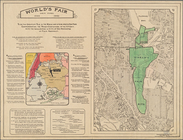
World's fair New York.: World…
note:
Lith.
Colored
.
Aboriginal America east of th…
note:
… intended to be
colored
.
1
2
3
4
5
6
7
8
9
10
Previous
Next
1
2
3
4
5
6
7
8
9
10
Previous
Next