Click to visit the main New York Public Library Homepage
The New York Public Library
Digital Collections
About Digital Collections
Browse
Search only public domain materials
Items
Collections
Divisions
Home
Search
Browse
About
Search only public domain materials
Items
Collections
Divisions
Digital Collections
Using Images
Using Data
Search
Filtered keyword search
Show filters
Hide filters
Show Only Public Domain
topic
Anthracite coal mines and mining
4
City planning
4
Geology
4
Social conditions
4
Coal
2
More
Less
name
Geological Survey of Pennsylvania
8
Hart, Lane S
8
Julius Bien & Co
8
Lesley, J. P. (J. Peter), 1819-1903
8
Ashburner, Charles A. (Charles Albert), 1854-1889
6
More
Less
collection
Maps of North America
15
Atlases of New York City
7
Maps of New York City and State
2
Lawrence H. Slaughter Collection of English maps, charts, globes, books and atlases
1
place
Pennsylvania
8
New York (State)
6
Schuylkill County
5
Carbon County
4
New York
4
More
Less
genre
Maps
25
Geological cross-sections
4
Topographic maps
4
Diagrams
2
Charts
1
More
Less
publisher
Geological Survey of Pennsylvania
6
MIT Press
4
Northern Transcontinental Survey
2
Second Geological Survey of Pennsylvania
2
Topographical Bureau
2
More
Less
division
x
Map Division
type
cartographic
21
still image
4
text
1
Date Range
to
25 results found for:
x
Fielding, I
Filtering on:
x
Division
: Map Division
Sort by:
Relevance
Title
Date created
Date digitized
Sequence
A map of the United States of…
use:
Release Source File for Free (
i
.e., high-res
A map of the United States of…
use:
Release Source File for Free (
i
.e., high-res
A map of the United States of…
use:
Release Source File for Free (
i
.e., high-res
Delaware
use:
Release Source File for Free (
i
.e., high-res
Georgia
use:
Release Source File for Free (
i
.e., high-res
… and Schuylkill counties, Volume
I
of Southern Coal
Field
, cross
use:
Release Source File for Free (
i
.e., high-res
… and Schuylkill counties, Volume
I
of Southern Coal
Field
, cross
use:
Release Source File for Free (
i
.e., high-res
Lake George and part of Lake …
use:
Release Source File for Free (
i
.e., high-res
…, Clay
I
Avenue, Wendover
use:
Release Source File for Free (
i
.e., high-res
…, Clay
I
Avenue, Belmont
use:
Release Source File for Free (
i
.e., high-res
General map of the anthracite coal
fields
use:
Release Source File for Free (
i
.e., high-res
Map of North Allegheny, showi…
use:
Release Source File for Free (
i
.e., high-res
Map of Beaver County showing …
use:
Release Source File for Free (
i
.e., high-res
Queens, Vol. 1, Double Page P…
use:
Release Source File for Free (
i
.e., high-res
Topographical map in ten-foot…
use:
Release Source File for Free (
i
.e., high-res
[S]econd Geolo[gical Survey o…
use:
Release Source File for Free (
i
.e., high-res
…
Field
in Carbon
use:
Release Source File for Free (
i
.e., high-res
Long Island Sound (western sh…
use:
Release Source File for Free (
i
.e., high-res
…
Field
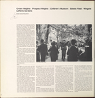
, Wingate, Lefferts
…'s Museum, Ebbets
Field
…'s Museum, Ebbets
Field
…'s Museum, Ebbets
Field
Map of Crazy Mountains and vi…
use:
Release Source File for Free (
i
.e., high-res
m
Map of Judith Basin, Montana …
use:
Release Source File for Free (
i
.e., high-res
Map of Colville Region, Washi…
use:
Release Source File for Free (
i
.e., high-res
End of results
|
Top