Click to visit the main New York Public Library Homepage
The New York Public Library
Digital Collections
About Digital Collections
Browse
Search only public domain materials
Items
Collections
Divisions
Home
Search
Browse
About
Search only public domain materials
Items
Collections
Divisions
Digital Collections
Using Images
Using Data
Search
Filtered keyword search
Show filters
Hide filters
Show Only Public Domain
topic
Nautical charts
117
Administrative and political divisions
80
Railroads
66
Real property
52
Harbors
41
More
Less
name
United States Coast Survey
115
Bache, A. D. (Alexander Dallas), 1806-1867
91
Tanner, Henry Schenck, 1786-1858
62
Burr, David H., 1803-1875
34
Mitchell, S. Augustus (Samuel Augustus), 1792-1868
33
More
Less
collection
Maps of North America
436
Lawrence H. Slaughter Collection of English maps, charts, globes, books and atlases
123
Maps of New York City and State
95
Atlases of the United States
44
John H. Levine Collection
13
More
Less
place
United States
99
New York (State)
92
North America
52
Virginia
40
New York (N.Y.)
38
More
Less
genre
Maps
723
Nautical charts
83
Bathymetric maps
48
Atlases
33
Topographic maps
30
More
Less
publisher
U.S. Coast Survey
51
U.S. Coast Survey Office
35
s.n
31
publisher not identified
19
A.H. Mueller
17
More
Less
division
x
Map Division
type
cartographic
723
still image
15
text
10
Date Range
to
729 results found for:
x
H. S
Filtering on:
x
Division
: Map Division
Sort by:
Relevance
Title
Date created
Date digitized
Sequence
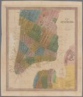
Map of the city of New-York.
note:
… of
H
.
S
. Tanner.
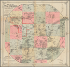
Map of the Vilas Preserve and…
note:
compiled by
H.S
Map showing the distribution …
note:
…. 1861 by Henry
S
. Graham
Map of the seat of war in Nor…
note:
J. Melish del. ;
H
.
S
. Tanner dirext.
… Co., N.Y. ; Res. of
H
.
S
. Rider, Le Roy, N
collection:
… Co., N.Y. ; Res. of
H
.
S
. Rider, Le Roy
Map of Virginia : showing the…
note:
…. 1861 by Henry
S
. Graham
Omaha and vicinity : Nebraska…
note:
….; topography by
H.S
. Wallace."…
Map of military reservation o…
note:
H.S
. Taber, Captain of Engineers, Chief Engr. Dept
Preliminary chart of San Luis…
note:
… the command of
H.S
. Stellwagen
Preliminary chart of Stellwag…
note:
… Lieut.
H.S
. Stellwagen, U.
S
.N, Assist.
A map of the canals & rail ro…
note:
… in the year 1839, by
H.S
Coast chart no. 10 Cape Cod B…
note:
…. McBlair, M. Woodhull,
H.S
. Stellwagen, U.
S
.N. and
H
Map of Virginia showing the d…
note:
… and wounded of the U.
S
. Army."…
Preliminary chart of Gloucest…
note:
… of Lieut.
H.S
. Stellwagen
Preliminary chart of St. John…
note:
… ; engd. by
H.S
. Barnard
Albemarle Sound, N. Carolina,…
note:
…. Sengteller,
H.S
. Barnard
Albemarle Sound, N. Carolina,…
note:
…. Meadel,
H.S
. Barnard
County & township map of the …
note:
… in the year 188[?] by
S
… by
S
. 11th Street, Berry Street,
S
. 10th
… bounded by
S
. 18th St., 9th Ave.,
S
. 6th St
note:
by and under the supervision of Roger
H
… Avenue,
S
. Second Street, Hooper Street,
S
. Third
Preliminary chart of part of …
note:
…"Engd. by E. Yeager,
H.S
. Barnard, A
County map of Kentucky and Te…
note:
… in the year 1882 by
S
… / George
S
. Green, Engineer in Charge. Drawn by E.
H
m
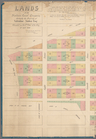
Lands of the Harlaem Canal Co…
note:
… by Joseph
H
. Bridges, City
Road from Philadela. to New Y…
note:
Copy in Map Div. 97-6238: Lawrence
H
Road from Philadela. to New Y…
note:
Copy in Map Div. 97-6238: Lawrence
H
Road from Philadelphia to New…
note:
Copy in Map Div. 97-6238: Lawrence
H
Road from Philadelphia to New…
note:
Copy in Map Div. 97-6238: Lawrence
H
Road from Philadelphia to New…
note:
Copy in Map Div. 97-6238: Lawrence
H
Road from Philadelphia to New…
note:
Copy in Map Div. 97-6238: Lawrence
H
Road from Philada. to New Yor…
note:
Copy in Map Div. 97-6238: Lawrence
H
Road from Philadelphia to Was…
note:
Copy in Map Div. 97-6238: Lawrence
H
Road from Philadela. to Washi…
note:
Copy in Map Div. 97-6238: Lawrence
H
Road from Philadela. to Washi…
note:
Copy in Map Div. 97-6238: Lawrence
H
Road from Philadela. to Washi…
note:
Copy in Map Div. 97-6238: Lawrence
H
Washington city
note:
Copy in Map Div. 97-6238: Lawrence
H
m
Map of Connecticut
note:
Prepared by the U.
S
The world, on Mercator's proj…
note:
By David
H
. Burr ; engraved by
S
. Stiles & Co
m
Map of Connecticut
note:
Prepared by the U.
S
… States. [F, G,
H
]
… States. [
H
]
… States. [
H
, I, J, K, L]
… with Saba Island. (U.
S
m
Mitchell's reference & distan…
note:
… in the year 1833 by
S
Philadelphia and the commence…
note:
Copy in Map Div. 97-6238: Lawrence
H
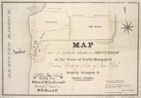
Map of a farm situate in Mont…
note:
…, by Saml.
S
. Doughty.
A map of the British Empire i…
note:
… --
S
. Augustine -- Providence -- Havana --
S
Hudson River & vicinity
note:
drawn by David
H
. Burr ;
S
. Stiles & Co
m
Hudson River & vicinity
note:
drawn by David
H
. Burr ;
S
. Stiles & Co
1
2
3
Previous
Next
1
2
3
Previous
Next