Click to visit the main New York Public Library Homepage
The New York Public Library
Digital Collections
About Digital Collections
Browse
Search only public domain materials
Items
Collections
Divisions
Home
Search
Browse
About
Search only public domain materials
Items
Collections
Divisions
Digital Collections
Using Images
Using Data
Search
Filtered keyword search
Show filters
Hide filters
Show Only Public Domain
topic
Real property
7240
Cities & towns
5007
Fire insurance
5007
City planning
1087
Social conditions
942
More
Less
name
Sanborn Map Company
5007
G.W. Bromley & Co
1236
New York (N.Y.). City Planning Commission
980
M.I.T. Press
942
Bromley, George Washington
824
More
Less
collection
Atlases of New York City
8886
Atlases of the United States
1174
Maps of New York City and State
331
Maps of North America
317
Atlases, gazetteers, guidebooks and other books
83
More
Less
place
New York (State)
8500
New York
2607
New York (N.Y.)
2152
Brooklyn (New York, N.Y.)
766
Bronx (New York, N.Y.)
634
More
Less
genre
Maps
10705
Atlases
1176
Cadastral maps
141
Indexes
108
Plans
88
More
Less
publisher
Sanborn Map Company
5011
G.W. Bromley & Co
1138
MIT Press
942
E. Belcher Hyde
684
New York (N.Y.). Board of Estimate and Apportionment
149
More
Less
division
x
Map Division
type
cartographic
9737
still image
963
text
270
Date Range
to
Looking for this collection?
Atlases of New York City
11,722 items
10,863 results found for:
x
new york plan
Filtering on:
x
Division
: Map Division
Sort by:
Relevance
Title
Date created
Date digitized
Sequence
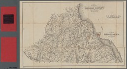
… County,
New
York
;
Plan
of Rockland Co.,
New
York
use:
… partner (e.g.,
New
York
… County,
New
York
;
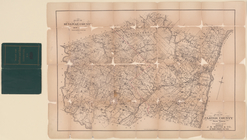
plan
of Ulster County,
New
York
use:
… partner (e.g.,
New
York
Plan
of an extension of the village
use:
… partner (e.g.,
New
York
m
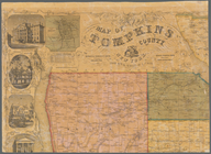
Map of Tompkins County,
New
York
use:
… partner (e.g.,
New
York
m
Large scale
plan
of Dublin
use:
… partner (e.g.,
New
York
Sub
Plan
from Plate
use:
… partner (e.g.,
New
York
m
Plan
général d
use:
… partner (e.g.,
New
York
Richardson's
new
map of the state
use:
… partner (e.g.,
New
York
m
Map of the City of
New
York
, showing its
use:
… partner (e.g.,
New
York
Map of the city of
New
York
, showing its
use:
… partner (e.g.,
New
York
Bounded by W. Ninty First Street, (
New
use:
… partner (e.g.,
New
York
Bounded by 20th Street, Delan…
use:
… partner (e.g.,
New
York
Bounded by Twelfth Avenue, W.…
use:
… partner (e.g.,
New
York
Bounded by E. Fortieth Street…
use:
… partner (e.g.,
New
York
Bounded by Fifty Ninth Street…
use:
… partner (e.g.,
New
York
Bounded by 149th Street, (Har…
use:
… partner (e.g.,
New
York
Bounded by 225th Street, (Spu…
use:
… partner (e.g.,
New
York
A
new
and accurate
plan
of the town
use:
… partner (e.g.,
New
York
Plan
of
New
York
City, from the Battery
use:
… partner (e.g.,
New
York
m
Map of Genesee County,
New
York
use:
… partner (e.g.,
New
York
Map of Genesee County,
New
York
use:
… partner (e.g.,
New
York
Bounded by Mc Dougall Street,…
use:
… partner (e.g.,
New
York
Bounded by Sixth Avenue, E. F…
use:
… partner (e.g.,
New
York
Bounded by [W. Hundred & Twen…
use:
… partner (e.g.,
New
York
Bounded by Hudson River Bulk …
use:
… partner (e.g.,
New
York
…., Peter D. Henderson
Plan
, August Heusel
Plan
, Rose
use:
… partner (e.g.,
New
York
A
new
and accurate map of the English
use:
… partner (e.g.,
New
York
Charts and
plans
use:
… partner (e.g.,
New
York
Bounded by Bowery, Rivington …
use:
… partner (e.g.,
New
York
Bounded by E. Ninety Second S…
use:
… partner (e.g.,
New
York
Bounded by Morton Street, Was…
use:
… partner (e.g.,
New
York
Bounded by W. Twentieth Stree…
use:
… partner (e.g.,
New
York
Bounded by E. Hundred & Twent…
use:
… partner (e.g.,
New
York
Bounded by 158th Street, 10th…
use:
… partner (e.g.,
New
York
Marine Park,
plan
of proposed aquarial garden
use:
… partner (e.g.,
New
York
Plan
of the city of Washington in the territory
use:
… partner (e.g.,
New
York
Plan
showing the proposed entrance
use:
… partner (e.g.,
New
York
Bounded by Reade Street, Nass…
use:
… partner (e.g.,
New
York
m
Map of Lebanon County, Pennsy…
use:
… partner (e.g.,
New
York
A
new
and accurate chart (from Captain
use:
… partner (e.g.,
New
York
…; Sub
Plan
From Plate 18
use:
… partner (e.g.,
New
York
m
Military map of the Indian Te…
use:
… partner (e.g.,
New
York
Plan
of Boston comprising a part
use:
… partner (e.g.,
New
York
Plan
of Boston
use:
… partner (e.g.,
New
York
Plan
of Boston
use:
… partner (e.g.,
New
York
…; Sub
Plan
From Plate No
use:
… partner (e.g.,
New
York
Plan
of the town of Worcester, 1795
use:
… partner (e.g.,
New
York
Plan
of Boston comprising a part
use:
… partner (e.g.,
New
York
m
A map of South Carolina : wit…
use:
… partner (e.g.,
New
York
Plan
of land & water lots
use:
… partner (e.g.,
New
York
1
2
3
4
5
6
7
8
9
10
…
43
44
Previous
Next
1
2
3
4
5
6
7
8
9
10
…
43
44
Previous
Next